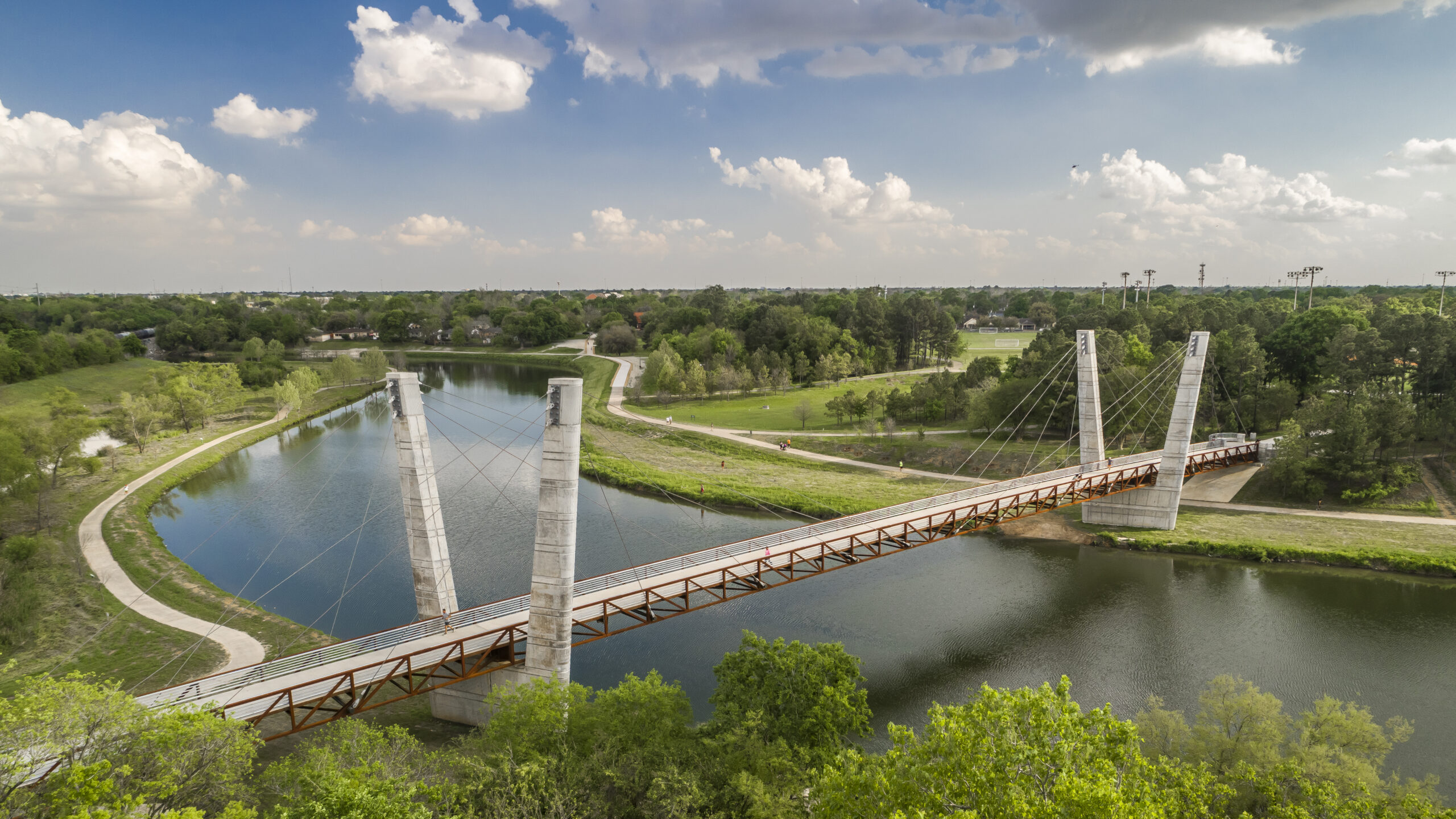


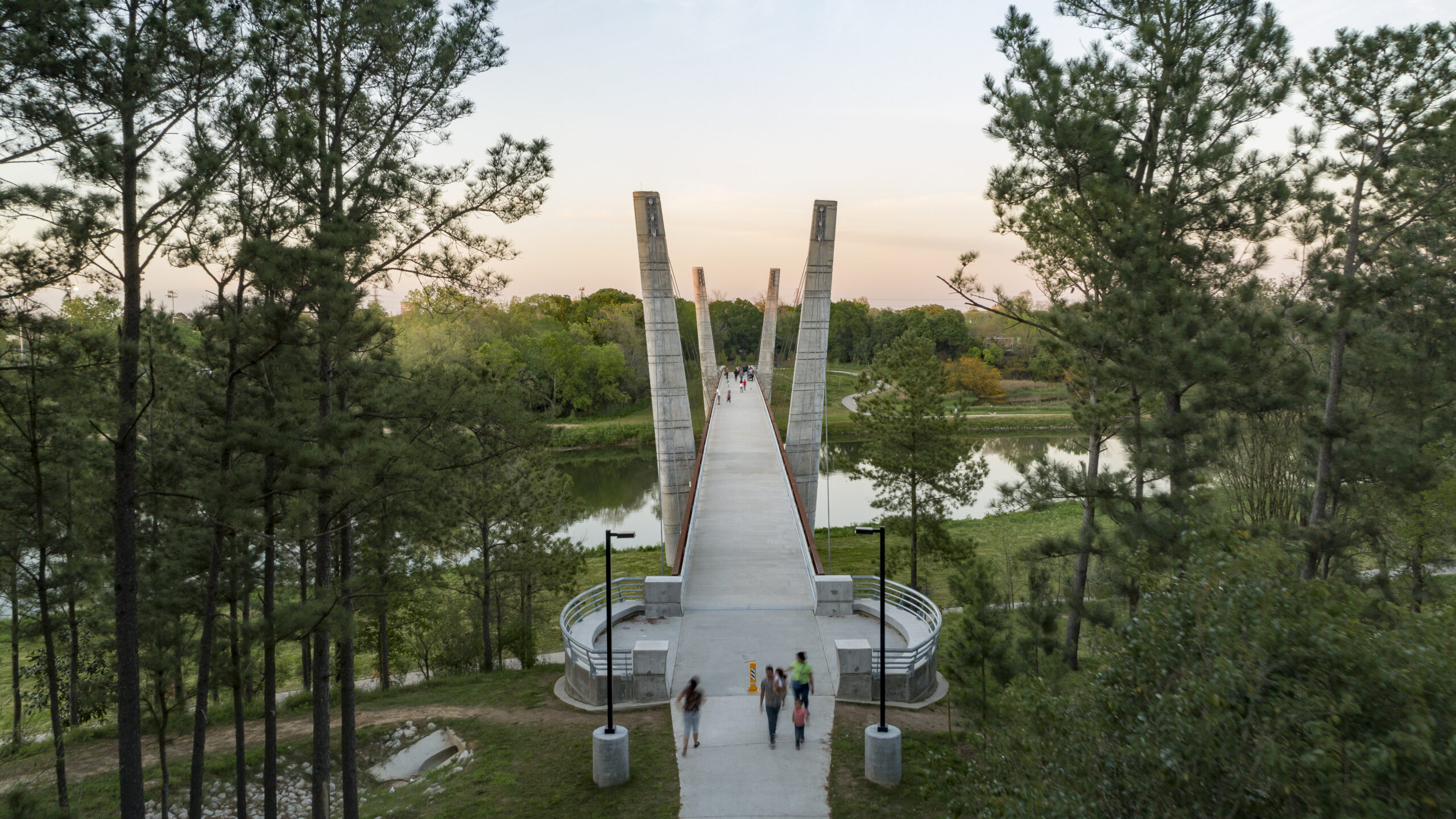


Mason Park, located at the confluence of two bayous, has served as an urban oasis since 1928. Despite a century of improvements to amenities, user access was significantly compromised by the wide expanse of Brays Bayou, which bisected the 104-acre green space into distinct northern and southern sections. Adjacent road and rail infrastructure further exacerbated accessibility issues for surrounding neighborhoods.
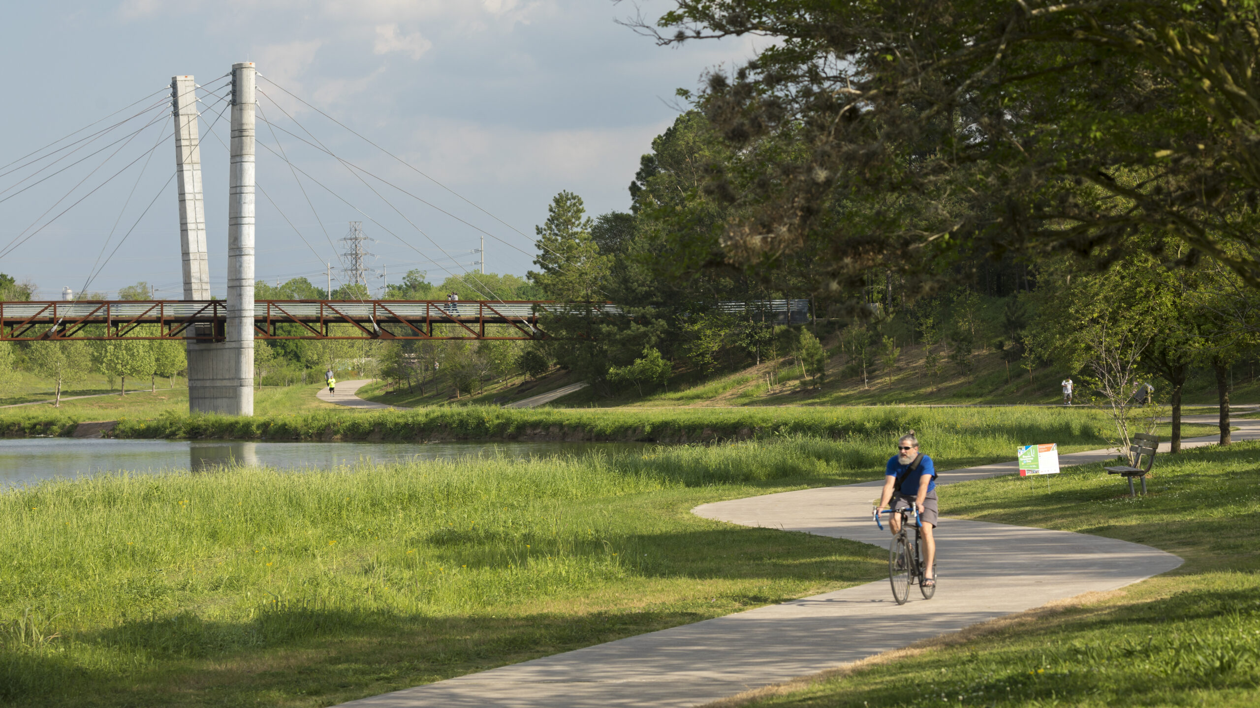
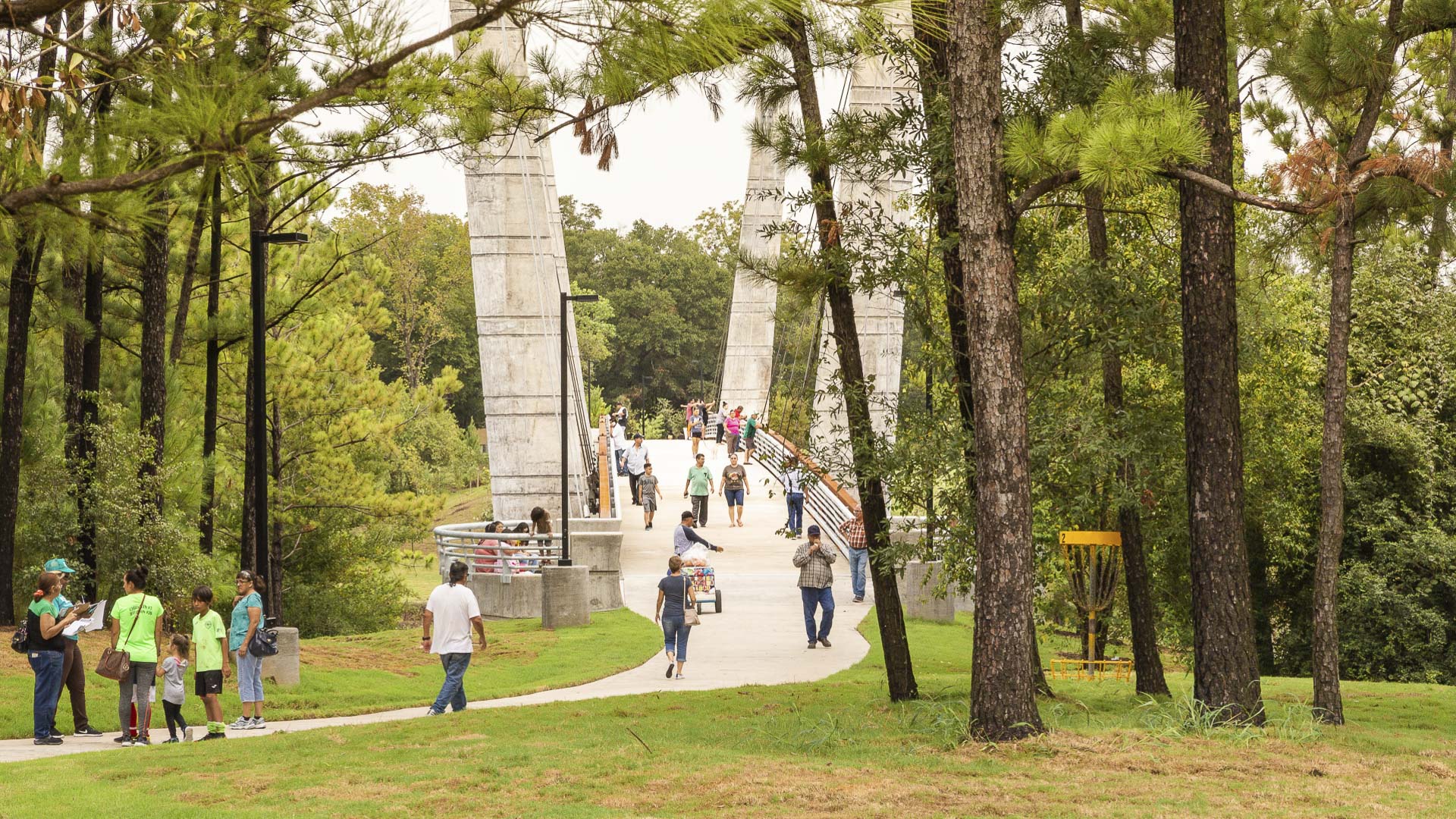
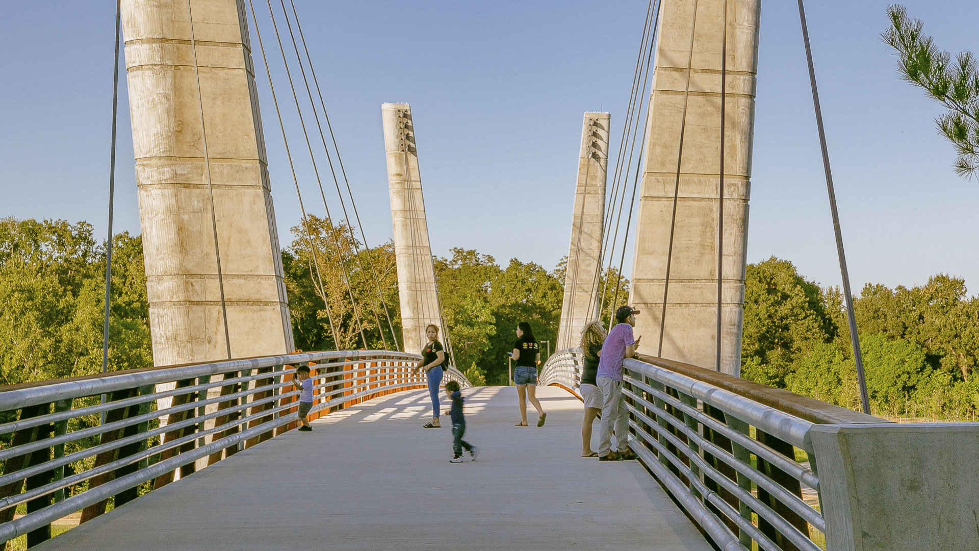
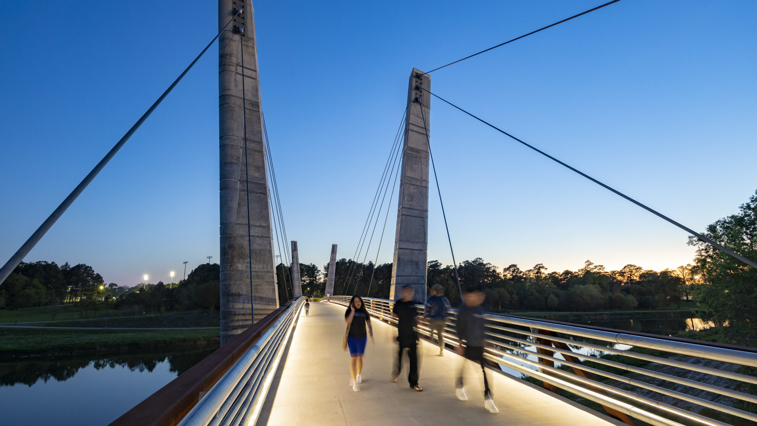
The Mason Park Bridge, a 485-foot cable-stayed, truss-decked structure spanning the bayou, now connects the two park areas and provides an iconic destination for cyclists and pedestrians utilizing the lower Brays Bayou trail system. The bridge also unites the Magnolia Park, Lawndale, Wayside, Pecan Park, Harrisburg, and Manchester communities, serving as a focal point for the neighborhood.
The design strikes a delicate balance between park aesthetics and bayou health. The team considered factors such as bridge height, span, bayou width, and pylon placement to minimize the impact on the area’s hydrology, creating a harmonious blend of engineering and nature. The result is a landmark crossing that grants park-goers access to community amenities while establishing a vital connection between two revitalized park areas.
Mason Park Bridge is a component of a broader initiative aimed at rejuvenating the ecology of Houston’s 4,000-acre Bayou Greenway arterial park system through the addition of trails, seating plazas, and lighting. As Houston grows, Mason Park Bridge serves as a catalyst for equity, promoting access to green spaces and fostering a sense of connection between the neighborhood’s surrounding Mason Park.
Jeffrey Open Space Park
The Jeffrey Open Space Park represents approximately 96 acres of park and trails, with an average width of 265 ft. The three-mile long spine is designed for passive uses with a network of trails that connect to residential neighborhoods and active recreation parks.
The design process included a series of community workshops to solicit community’s commen...
Houston’s Gateway Art Bridges : I-59/69 Beautification
As a city dominated by freeway infrastructure, Houston will be reconstructing portions of its iconic freeways in the near future. This created an opportunity for SWA to reclaim the Houston Interstate experience with a temporary art installation that provides a bold pop of color celebrating Houston’s diversity at eight key threshold bridges along the I-59/69 co...
Guiyang Hot Springs
Guiyang Hot Springs, located in Guiyang City, China, brings together the rhythm of the Nanming River, and surrounding trails and trees to create a new urban ‘living room’ in the interstitial space created by new development and roadway infrastructure. Nestled into a mountainous site, the master planning addressed elevation changes of up to 100 meters and the e...
Sanshan Hillside Park
The Pearl River Delta has undergone a dramatic transformation over the past four decades, evolving from farmland to a global manufacturing and technology powerhouse. Amid the frenetic pulse of this sprawling megalopolis of 86 million people, Sanshan Hillside Park stands as a mountaintop oasis.
Envisioned as New Town’s Central Park, the design embr...