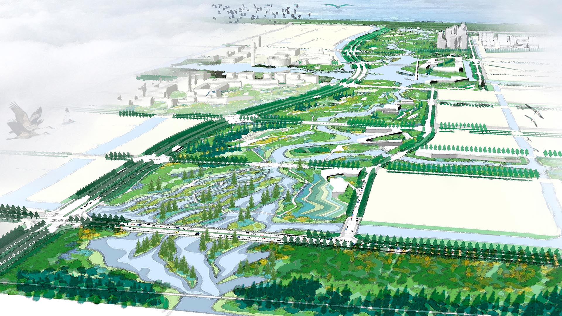
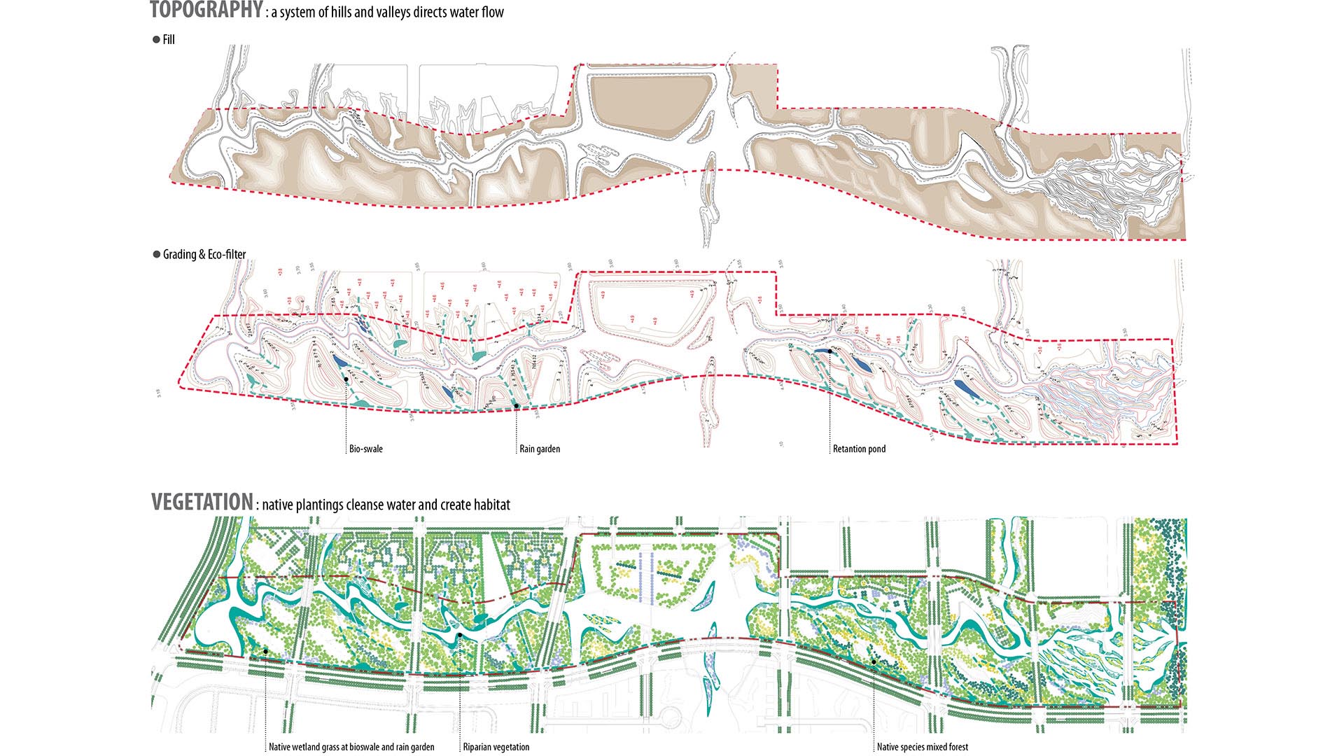
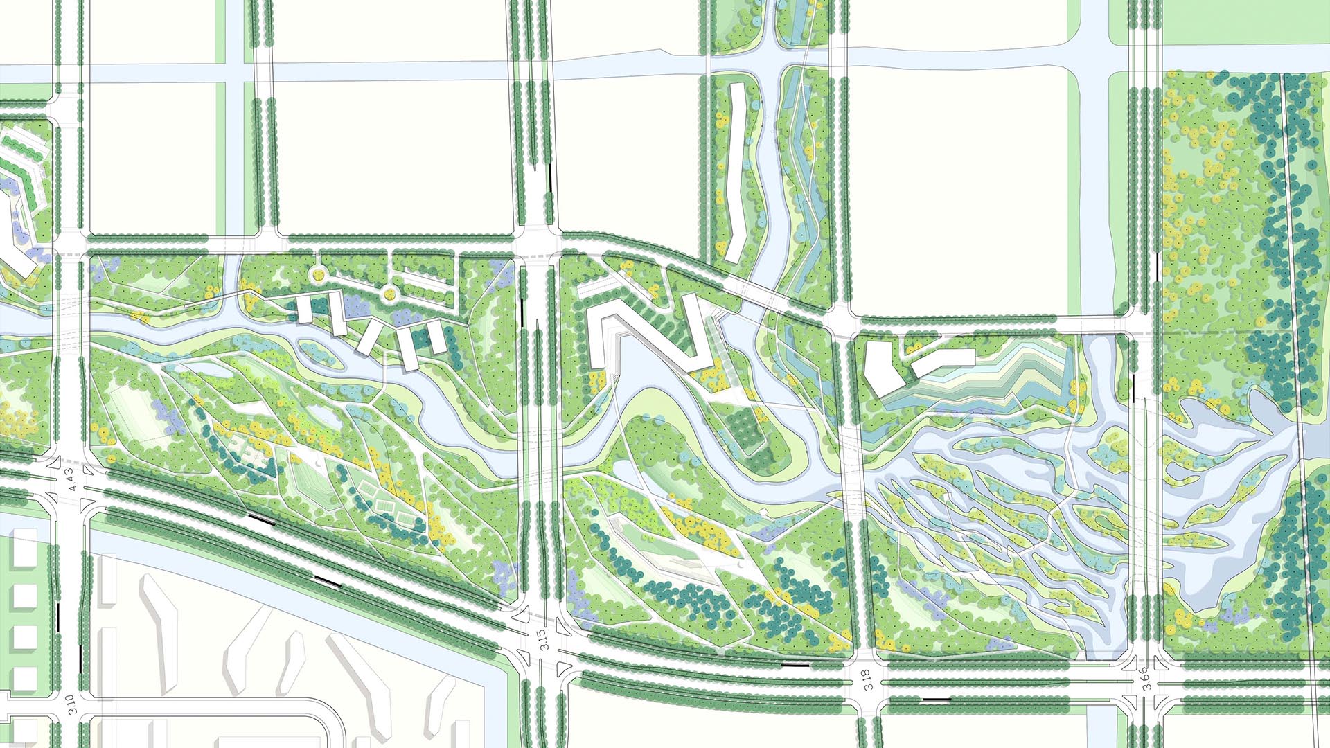
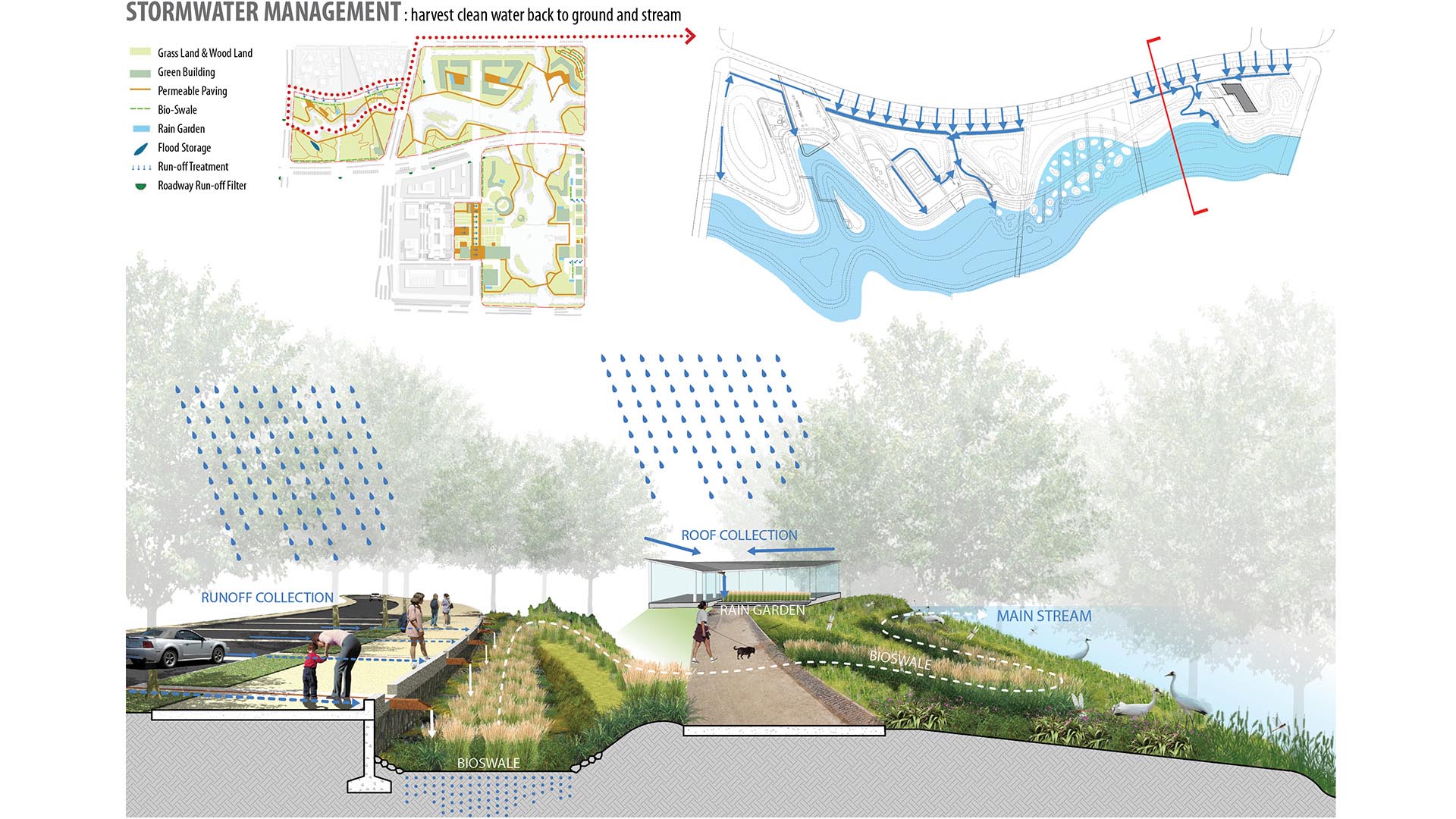
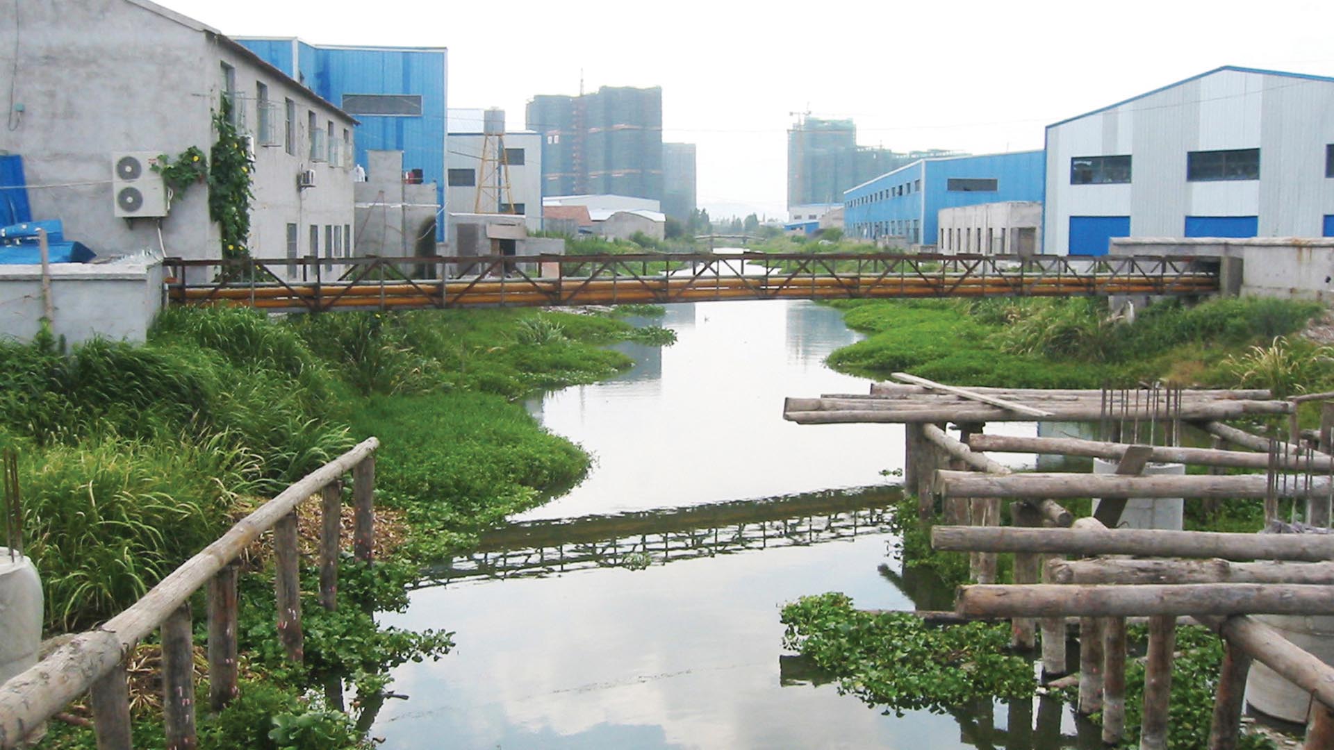
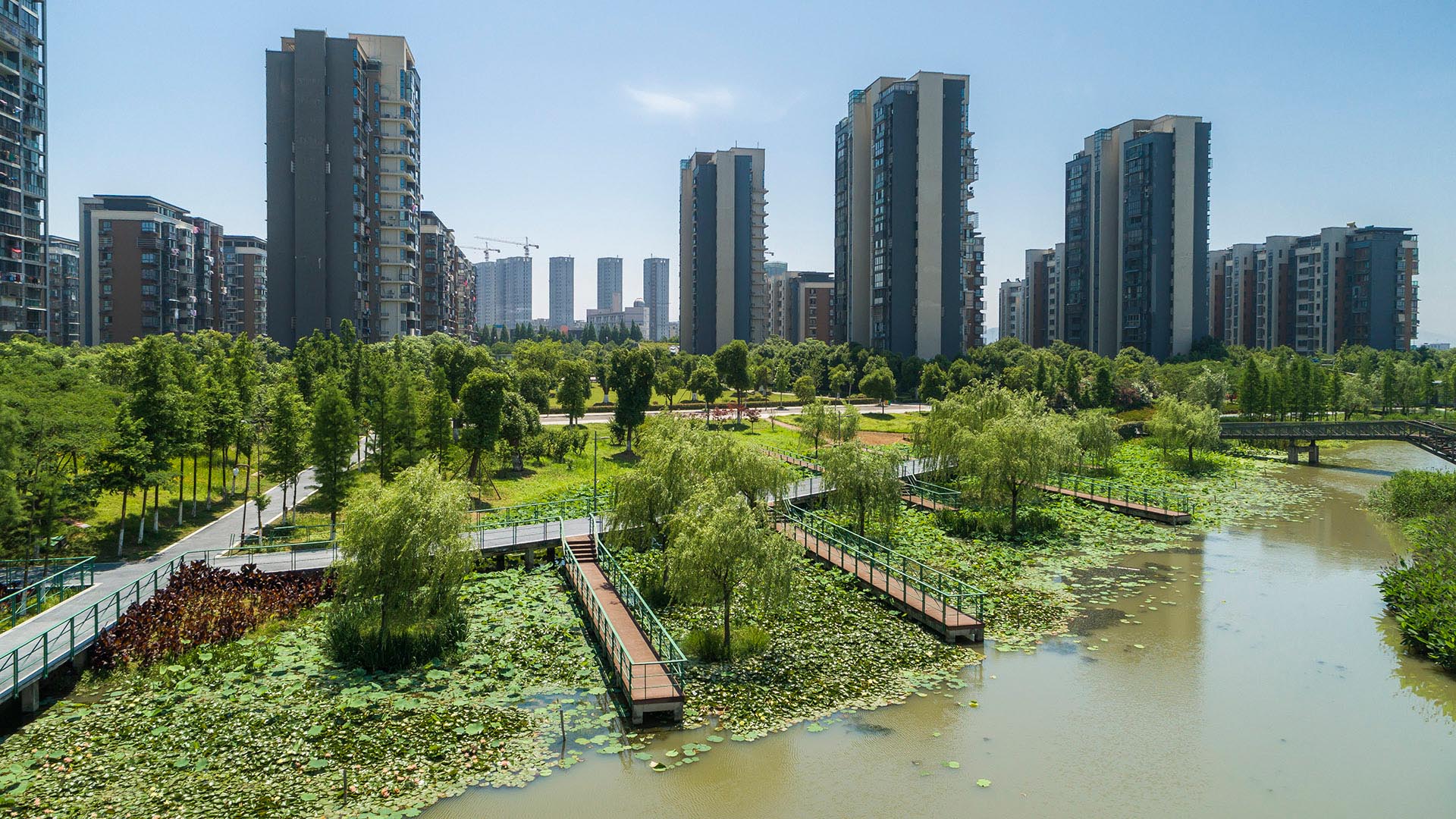
SWA provided planning and design services for the 3.3km long, 250-acre metropolitan Ningbo Eco-Corridor, which transforms a former agricultural plain that had been taken over by industrial use into urban green infrastructure. Located in the heart of the Yangtze River Delta on China’s coastline, Ningbo is one of China’s oldest cities, with an area of 3,616 square miles and a population of 5.43 million. Ningbo, which translates to “tranquil waters,” has been a well-known key port for foreign trade since ancient times. The development of this area inspired a strategy to establish Ningbo as a larger metropolitan area of economic and environmental importance and has set the stage for an ecological approach to the re-development of the city. Acting as a living filter, the design utilizes ecological strategies of hydrology, vegetation and topography, providing recreational, educational and cultural facilities for the Ningbo Eastern New City. Each area of development exemplifies a sustainable ecological approach by treating and recycling surface run-off water, harvesting solar energy, and reducing the urban heat-island effect. SWA additionally implemented a sustainable hydrological design that allows water to be filtered and aerated effectively and retained for aquifer recharge. The design seeks to offer a link between humans and their environment, fostering a community relationship to water and opportunities for environmental and ecological education. By linking together the ecological network in this region, the Ningbo Eco-Corridor enhances public health, quality of life, and property values of local and neighboring communities, and encourages other cities in the region to support ecological components in their respective developments.
South Waterfront Greenway
A bold new plan for the area along the Willamette River includes a 1-1/2 mile extension of the City’s downtown’s parks and the reclamation of the river’s edge for public recreation. Working closely with the City of Portland, developers, and natural resource advocates, the design team devised a rational plan that places access and activity in targeted nodes wit...
Bagby Street Improvement Plan
Inspired by the success of Avenida Houston, on the east side of the city’s Downtown, Mayor Sylvester Turner wished to create something equally iconic on the west side. Bagby Street connects civic uses (including City Hall and its annex), cultural uses (Hobby Center, Bayou Place, and others) and parks (including Sam Houston Park and Tranquility Park).
Th...
Ricardo Lara Park
Ricardo Lara Park is a vibrant city park and a case study in landscape infrastructure. It demonstrates how a small investment and creative thinking about landscape can transform the very infrastructure that has long divided and isolated a community into an amenity that unites it, offering much-needed environmental and recreational benefits.
Here, more ...
Dubai Hills Boulevard and Public Realm
Envisioned as a garden oasis strategically situated where city meets desert, Dubai Hills will be a vibrant yet elegant mixed-use community for 21st-century living. The key public realm element of this massive 1,000-hectare development is a 5.6-kilometer urban boulevard lined with shops, residences, and offices along the district’s central spine. SWA/Balsley de...


