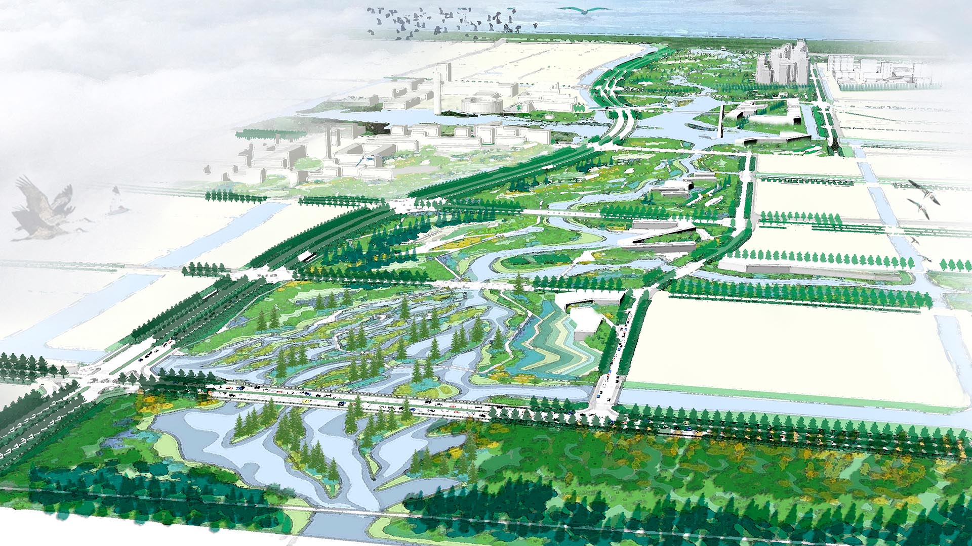
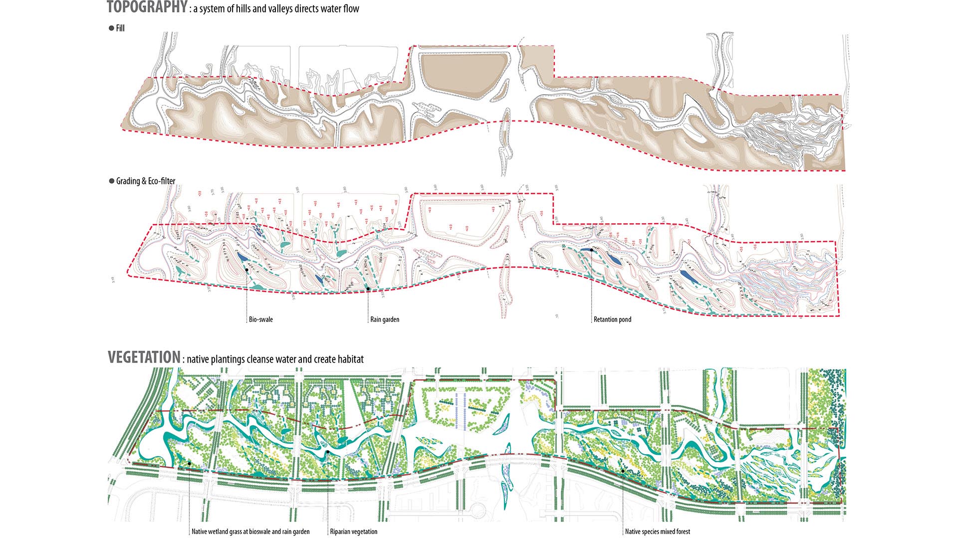
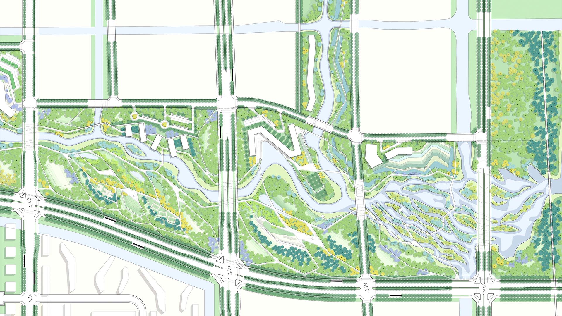
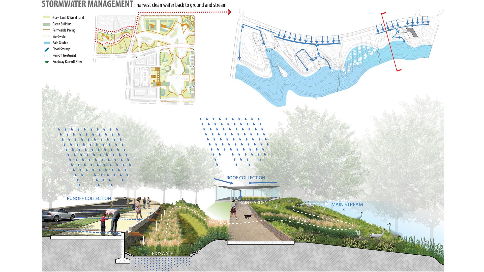
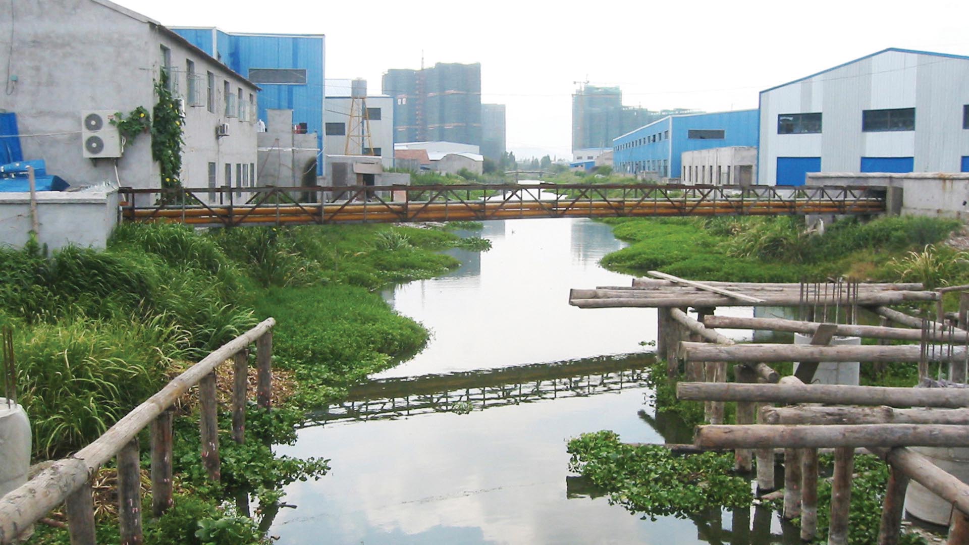
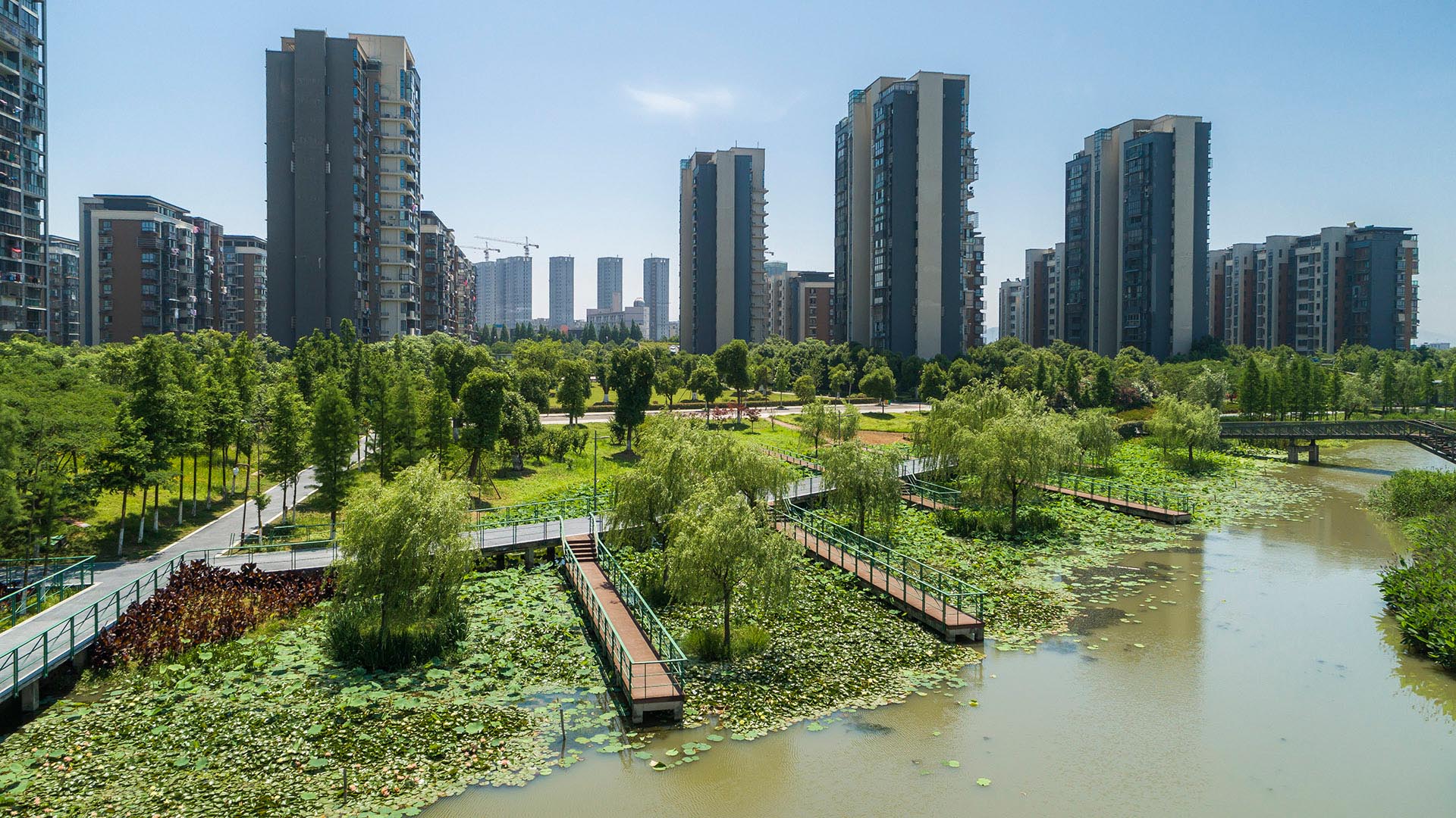
SWA provided planning and design services for the 3.3km-long, 250-acre metropolitan Ningbo Eco-Corridor. The project transforms a former agricultural plain that had been taken over by industrial use into urban green infrastructure. Located in the heart of the Yangtze River Delta on China’s coastline, Ningbo is one of China’s oldest cities, with an area of 3,616 square miles and a population of over five million. Ningbo, which translates to “tranquil waters,” has been a well-known key port of foreign trade since ancient times. The development of this area inspired a strategy to establish Ningbo as a larger metropolitan area of economic and environmental importance and has set the stage for an ecological approach to the re-development of the city. Acting as a living filter, the design utilizes ecological strategies of hydrology, vegetation and topography, providing recreational, educational and cultural facilities for the Ningbo Eastern New City. Each area of development exemplifies a sustainable ecological approach by treating and recycling surface run-off water, harvesting solar energy, and reducing the urban heat-island effect. SWA implemented a sustainable hydrological design that allows water to be filtered and aerated effectively and retained for aquifer recharge. The design seeks to offer a link between humans and their environment, fostering a community relationship to water and opportunities for environmental and ecological education. By linking together the ecological network in this region, the Ningbo Eco-Corridor enhances public health, quality of life, and property values of local and neighboring communities, and encourages other cities in the region to support ecological components in their respective developments.
Tianjin Eco-City
The vision for Tianjin Eco-City is of a socially harmonious, environmentally friendly, and resource-efficient model for sustainable development. The new city encompasses two flagship civic projects: the National Maritime Museum and the surrounding South Bay Park. South Bay Park is the project’s central green infrastructure, but also provides a significant outd...
Greening Houston’s Freeways
As Houston’s Downtown has developed and expanded over many decades, public green space has been increasingly constrained by several interstate routes: primarily I-59, -45, and -69. These thoroughfares, while essential for commuters, have left little room for workers and nearby residents to enjoy unimpeded access to their locale’s adjacent trailways and bayous,...
Santana Row
SWA provided full landscape architectural services for the development of a neo-traditional town center near downtown San Jose. The client’s vision called for a variety of design styles to create a town center with an impression of growth over time. This theme is expressed in building elevations as well as landscape design. The restaurants and boutique r...
Santa Monica North Beach Trail Improvements
While the beaches of Santa Monica are arguably one of the most iconic landscapes in Southern California, the trails running through them are less well known. Among those is the Marvin Braude Bike Trail, which runs from Mexico to Oregon and is commonly referred to as “The Strand” by locals. In recent years, The Strand bike trail had become congested and dangero...


