


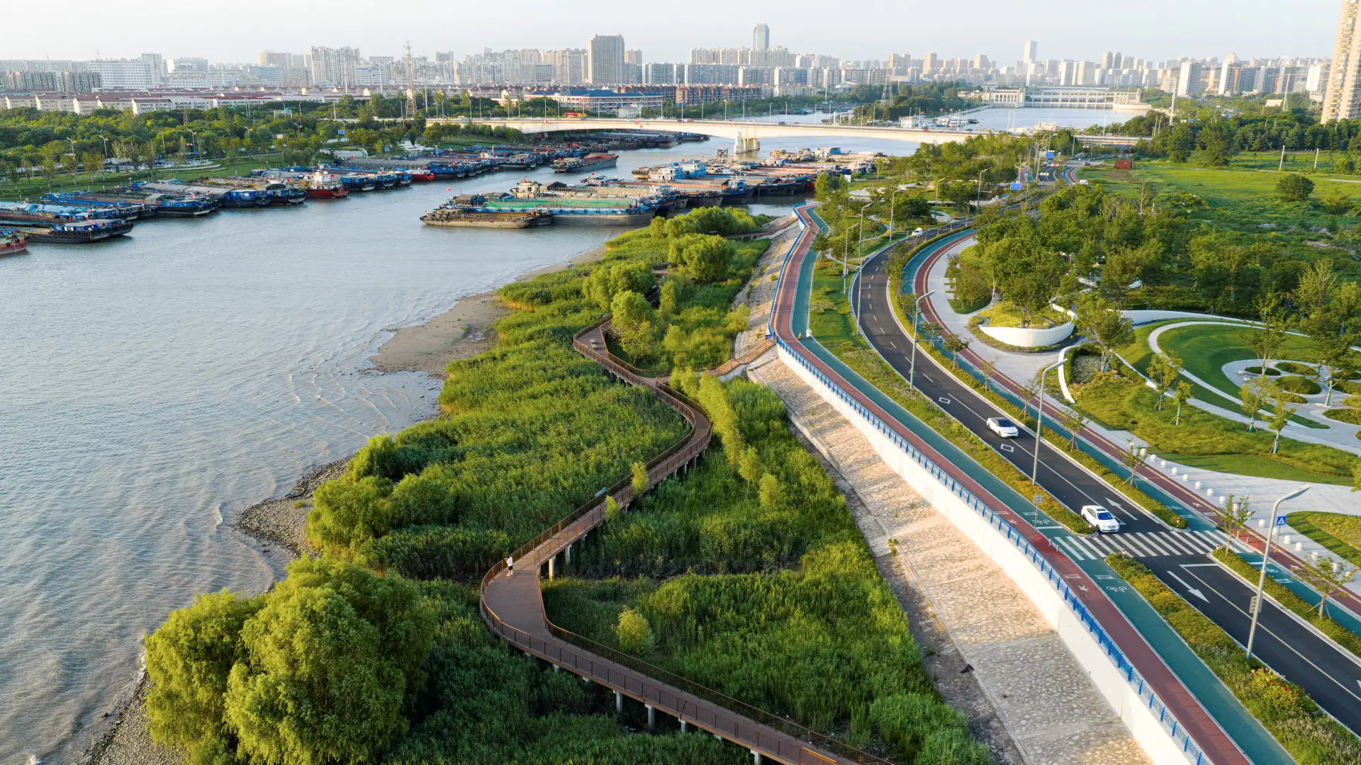


A prominent riverfront city in Jiangsu Province, Nantong has long been shaped by its proximity to the Yangtze River, Hao River, Tonglv Canal, and Rengang River. The establishment of Nantong Port in 1904 and subsequent wharf construction drove decades of industrial growth, but as shipping operations shifted downstream to deeper waters, older docks in this area were gradually decommissioned. In 2019, the city launched an ambitious plan to transform nearly 20 kilometers of industrial docks into green public space, with the first five-kilometer phase centered on the Tonglv Canal, Rengang River, and Riverside Flower Meadow—an area totaling one million square meters.
The project reconnects communities with the waterfront while integrating new flood-control infrastructure. The design introduced program zones, activity spaces, and commercial activation strategies to revitalize the waterfront. A sequence of promenades, plazas, and waterfront terraces creates a layered public experience, reconnecting residents to the river’s edge.
Ecological protection was a central priority. In collaboration with hydraulic engineers, the team preserved sedimentary riverbanks at key confluences, supporting diverse migratory bird habitats. Low-impact boardwalks weave through reed beds, allowing visitors to experience the river ecology without disturbing it. In total, 28,000 square meters of wetlands were safeguarded.
SWA served as lead landscape designer, responsible for the overall design vision and schematic development. Shanghai Municipal Engineering Design Institute acted as the project’s general design institute, overseeing multidisciplinary engineering, infrastructure systems, and detailed implementation. The first three phases have been open to the public since 2024.
By integrating public space, industry, and ecology, the project restores Nantong’s historic river culture while establishing a forward-looking model for resilient, multifunctional waterfront redevelopment along the Yangtze River.
Aquatic Park & Pier Vision Study
The Aquatic Park and Pier Vision Study is a community-led effort examining new possibilities along San Francisco’s northern waterfront. Prompted by the need to replace the disintegrating Aquatic Park Pier — a historic, curvilinear structure that shelters shoreside water for swimmers and boaters — the Vision Study looks beyond the immediate boundaries of the Ma...
Riverside Park South
Located on the West Side of Manhattan on the scenic Hudson River shoreline, Riverside Park South is a massive, multiphase project of sweeping ambition and historic scope. Combining new green space, new infrastructure, and the renovation of landmark industrial buildings, the plan – originally devised by Thomas Balsley Associates in 1991 – is an extension of Fre...
OCT Bay
Located in Shenzhen, OCT Bay has a combined site area of approximately 1.25 square kilometers including equal parts new urban center and nature preserve. SWA provided both master planning and landscape architectural services for the entire site. As a new urban cultural and entertainment destination, OCT Bay provides urban amenities, entertainment components, p...
Ningbo East New Town Civic Plaza
As an extension of the Ningbo East New Town Government Center, this civic plaza extends the geometry and ecology of SWA’s past work in the city. A central civic axis runs from the government buildings to the Dongqian Lake edge, providing a large, flexible gathering/event space adjacent to an expansive lawn as well as sweeping views of the water. Per city plann...