

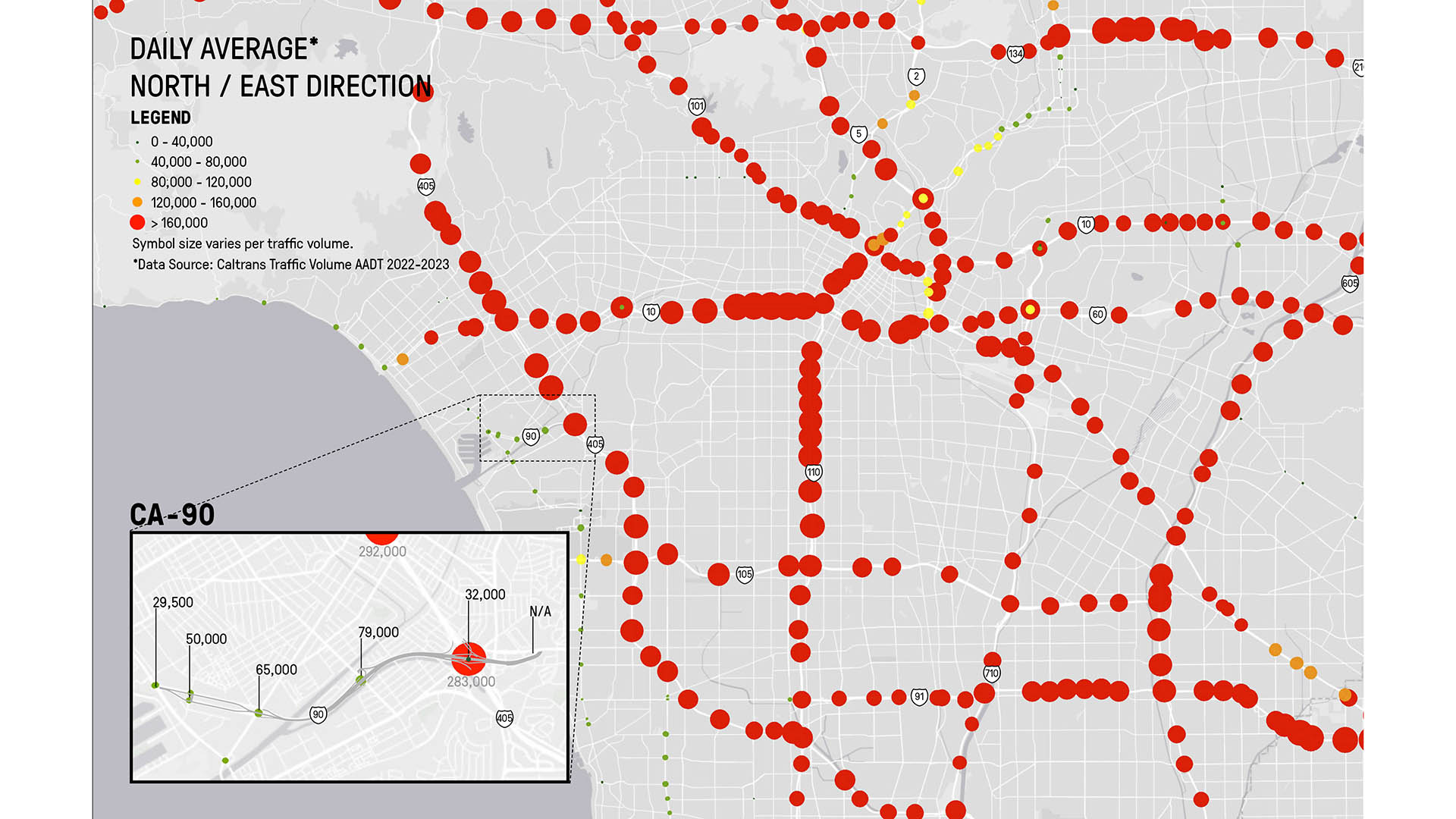
What if we transformed one of L.A.’s least used freeways into one of the county’s largest urban parks—reconnecting a historically divided community and drastically expanding affordable housing in an underserved district?
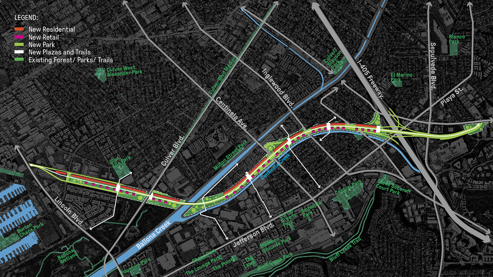
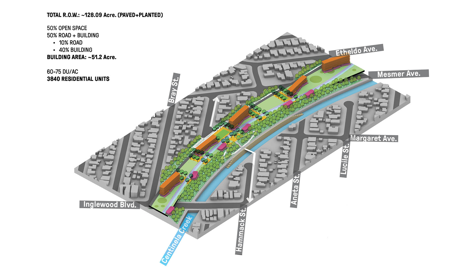
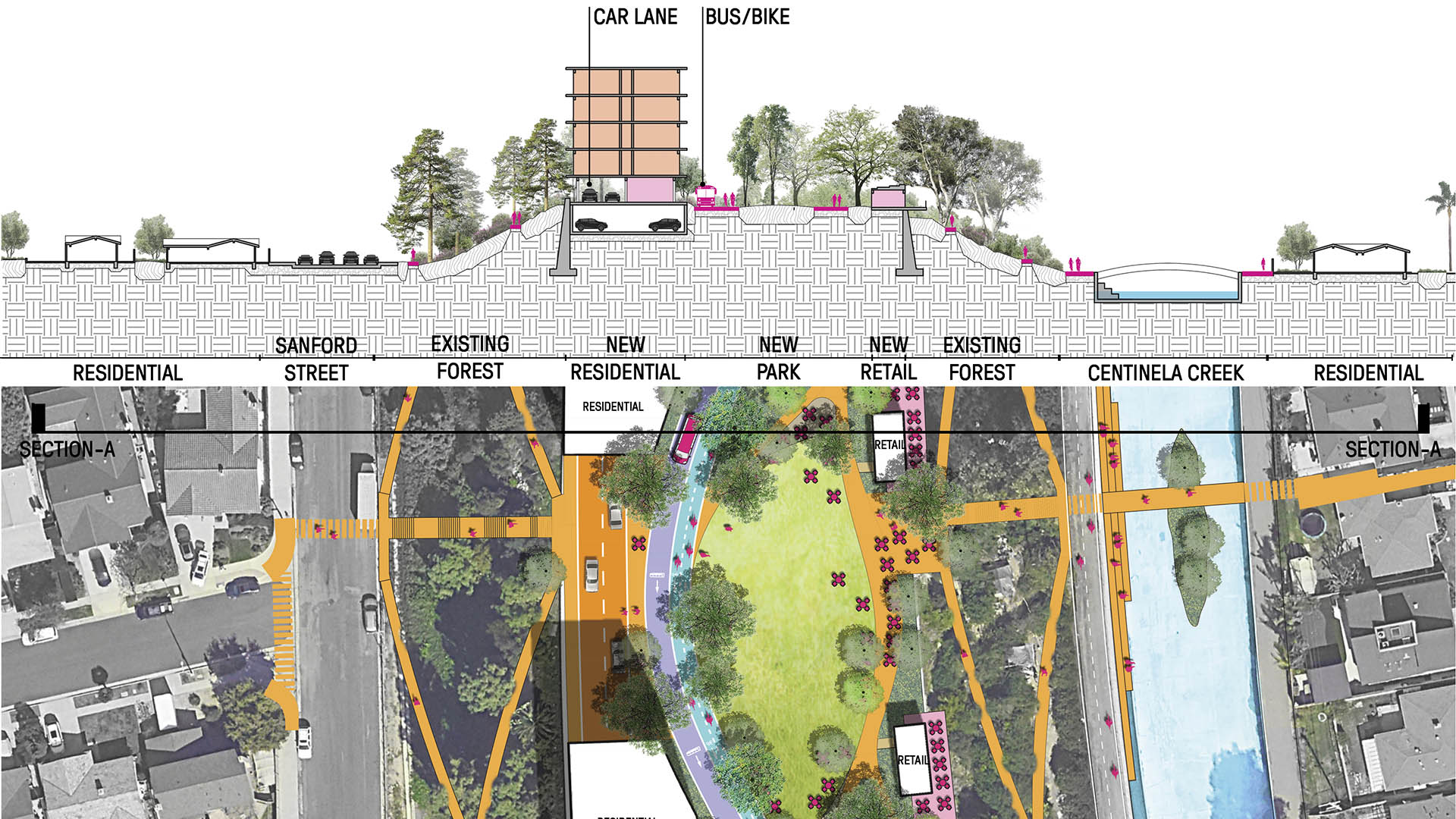
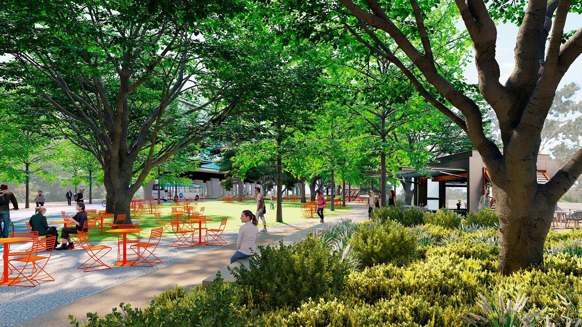
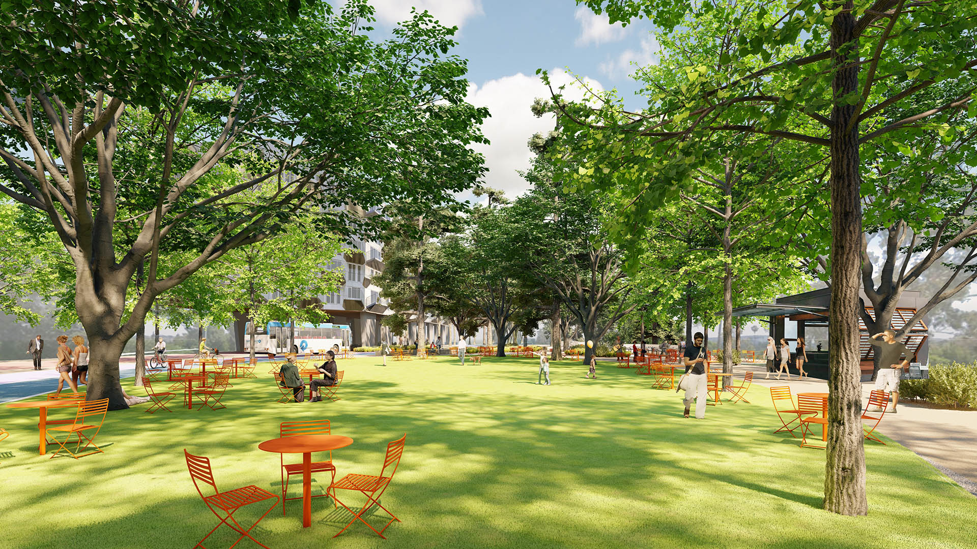
Marina Central Park, a vision co-developed by SWA and the nonprofit Streets for All, proposes a transformation of three miles of the unfinished Marina Freeway (CA-90) into a 128-acre linear park including almost 4,000 new units of affordable housing, a network of new multimodal trails, dedicated lanes for a future Bus Rapid Transit line between Lincoln and Sepulveda Boulevard, expanded retail frontage, and enhanced access to the Ballona Creek Trail and Ecological Reserve.
Altogether, the vision addresses a suite of problems shared by Angelenos citywide: declining air quality, stormwater flooding, a critical housing shortage, and Black and Brown neighborhoods rent apart by 1960s-era highway infrastructure fueled by racist planning policies—reimagining the corridor as a model for sustainability, walkability, and improved quality of life.
Learn more:
Read about it in Urbanize LA.
Elk Grove Civic Center
SWA’s design for this community resource improves upon part of a 56-acre master plan with a civic center campus set within a beautiful park, and an added public outdoor commons. The pedestrian-friendly commons weaves new buildings together with mature trees and an outdoor living space linking together a community center, an aquatics center, and a future librar...
Park 101
The ambitious Park 101 aims to cover part of downtown Los Angeles’ 101 Freeway with a multi-purpose park that will include playgrounds, seating, festival areas, and a plaza. The approximately four-block cap park will reconnect the two sections of Downtown that have long been separated by the freeway, greatly enhancing the currently noisy, with much-needed shad...
Polliwog Park
Originally built in the 1970s, Polliwog Park is a high-use neighborhood amenity that provides active recreation and play facilities to local families. The original playground was replaced in 2003 but required a full update in 2020 to account for routine flooding. SWA’s design allows the park to remain an active community feature year-round.
In addition ...
Honggang Park
Nestled between two hills in Shenzhen’s Luohu District, Honggang Park is a green corridor bringing over 80 acres of open space through the city’s dense fabric. Celebrating the site’s stark topography, SWA’s design carefully threads hiking trails along the slopes to minimize ecological disturbance, with stairs providing shortcuts along switchbacks. Altogether, ...