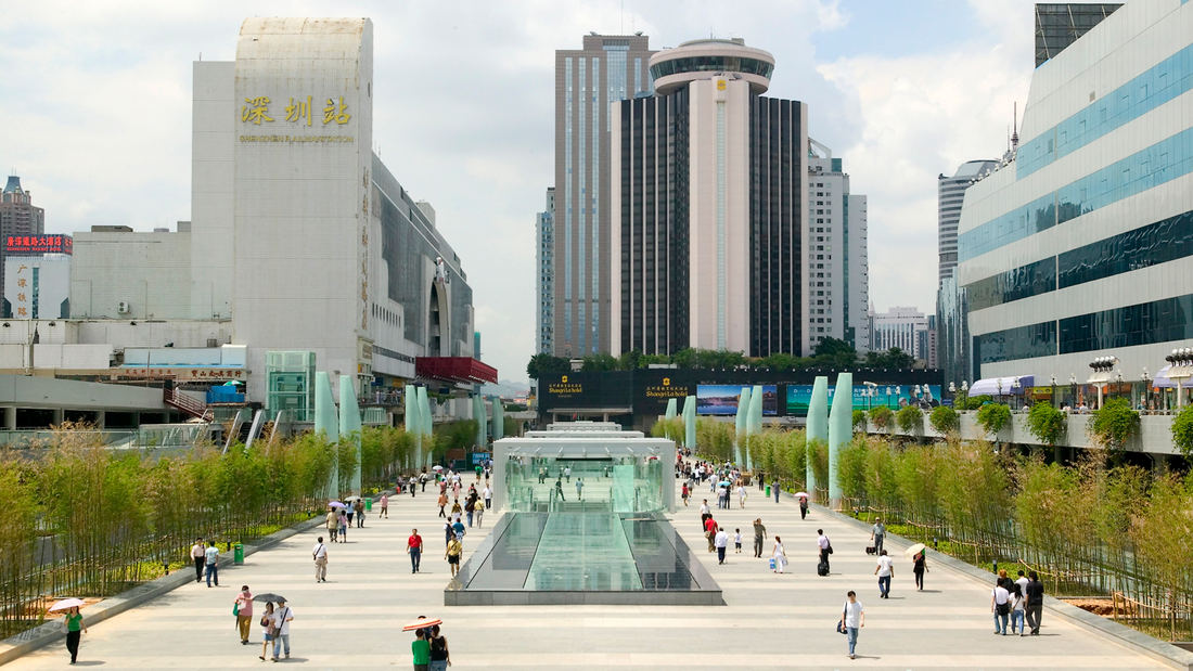
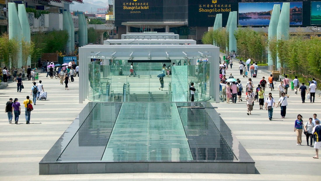
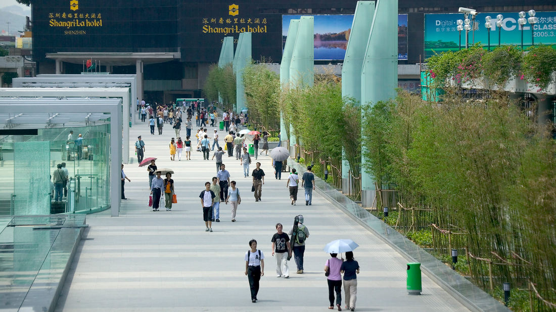
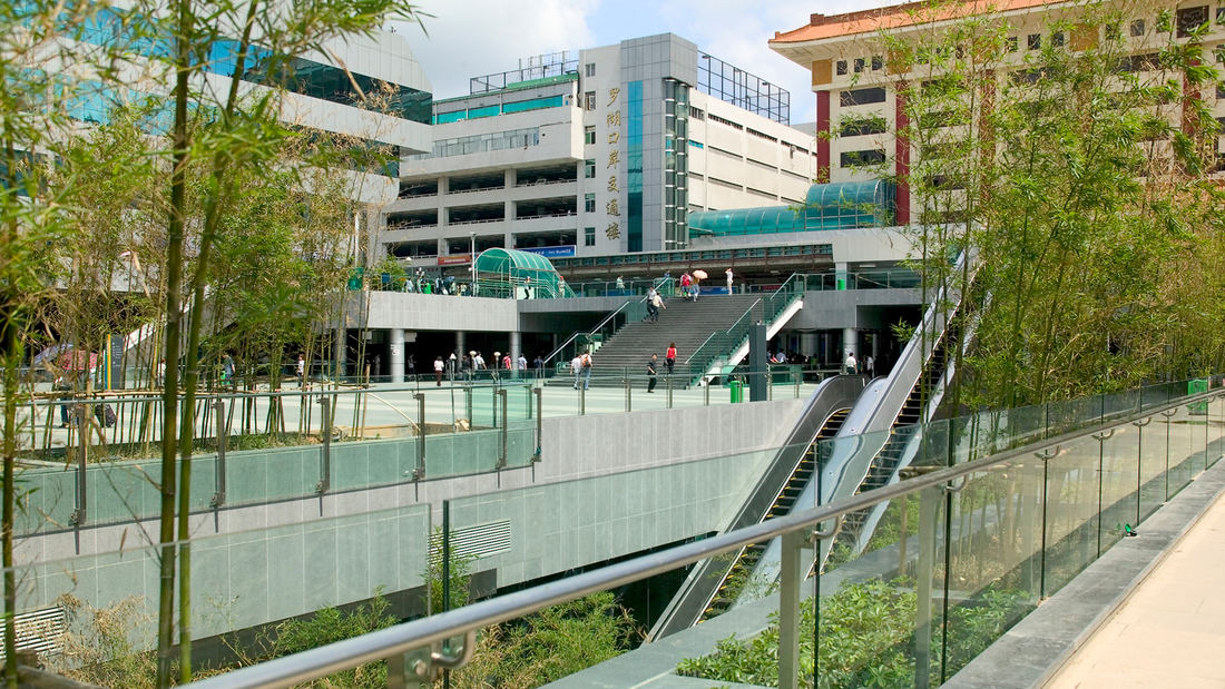
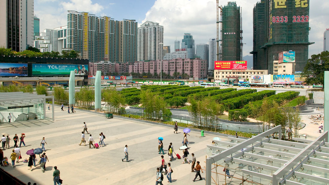
Luohu Land Port and Train Station is a border control area and the busiest place in Shenzhen, China. As such, the city was faced with the challenge of moving as many as 600,000 people per day and determined to build a subway. Under the auspices of the Shenzhen Municipal Planning Bureau, a team of consultants from eight different countries worked together on the redevelopment of the 37.5 hectare project, beginning with a traffic study. SWA’s work included public plazas and gardens, streetscape treatment for four city streets, transit shelters, lighting, signage and landscape amenities in a plan that modernizes and consolidates circulation and transportation modes while providing for a people-oriented public amenity. The transformation of the highly visible and intensely used three-block area of public space into a well organized, up-to-date and world-class example of urban design was achieved over a three-year period. The new facility accommodates the huge flux of travelers changing from one mode of transportation to another: heavy rail transfer from Hong Kong to mainland China; to Shenzhen’s new subway; to long distance buses; to short-haul buses and jitneys; to taxies and private cars and finally to the busy sidewalks of the commercial core of the city. The hot and humid climate guided the direction of the designers to move all traffic underground where it could be cooled by air-conditioning. The massive atrium, glass walls and skylights allow light and air to permeate the four subterranean levels where travelers can see the condition of the sky and the adjacent garden courtyards. The concourse is perhaps the most important of the subgrade levels as it connects travelers to the luxurious Shangri-La Hotel, the historic Port Building, the lively train station and the new bus facility with its multi-storied retail shops. Sunken gardens with water, gravel and black bamboo enhance the spaces and provide relief from the intensity of the busy travel experience. The surface level of the complex is largely comprised of a 400-meter-long plaza and glass atrium. The plaza is sized to handle the tremendous influx of visitors during the peak days before and after the national holidays when the numbers overwhelm the border control and travelers back up across the plaza. Chinese granite in alternating bands of tan and charcoal cover the ground plane while polished granite seating lines the sides of the vast promenade. At the center of the promenade is a large reflecting pool of water over the glass atrium that provides the light below, framed by low polished granite walls. At the terminus of the water panel, a glass-walled elevator is surrounded by a water sheet that falls into the pool. At night, 10-meter-high oval frosted glass lights provide a cooling glow to the space. Fritted and opaque glass form the curtain walls, handrails for people movers, signage and bridges to create a translucent aspect to the space which allows the textures and colors of the plantings to dominate. The aqua tones of all the glass elements, coupled with the generous use of water, create a cooling quality to the entire development. An architectural cladding system for new and proposed buildings unifies the various architectural styles around the plaza. As Shenzhen is known as the “Garden City”, it was a primary guide in the planning by the landscape architects that this concept be reflected in the design. The intense heat as well as the construction of the subgrade levels set limitations to the planting, so the dominant design elements are hardscape, interrupted by a simple palette of plantings. Groves of bamboo flank the promenade, with the city flower, Bougainvillea, cascading brilliantly from planters along the upper levels surrounding the plaza providing shade as well as color to the busy corridor. The main green space of the center is a garden to the east of the ceremonial plaza. As a landmark to traffic from the east, a magnificent 200-year-old Fig tree was preserved in the design by maintaining the grade around the tree with a curving polished black granite wall that spirals down to the sunken garden. A curvilinear water table floats on the surface of the granite adjacent to parallel, triple rows of Ficus trees between panels of lawn. Bisecting the alleés diagonally, a wide path, corresponding to the subway line beneath, connects the station to LoWu Commercial Center, a colossal shopping mall. The open park space is integrated into the station complex as a space for travelers to rest, refresh themselves and to wait or rendezvous with others. With the traveler’s comfort and clarity of direction as vital considerations, the designers developed a sophisticated graphics system for navigating the new center and various transportation modes. The way-finding system, which replaced the confusing and cluttered signage of the old train station, is a color-coded classification scheme that simplifies and unifies the entire transit system. The ample bus shelters are shaded by large metal trellises finished in yellow to symbolize the bus system; taxi zones are indicated with red directional signage.
2018 Winter Olympics
SWA’s master plan for the three Nordic Events venues—the Ski Jumping, Cross Country Skiing, and Biathlon stadia and courses—honors the natural beauty of a spectacular Olympic Winter Games landscape as never before. The venues were originally slated to be located in separate valleys, requiring athletes and spectators to travel from site to site. But in PyeongCh...
Alief Park and Neighborhood Center
Located in West Houston, the Alief Neighborhood Center and Park serves one of the city’s most diverse communities. Over 90 languages are spoken in Alief, which is home to first-generation immigrants from across the world and refugees from as far away as Vietnam and close as Louisiana—especially in the wake up Hurricane Katrina, when many families made a ...
Library of Congress Packard Campus
A 45-acre site 70 miles southwest of Washington, D.C. serves as the home for the Library of Congress’s Motion Picture, Broadcasting, and Recorded Sound Collections. The 400,000-square-foot complex consolidates the world’s largest audio-visual collection and provides improved facilities for research, digital conversion, long-term conservation, and public apprec...
Atlanta Museum of Freeway Art (MOFA)
The freeway is an integral part of the open space of the American City, a series of infrastructural systems that affect the spatial characteristics of our natural and cultural landscapes. The Atlanta Connector Transformation Project is a collaborative effort between the City of Atlanta, Georgia Department of Transportation, Downtown and Midtown to improve the ...


