

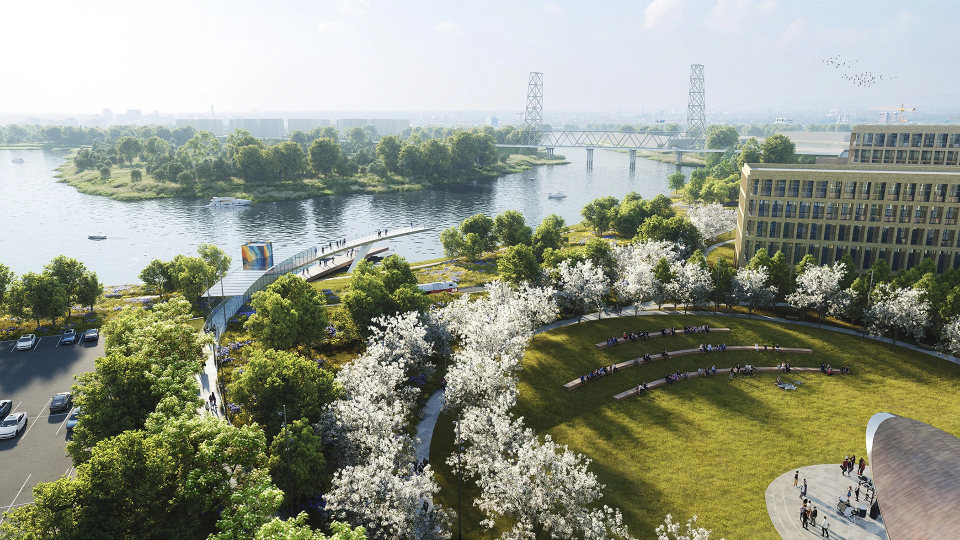


Beaumont sits at the heart of Texas’s “Golden Triangle” and has recently been named a top travel destination and the “Cajun Capital of Texas,” with billions of dollars in new energy investment now flowing into the city. Yet despite this momentum and its historic architecture, downtown Beaumont has struggled to sustain vitality, attract businesses, and create jobs.
In response, the City formed an advisory council of private citizens to develop turnaround strategies and recommend public investments. SWA was retained to update the city’s 2008 Downtown conceptual plan, connecting the Lake District — completed in 2010 — to the Neches River waterfront, and generating ideas for a new waterfront park and expanded civic center.
At the center of the plan is a multi-block, below-street-level waterway, 18 feet deep, conceived as a public space framework. The waterway supports vertical mixed-use development blending historic buildings with new construction, reconnecting downtown with its riverfront.
Key goals include reducing energy consumption, enabling car-free mobility, and repurposing underused land. Environmental regeneration is a priority: wetland restoration and measures to mitigate flash flooding and extreme heat, paired with cooling features, adapted vegetation, and improved biodiversity. Social infrastructure runs throughout, strengthening community engagement and resilience. Public-private partnership underpins the strategy, driving economic growth and private investment toward a cultural hub with spaces designed to engage residents and visitors alike.
SWA led extensive public engagement — town halls and group discussions — to ensure the plan reflects community aspirations, shaping a revitalized downtown that honors Beaumont’s past while building toward its future.
Houston Resilience Hub Network Master Plan
The Houston Resilience Hub Network Master Plan aims to mitigate the disproportionate impact of disasters on vulnerable communities by establishing a network of strategically located facilities. These hubs offer vital resources and support during routine operations, emergencies, and recovery phases.
The network comprises four interconnected components: H...
ARTIC – Anaheim Regional Transportation Intermodal Center
ARTIC, the new 16-acre Anaheim Regional Transportation Intermodal Center in Southern California, forms a seamless gateway from Anaheim to all of Orange County, spurring economic growth and community redevelopment throughout the region. The landscape design establishes a unique and identifiable image for the ARTIC Mixed-Use District by complementing the site’s ...
Downtown Jebel Ali Landscape Master Plan, UAE
Downtown Jebel Ali is a new development located 35 kilometers southwest of Dubai, along an 11 km stretch of Sheikh Zayed Road. Representing the first phase of a major mixed-use development on the outskirts of Dubai, the project includes two high-rise office buildings and two high-rise apartment buildings with access to Sheik Zayed Road. Mixed-use buildings and...
Guangzhou Axis District Planning
The Guangzhou Green Axis District Urban Design paved the way for new growth in one of China’s major metropolitan areas by bringing nature into the city, connecting people to the river and CBD, and providing a major park and open space for all ages. In the early 2000s, when the project commenced, Guangzhou was a rapidly growing city of approximately 8 million. ...