

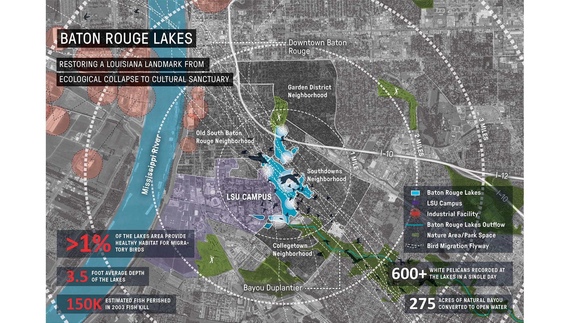
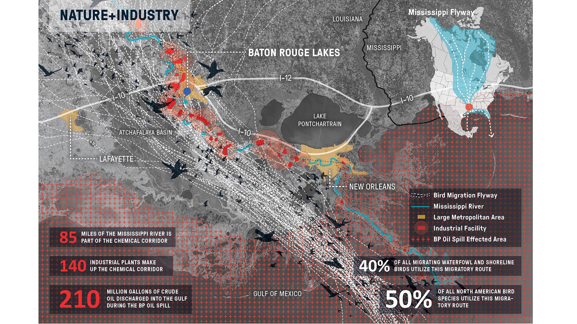


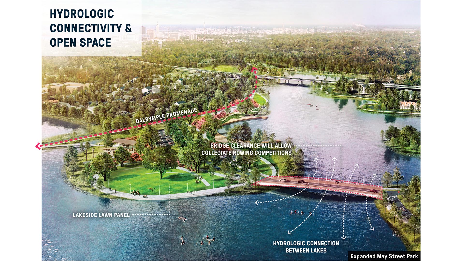
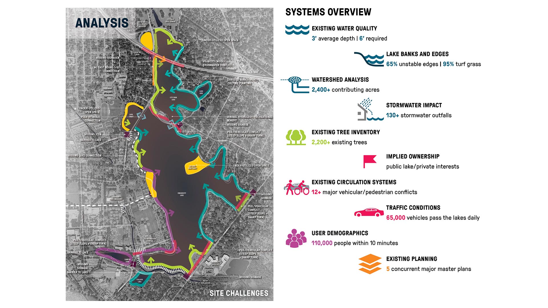

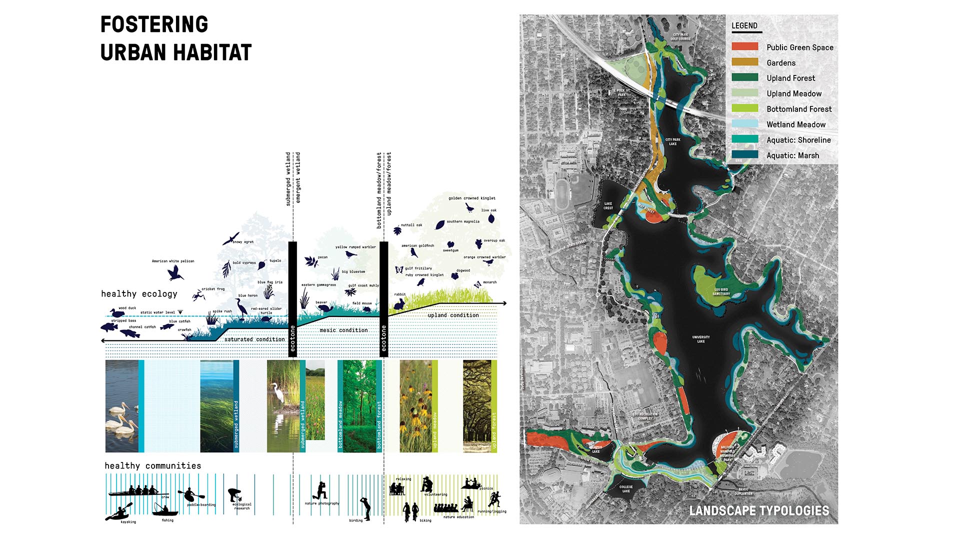

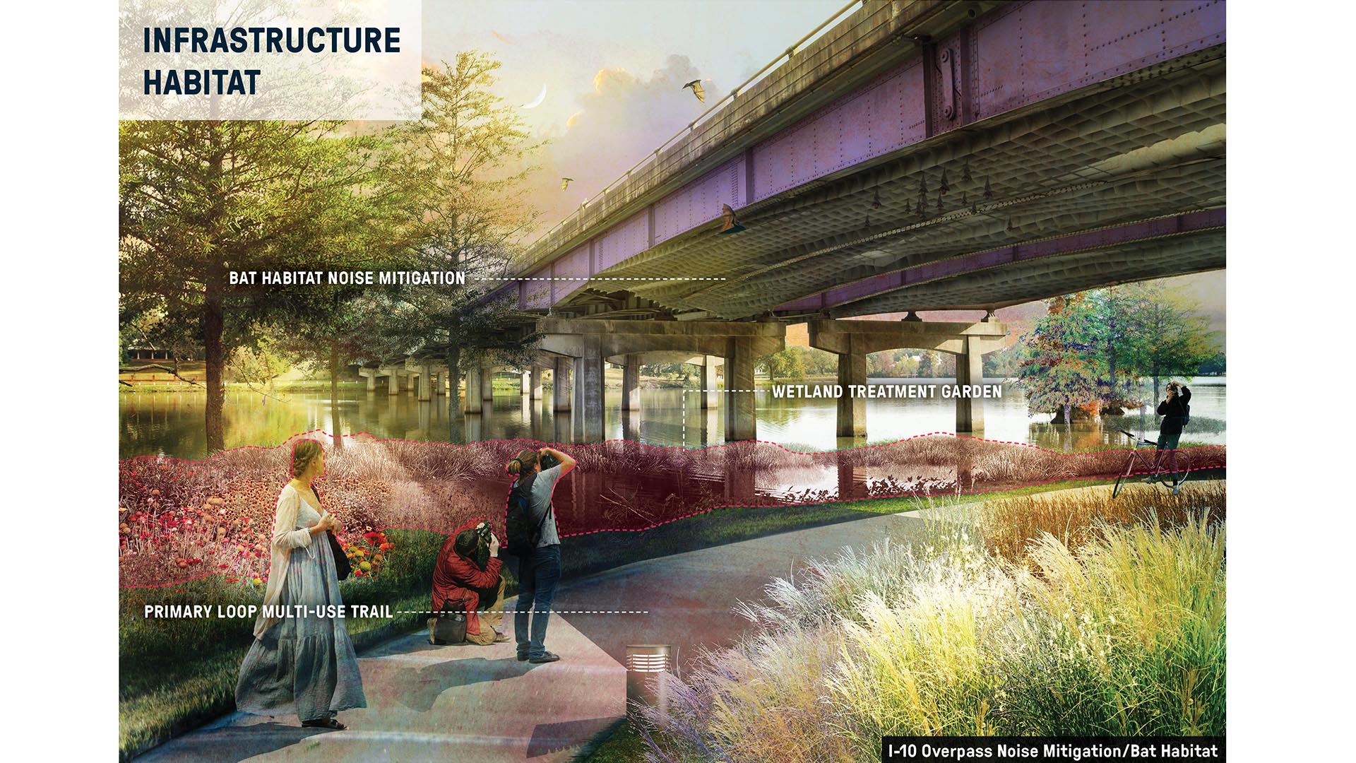
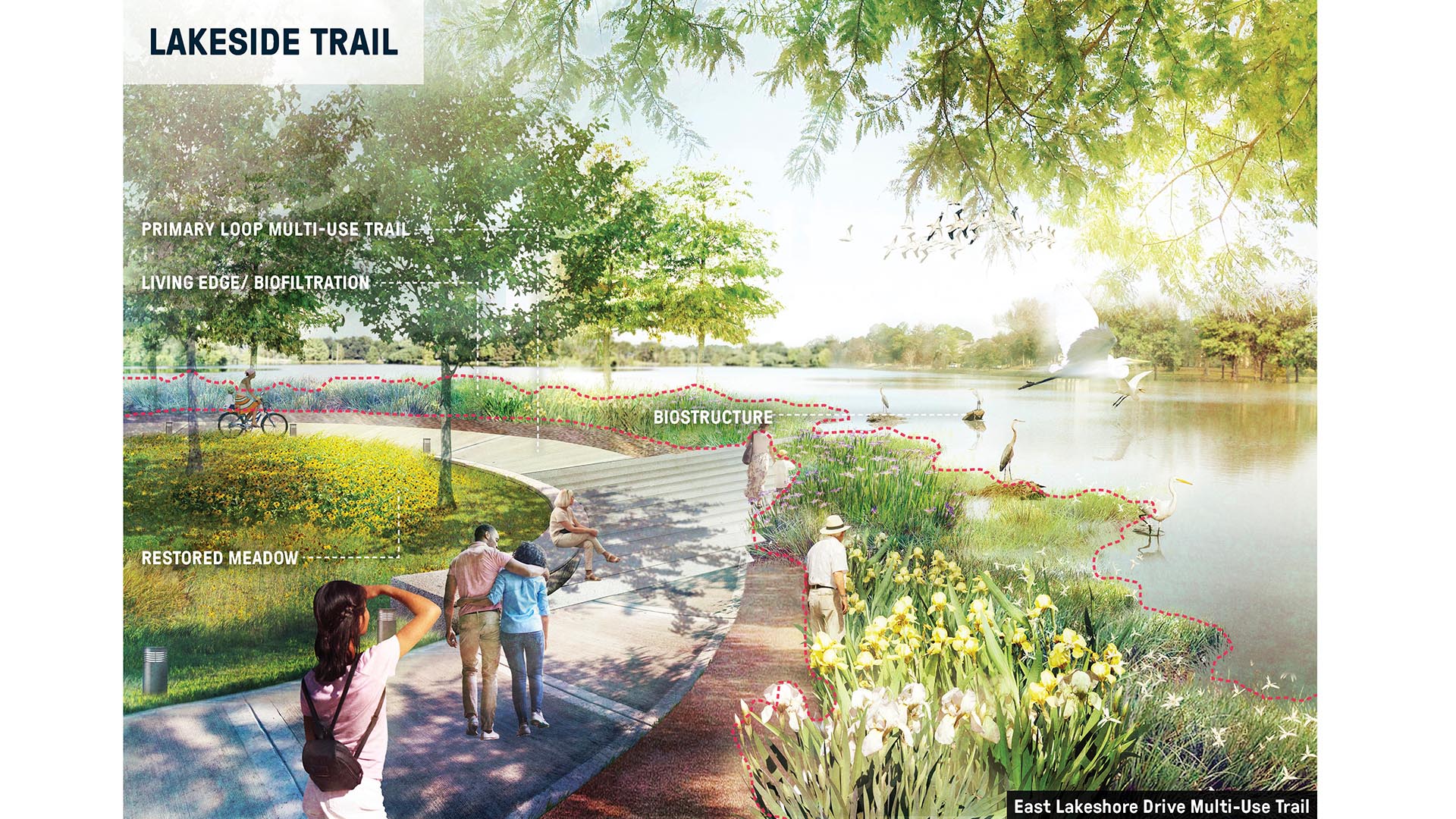

The 275-acre Baton Rouges Lakes system is a series of six lakes in central Baton Rouge adjacent to Louisiana State University, three major parks, and a diverse mix of neighborhoods. Recognizing opportunity in crisis, a newly funded master plan provides sound ecological restoration methods that will heal a dying lake system while reconnecting the region to its ecological and cultural heritage. No longer the epicenter of “cancer alley,” the Baton Rouge Lakes, as the centerpiece of Louisiana’s capital, have the potential to elevate the city’s identity to one based on best management practices, positioning man and water in equilibrium. Using nature as a catalyst for healthy lifestyles while providing habitat infrastructure for migratory birds and aquatic wildlife, the project will serve as a touchpoint for visitors from across the Parish and throughout the country to experience Louisiana in a new way. The first phase of work identified corrects water quality issues; phase two provides safe pedestrian, bike, and vehicular connectivity; phase three includes ten projects that produce recreational opportunities for a broad cross section of users. To guide the project toward implementation, a nonprofit Lakes Conservancy has been created.
To learn more about the effort from SWA Principal Kinder Baumgardner, please see his interview with the Baton Rouge Area Foundation.
Xingfa Quarry Park
Just north of Beijing, between the Great Wall and Yanqi Lake, the Xingfa Cement Plant once fueled China’s construction boom, operating for over two decades before its 2015 closure under the National Air Quality Action Plan. Today, an adjacent quarry that once provided raw materials has been remediated as a 107.5-hectare terraced park that anchors an accompanyi...
Main Street Garden Park
A key component in the downtown revitalization strategy, Main Street Garden Park required razing two city blocks of buildings and garages to make way for its transformation into a vibrant public space teeming with civic life. This two-acre park fosters downtown residential and commercial growth and was designed to accommodate the needs of residents in adjacent...
Tunica River Park
In 1990 the Mississippi Legislature legalized gaming as a job and tax creation strategy. Tunica, located at the northern border of the state near Memphis, Tennessee, was the first county to adopt gaming as an economic development strategy and implemented a program of rapid growth. The first casino was completed in 1992 and eight more were opened during the nex...
Bensonhurst Park
Bensonhurst Park is part of the larger Shore Parkway, an 816.1-acre collection of parks that stretches across Brooklyn and Queens. Today, the site provides a series of pathways, passive seating areas, recreational fields and a playground.
SWA/Balsley created a master plan for the redesign of the north end of the park and final design and construction doc...