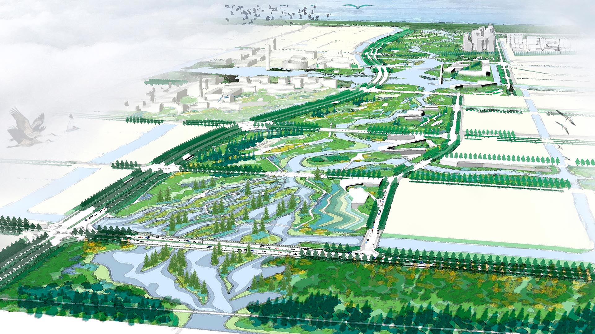
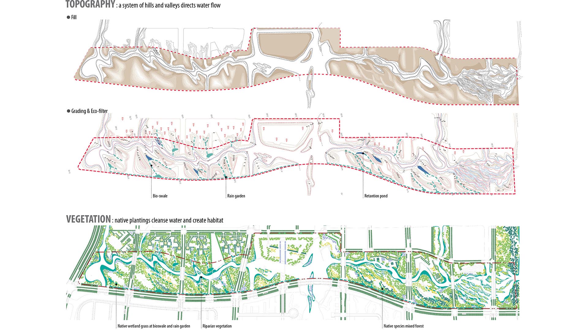
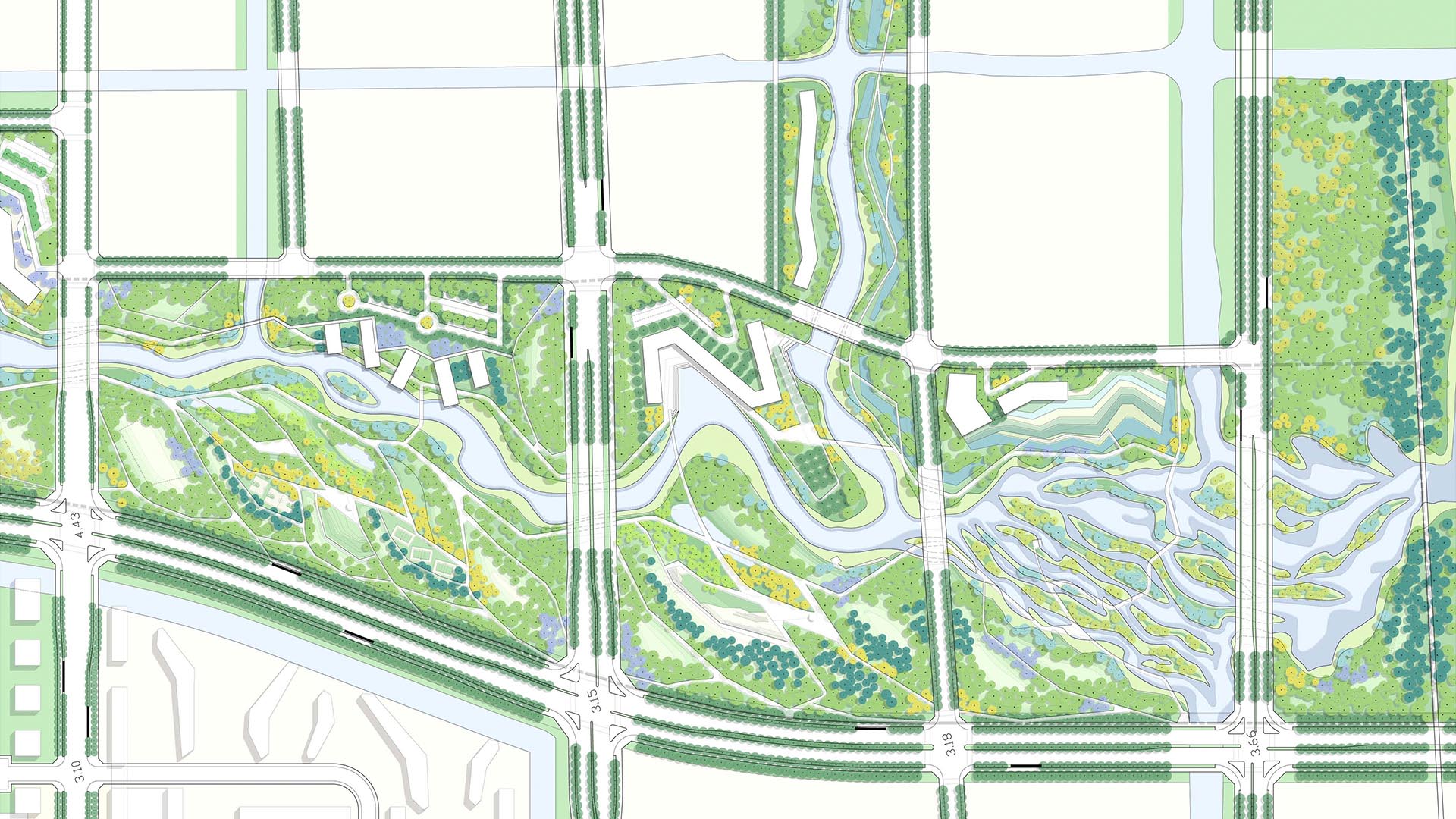
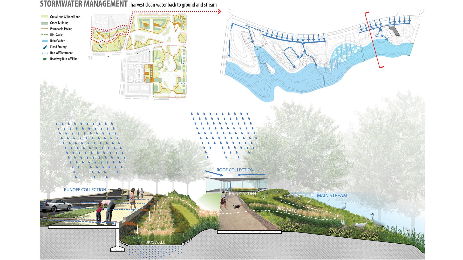
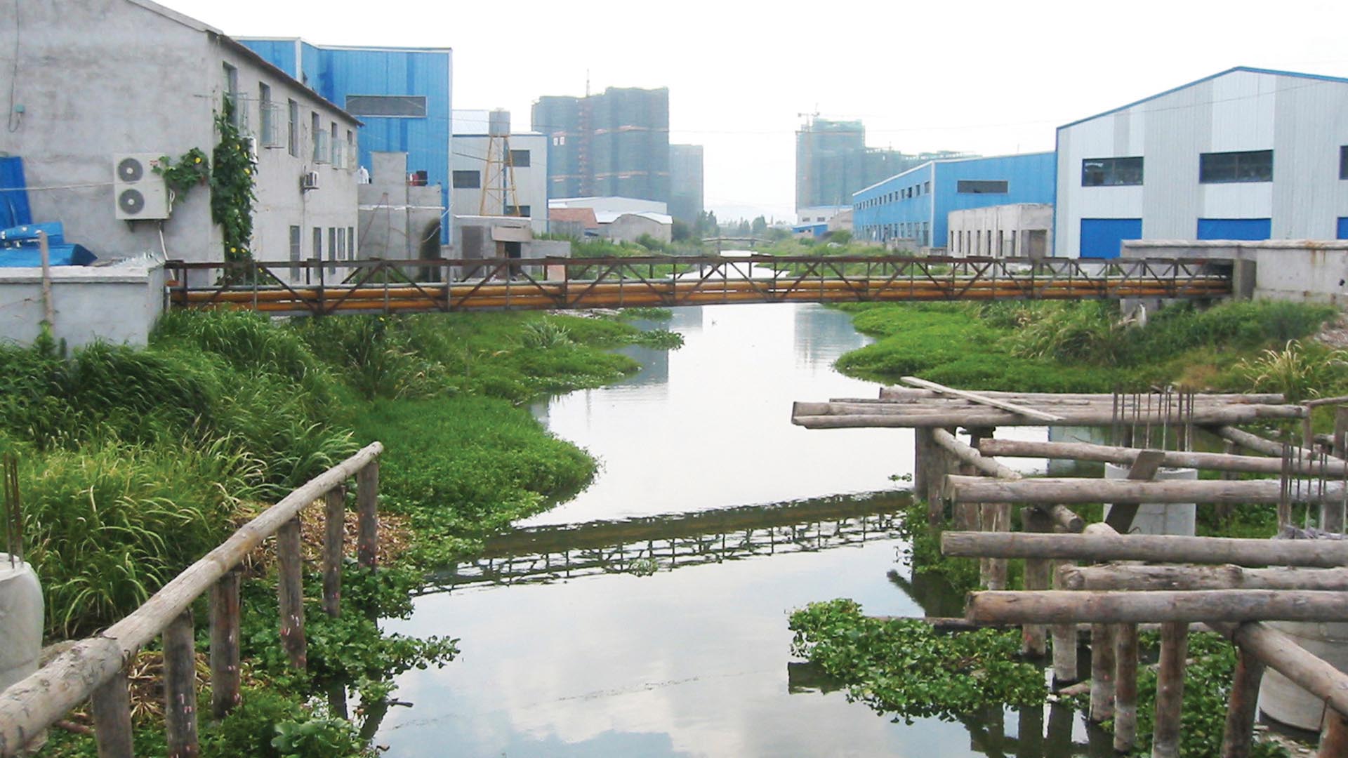
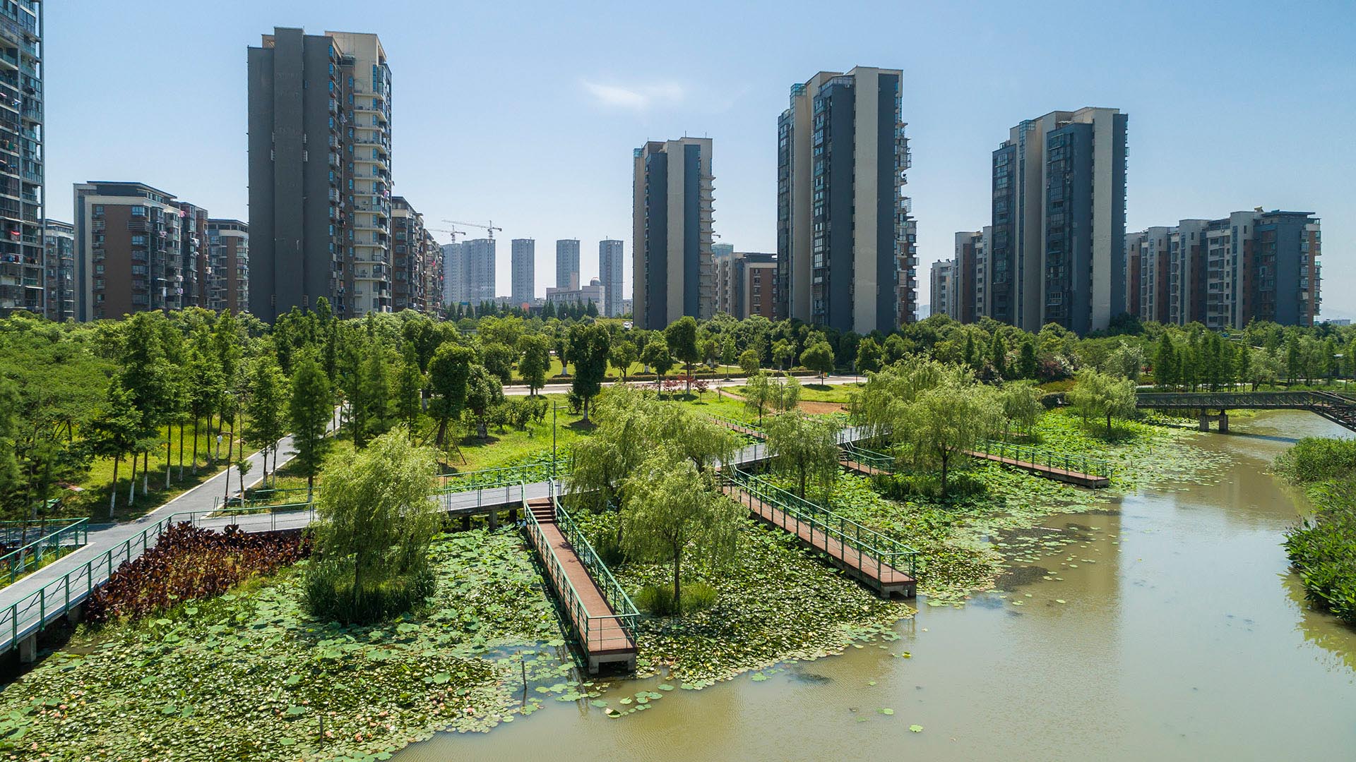
SWA provided planning and design services for the 3.3km long, 250-acre metropolitan Ningbo Eco-Corridor, which transforms a former agricultural plain that had been taken over by industrial use into urban green infrastructure. Located in the heart of the Yangtze River Delta on China’s coastline, Ningbo is one of China’s oldest cities, with an area of 3,616 square miles and a population of 5.43 million. Ningbo, which translates to “tranquil waters,” has been a well-known key port for foreign trade since ancient times. The development of this area inspired a strategy to establish Ningbo as a larger metropolitan area of economic and environmental importance and has set the stage for an ecological approach to the re-development of the city. Acting as a living filter, the design utilizes ecological strategies of hydrology, vegetation and topography, providing recreational, educational and cultural facilities for the Ningbo Eastern New City. Each area of development exemplifies a sustainable ecological approach by treating and recycling surface run-off water, harvesting solar energy, and reducing the urban heat-island effect. SWA additionally implemented a sustainable hydrological design that allows water to be filtered and aerated effectively and retained for aquifer recharge. The design seeks to offer a link between humans and their environment, fostering a community relationship to water and opportunities for environmental and ecological education. By linking together the ecological network in this region, the Ningbo Eco-Corridor enhances public health, quality of life, and property values of local and neighboring communities, and encourages other cities in the region to support ecological components in their respective developments.
Bayou Greenways
While Houston does have significant park spaces and trails, the city of no zoning has historically been unable to create enough designated open spaces and the necessary connectivity between them. The key to increasing the open space network lies within the region’s floodplains. Relatively flat terrain, intense rain events, and urbanized watersheds create broad...
Moji Mountain Park Master Plan
Moji Mountain, one of the most distinctive symbols of Yichang, now boasts the city’s largest public open space. The 120-hectare park is located along the banks of the Yangtze River, and has a rich historical connection to both the river and the city. De-forested in the past for agricultural uses, the mountain’s slopes have been replanted and now support a new ...
Fort Wayne Riverfront
As a city that was built and thrived because of its location as a crossroads between wilderness and city, farm and market, the realities of infrastructure both natural and man-made are at the heart of Fort Wayne’s history. We consider waterways as an integral part of open spaces of the City, forming a series of infrastructural systems that affect the dynamics ...
Sands Bethworks
One of the most prominent examples of redirecting the environmental legacy of a post-industrial landscape can be traced to the south banks of the Lehigh Canal, in the city of Bethlehem, Pennsylvania. Comprising 1,800 acres (20 of which belong to this project) and 20 percent of Bethlehem’s total land mass is the former headquarters of Bethlehem Steel Corporatio...


