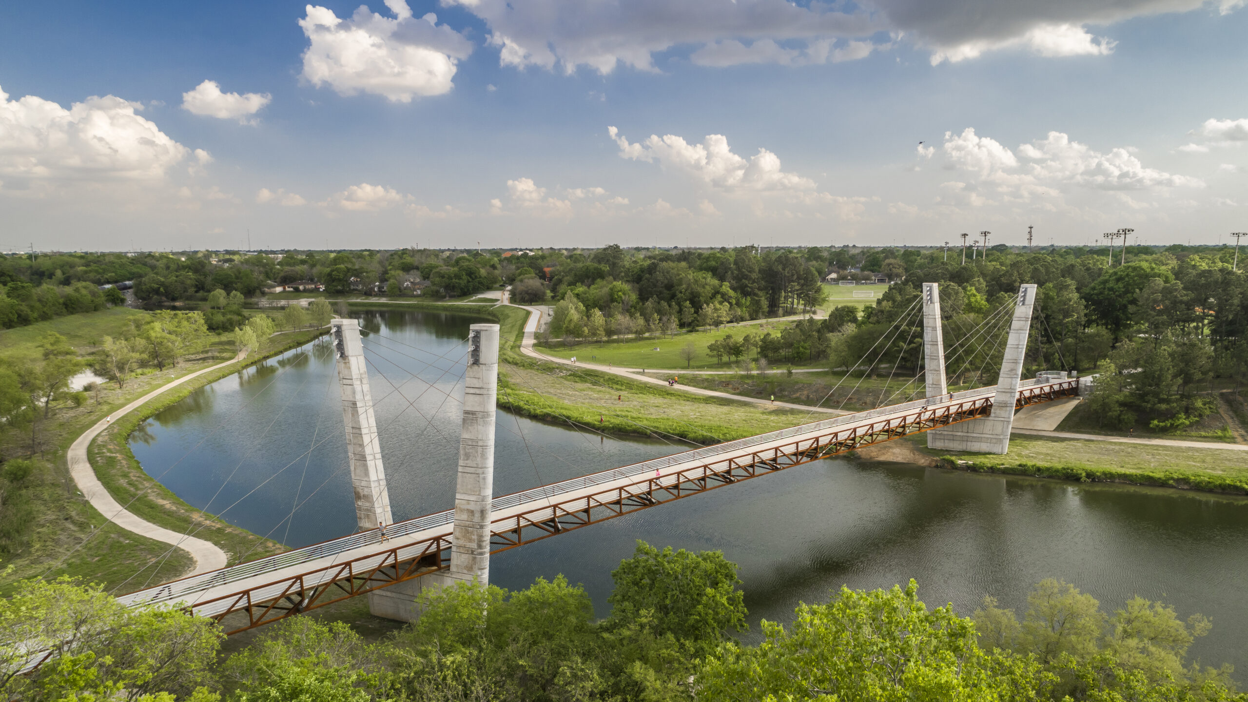


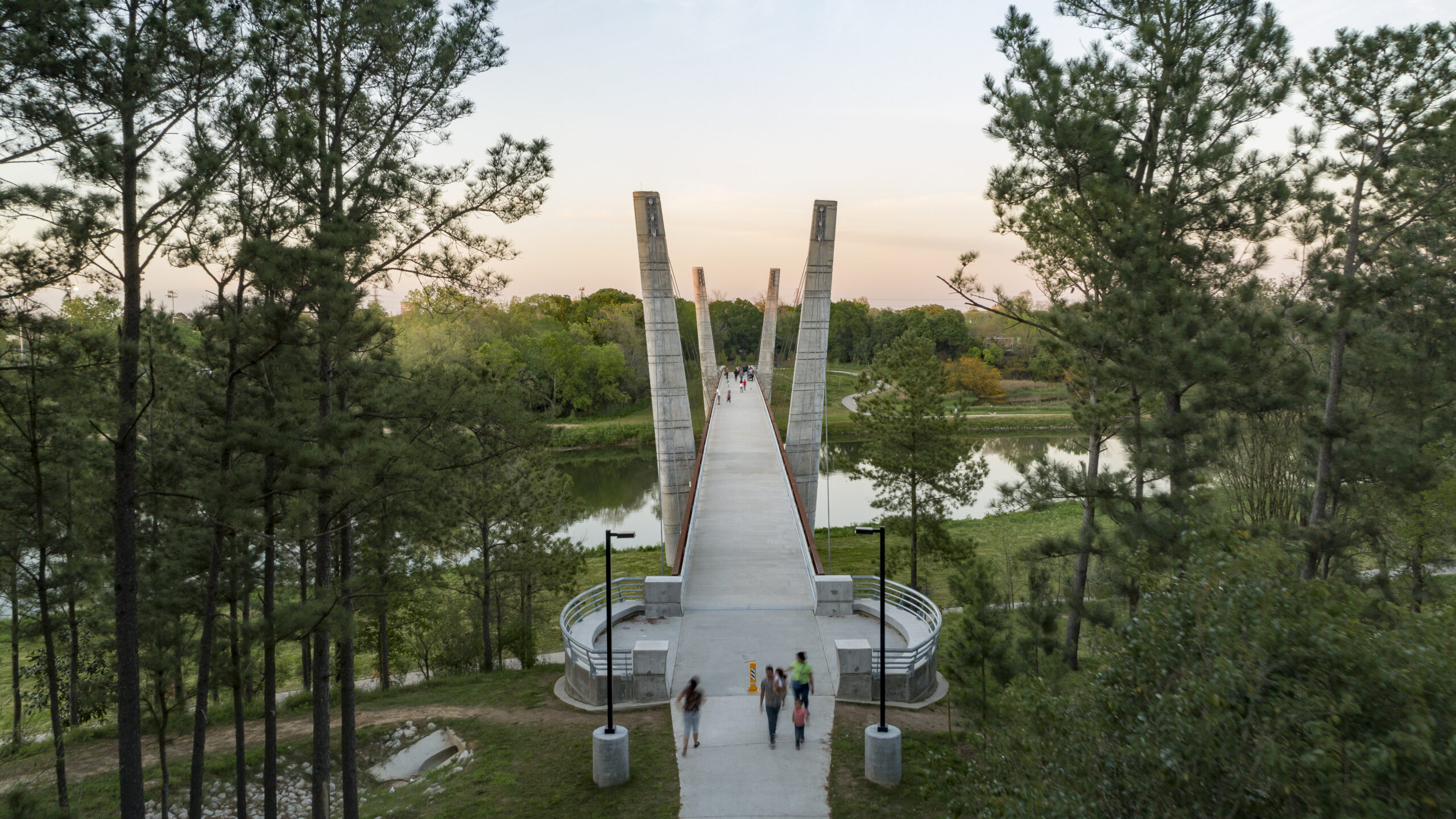

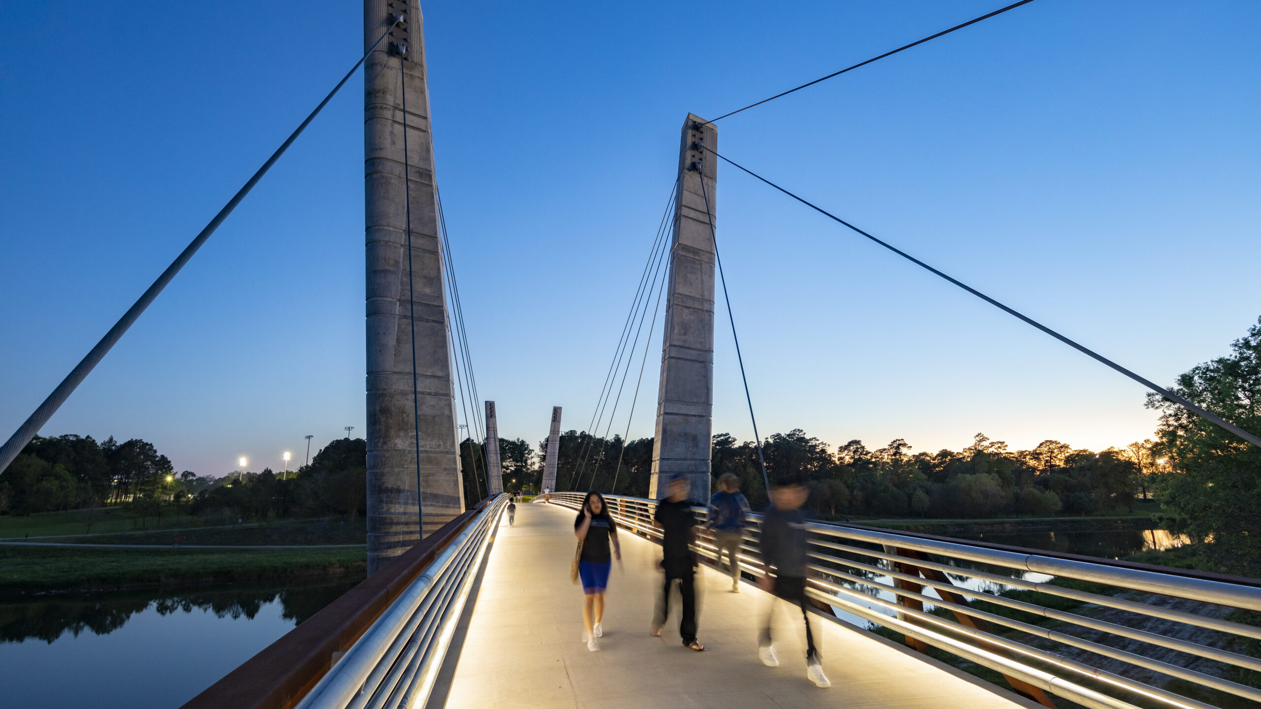


Mason Park, located at the confluence of two bayous, has served as an urban oasis since 1928. Despite a century of improvements to amenities, user access was significantly compromised by the wide expanse of Brays Bayou, which bisected the 104-acre green space into distinct northern and southern sections. Adjacent road and rail infrastructure further exacerbated accessibility issues for surrounding neighborhoods.
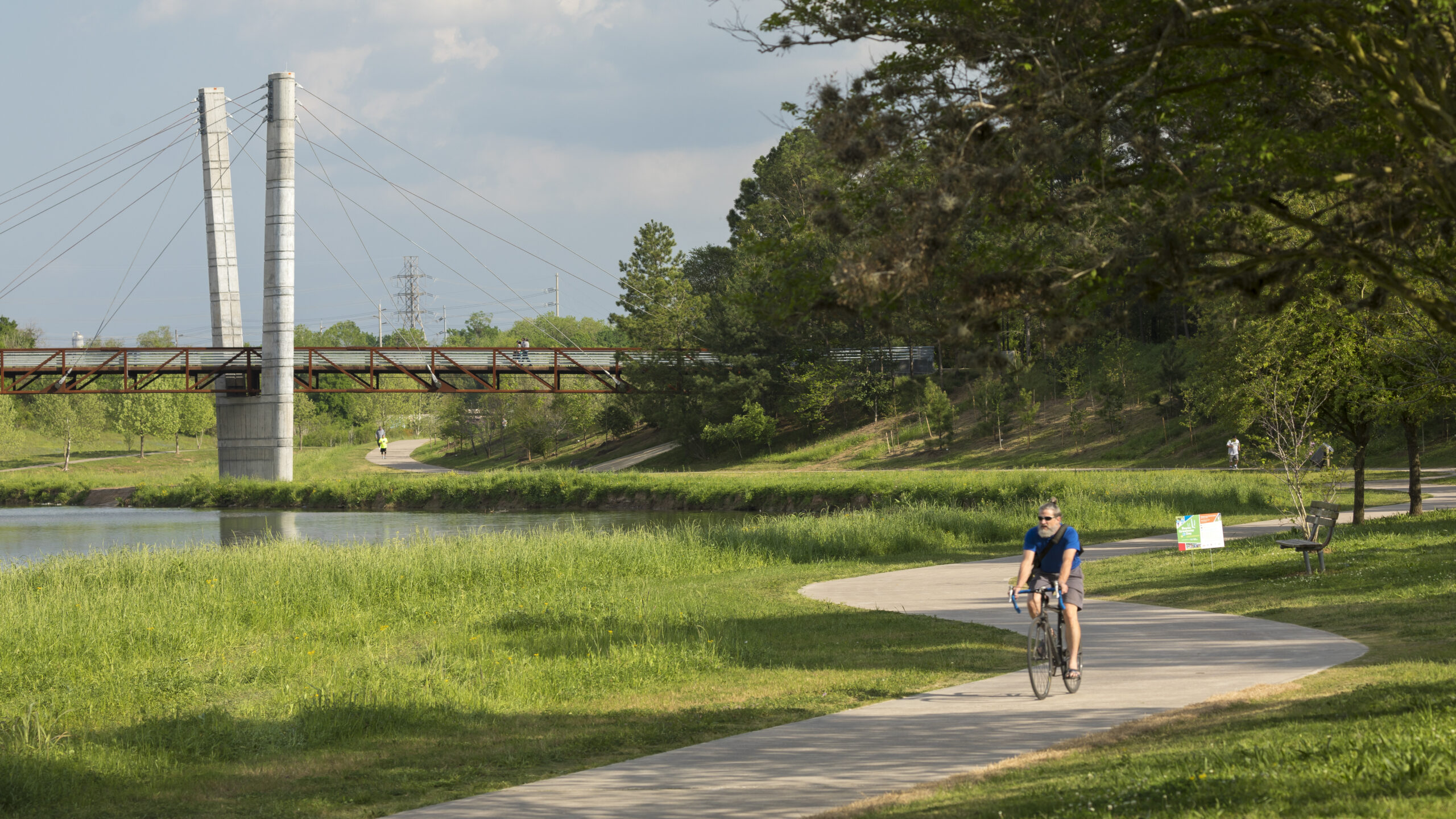
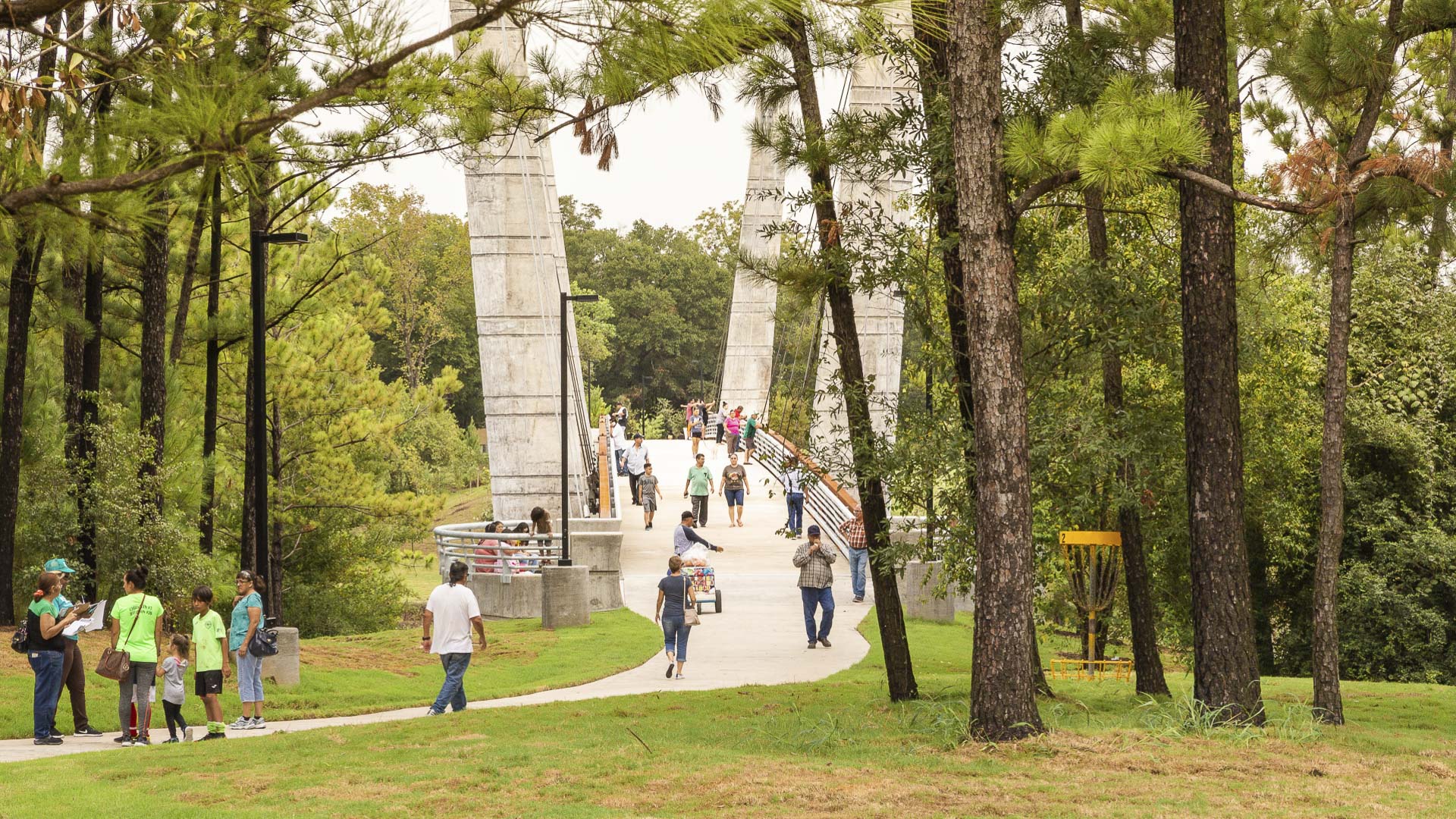
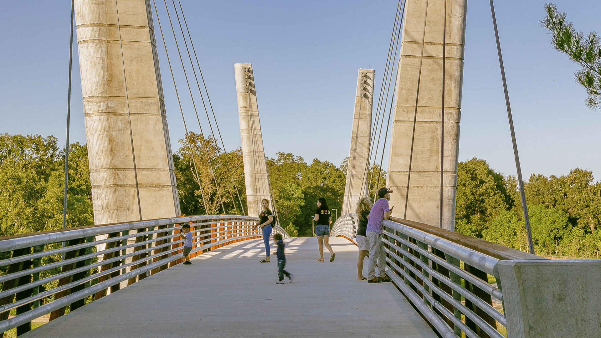
The Mason Park Bridge, a 485-foot cable-stayed, truss-decked structure spanning the bayou, now connects the two park areas and provides an iconic destination for cyclists and pedestrians utilizing the lower Brays Bayou trail system. The bridge also unites the Magnolia Park, Lawndale, Wayside, Pecan Park, Harrisburg, and Manchester communities, serving as a focal point for the neighborhood.
The design strikes a delicate balance between park aesthetics and bayou health. The team considered factors such as bridge height, span, bayou width, and pylon placement to minimize the impact on the area’s hydrology, creating a harmonious blend of engineering and nature. The result is a landmark crossing that grants park-goers access to community amenities while establishing a vital connection between two revitalized park areas.
Mason Park Bridge is a component of a broader initiative aimed at rejuvenating the ecology of Houston’s 4,000-acre Bayou Greenway arterial park system through the addition of trails, seating plazas, and lighting. As Houston grows, Mason Park Bridge serves as a catalyst for equity, promoting access to green spaces and fostering a sense of connection between the neighborhood’s surrounding Mason Park.
Jeffrey Open Space Park
The Jeffrey Open Space Park represents approximately 96 acres of park and trails, with an average width of 265 ft. The three-mile long spine is designed for passive uses with a network of trails that connect to residential neighborhoods and active recreation parks.
The design process included a series of community workshops to solicit community’s commen...
Longgang River Blueway System
The Shenzhen Longgang River Blueway System is envisioned to unlock the tremendous land value of this 13-mile-long suburban watershed and galvanize the city’s future growth. SWA’s proposal addresses urbanization issues pertaining to water, the environment, and open space shortage, while also activating industrial and cultural revitalization in the surrounding d...
Buffalo Bayou Smith to Travis Streets Trail Segment
This effort in Downtown Houston extends the Buffalo Bayou trail system eastward with the Smith to Travis Trail, connecting two historically significant sites: Sesquicentennial Park and Allen’s Landing, where the city was founded. It is a technically challenging segment located twenty feet below street level that traverses under multiple roadway bridges crossin...
Shunde New City
The Pearl River Delta is the second largest bird migration delta and estuary in Southeast Asia. Preserving and restoring bird and wildlife corridors while also providing regional connectivity, transportation, and development options is at the pinnacle of today’s development challenges. In the Shunde New City Plan, urban development and nature are integra...