

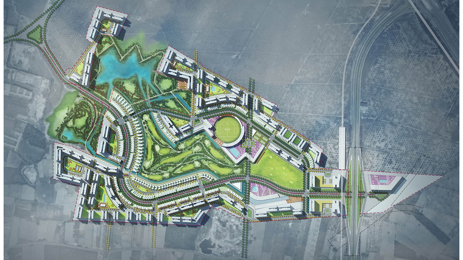


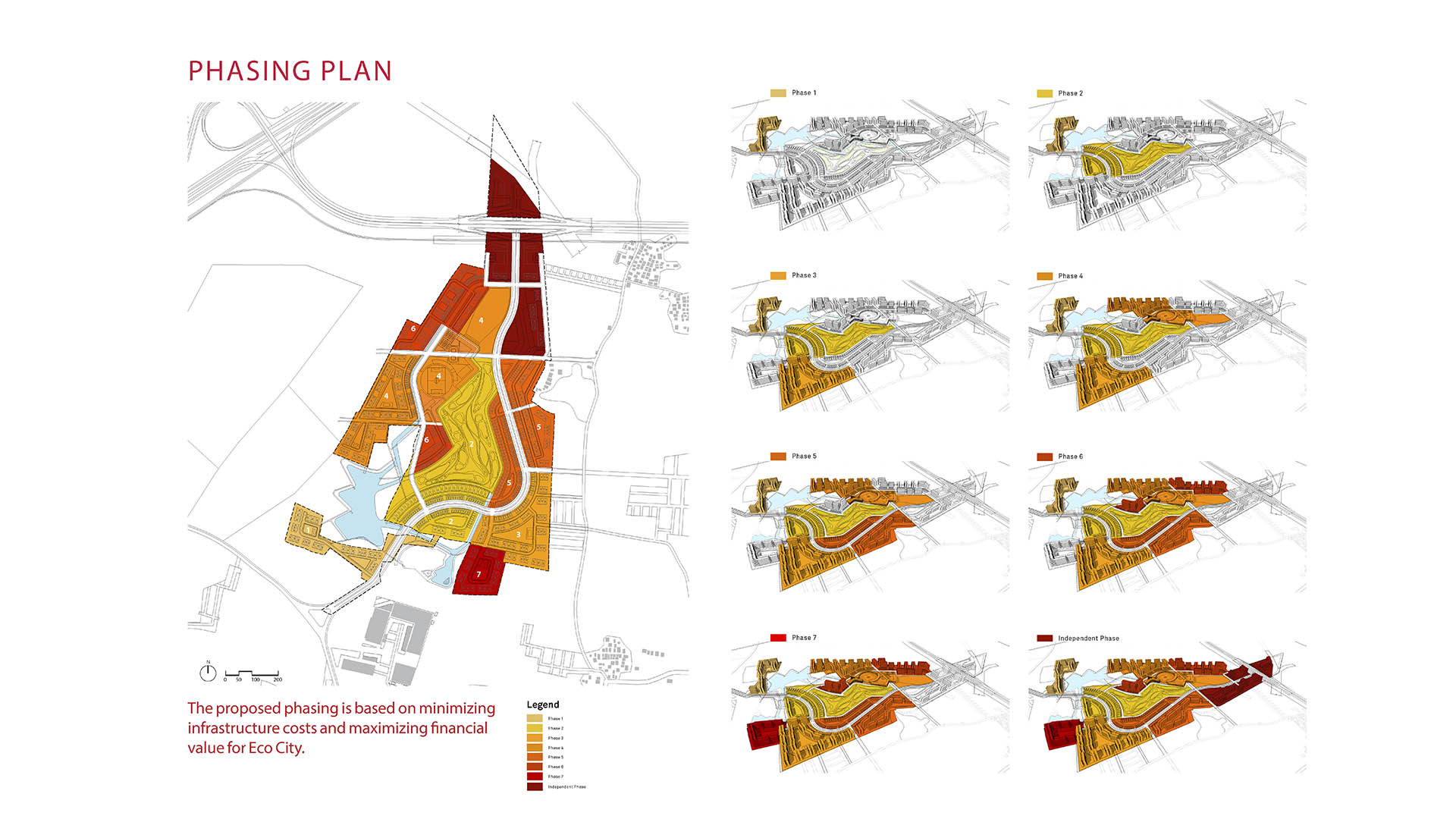

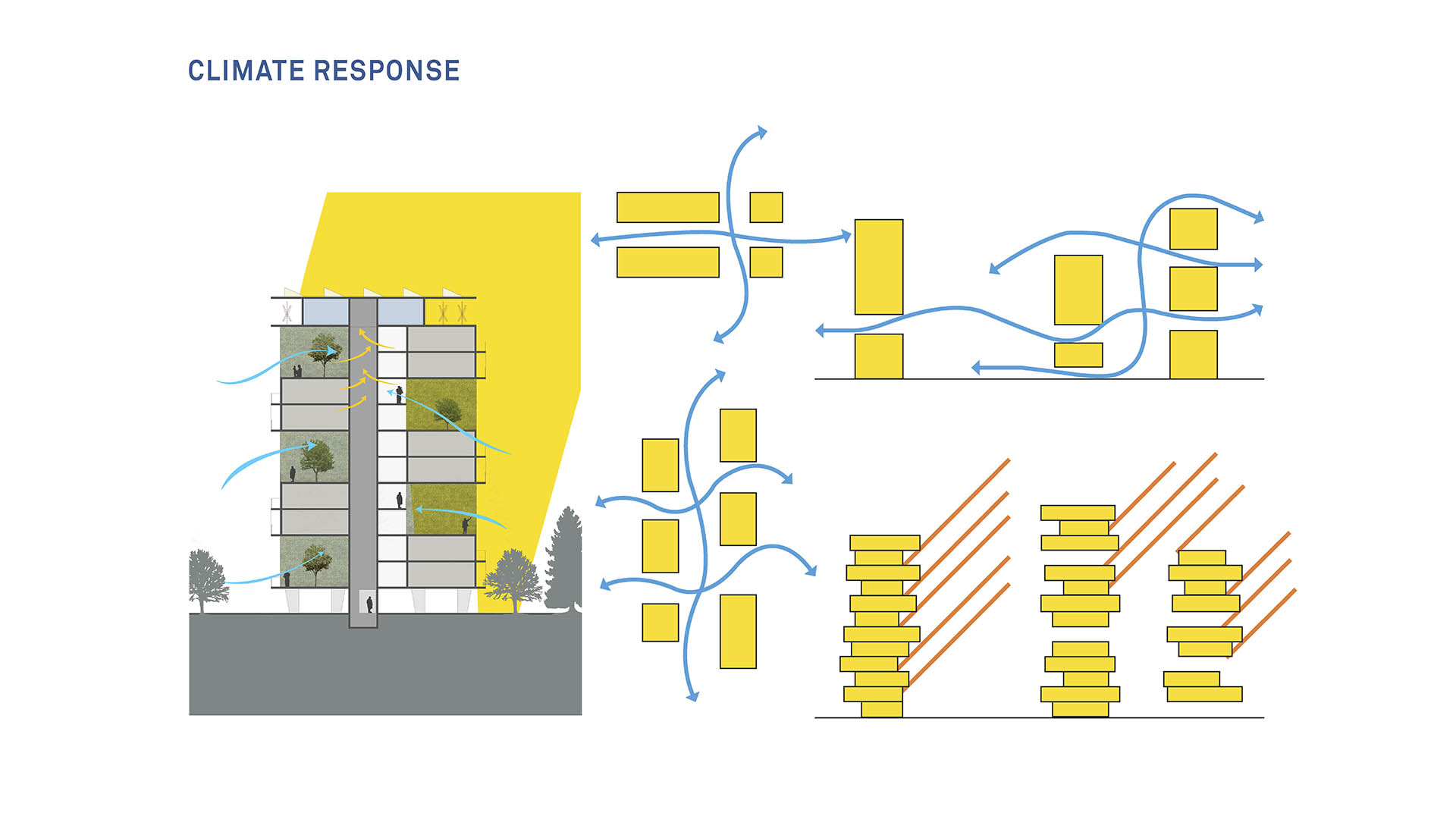
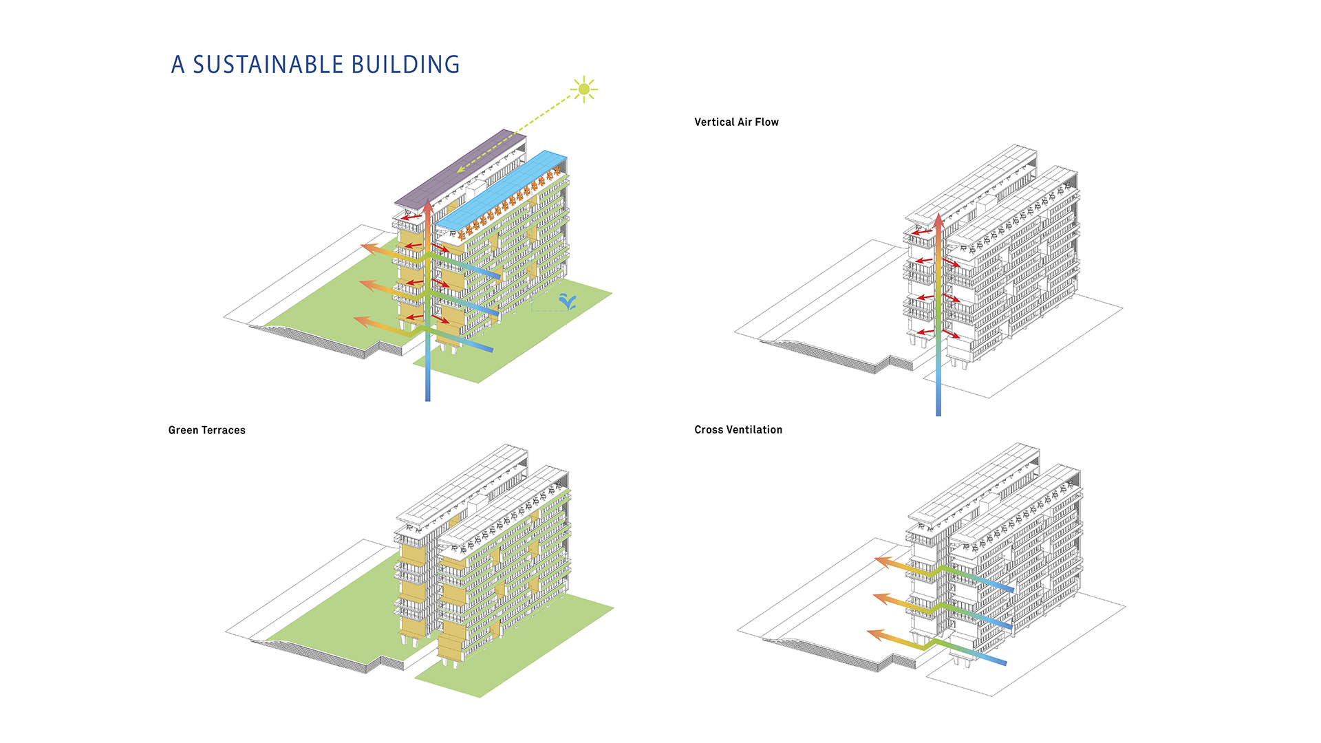

At the crossroads of ecology and community, this master plan synergizes a unique blend of spaces that support active lifestyles and foster innovation and creativity. Tata Eco City Master Plan was been developed layer by layer, using a set of strategic design interventions to help ensure that the delicate balance between nature and the built environment is protected and enhanced. Based on principles of sustainability, the public realm is woven into the built environment to provide a lifestyle that promotes a healthy “live-learn-play” balance. Drawing nature and surrounding landscape into the public realm, the plan creates a series of neighborhoods for phased and flexible development, structured around a nine-hole golf course and driving range.
The golf course forms the central open space of the community while opening up to the two existing water bodies and quarry to the south. A pedestrian, jogging, and bicycling network is interwoven with this central open space to provide site-wide connectivity, while an athletic complex and international school is at the heart of the community, and commercial and hotel parcels act as the northern gateway.
Houston Warehouse District Vision Plan
The Houston Warehouse District is home to numerous cultural attractions and has established itself as an arts community over the past 40 years. Its diversity and distinct character make it a valuable cultural asset to downtown and to the City of Houston. The district’s fabric includes light industry, residences, mixed-use development, and higher educatio...
Kunming Eco-Communities
The concept for the Kunming Eco-Town is based on an understanding of the historical natural processes of the location. The masterplan restores balance in the landscape through sensitive development. In using a watershed planning approach to determine the most sensitive lands and subsequently, where development is appropriate, the issues of a healthy, functioni...
Cross Creek Ranch
As urban areas expand, degraded lands robbed of natural resilience and biodiversity often lie in development’s path—presenting both challenges and opportunities. The Flewellen Creek Restoration project transforms a derelict 130-acre ranching ditch into a vibrant 3-mile ecosystem, anchoring the new 3,200-acre Cross Creek Ranch community.
Rooted in ...
Shunde Guipan River Waterfront
SWA participated in a competition reimagining 19-kilometers of the Guipan River waterfront in Shunde, China. While the Pearl River Delta is one of the fastest growing regions of Southern China, one of the many casualties of this growth was the delta itself. Presently, Shunde has a growing flooding problem enhanced by channelizing, condensing, and containing th...