

Designing for Sea Level Rise
Sea-level rise is often described as a future condition to anticipate through projections for 2050 or 2100. Along many coastlines, however, its effects are already becoming part of everyday life.
Higher tides reach farther inland. Roads and public spaces flood more frequently. Shorelines erode, wetlands shift, and storms push water into places that once remained dry. These changes may arrive gradually or episodically, but together they are beginning to reshape the relationship between coastal communities and the water around them.
For landscape architects, planners, and urban designers, these changing conditions raise questions that extend well beyond the water’s edge. How can a public space accommodate periodic inundation and recover quickly? Where can wetlands and other coastal ecosystems be given room to migrate? How should streets, buildings, and infrastructure relate to future flood elevations? And how can investments made today preserve possibilities for adaptation decades from now?
Across coastal landscapes in the United States and abroad, SWA has explored these questions at scales ranging from individual buildings and public spaces to waterfronts, ecological systems, and entire urban districts. The projects that follow offer a growing repertoire of strategies for designing with changing water conditions: making space for inundation, restoring coastal processes, elevating critical infrastructure, creating new relationships between buildings and ground, and structuring long-term development around an uncertain shoreline.


Hunter’s Point South Park
Queens, New York
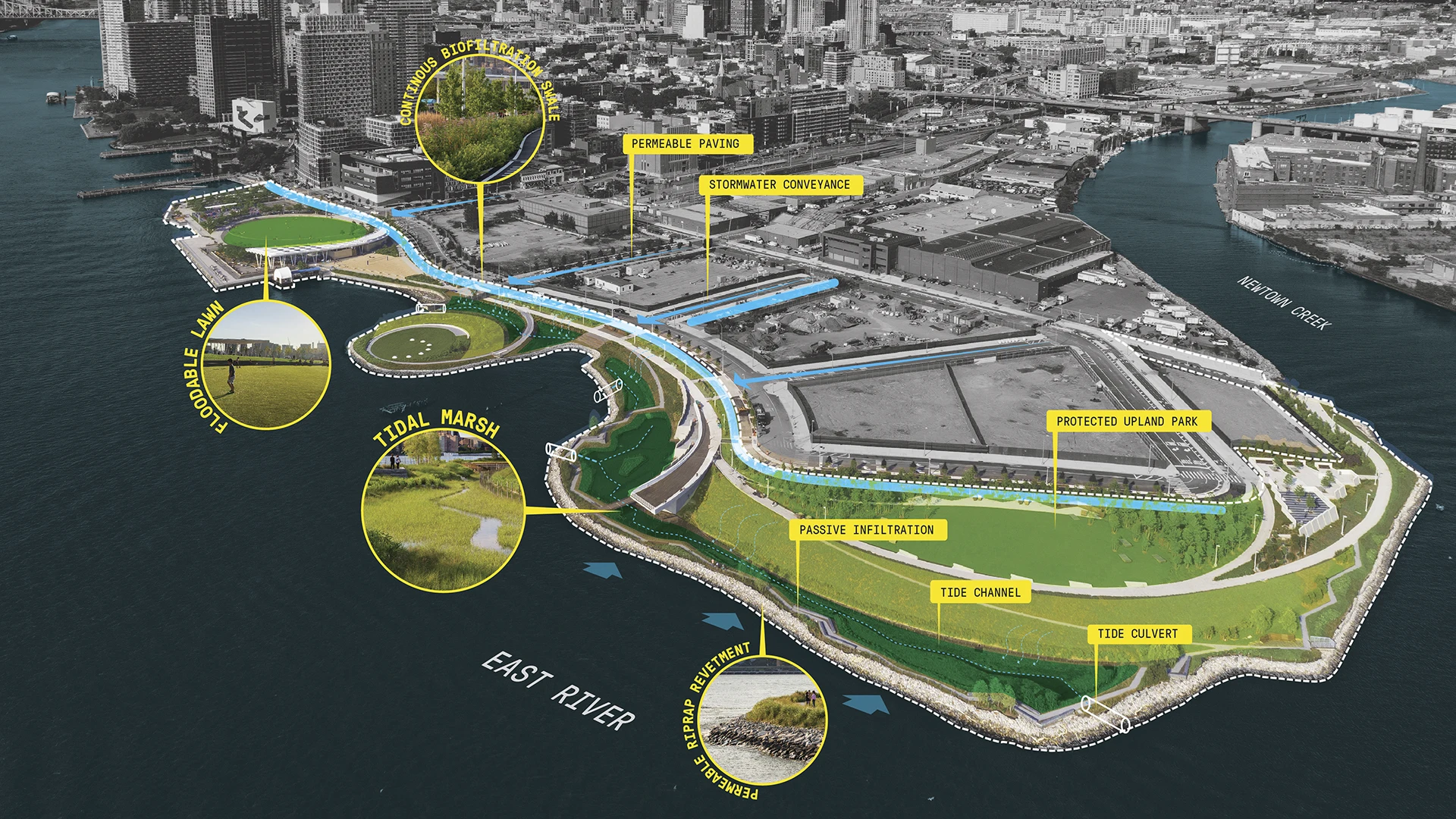
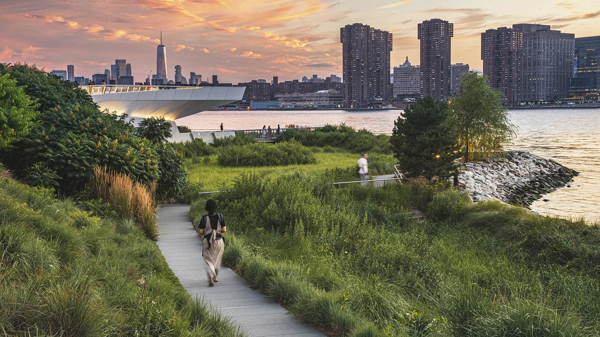
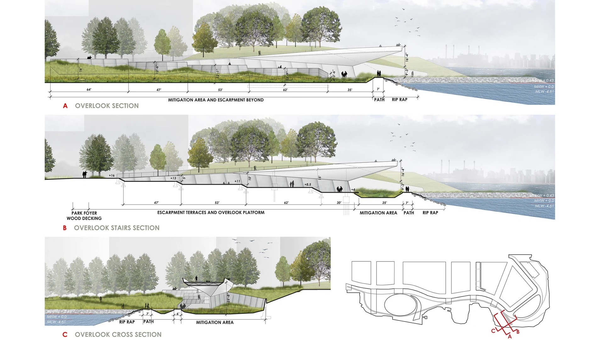
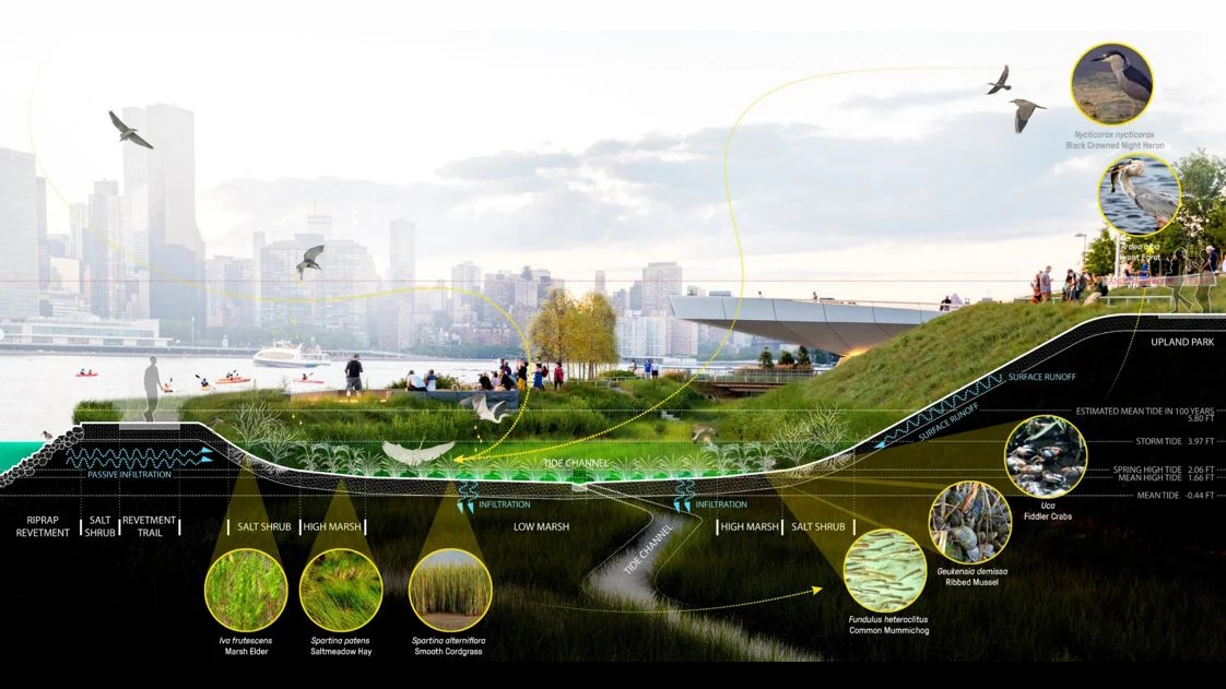
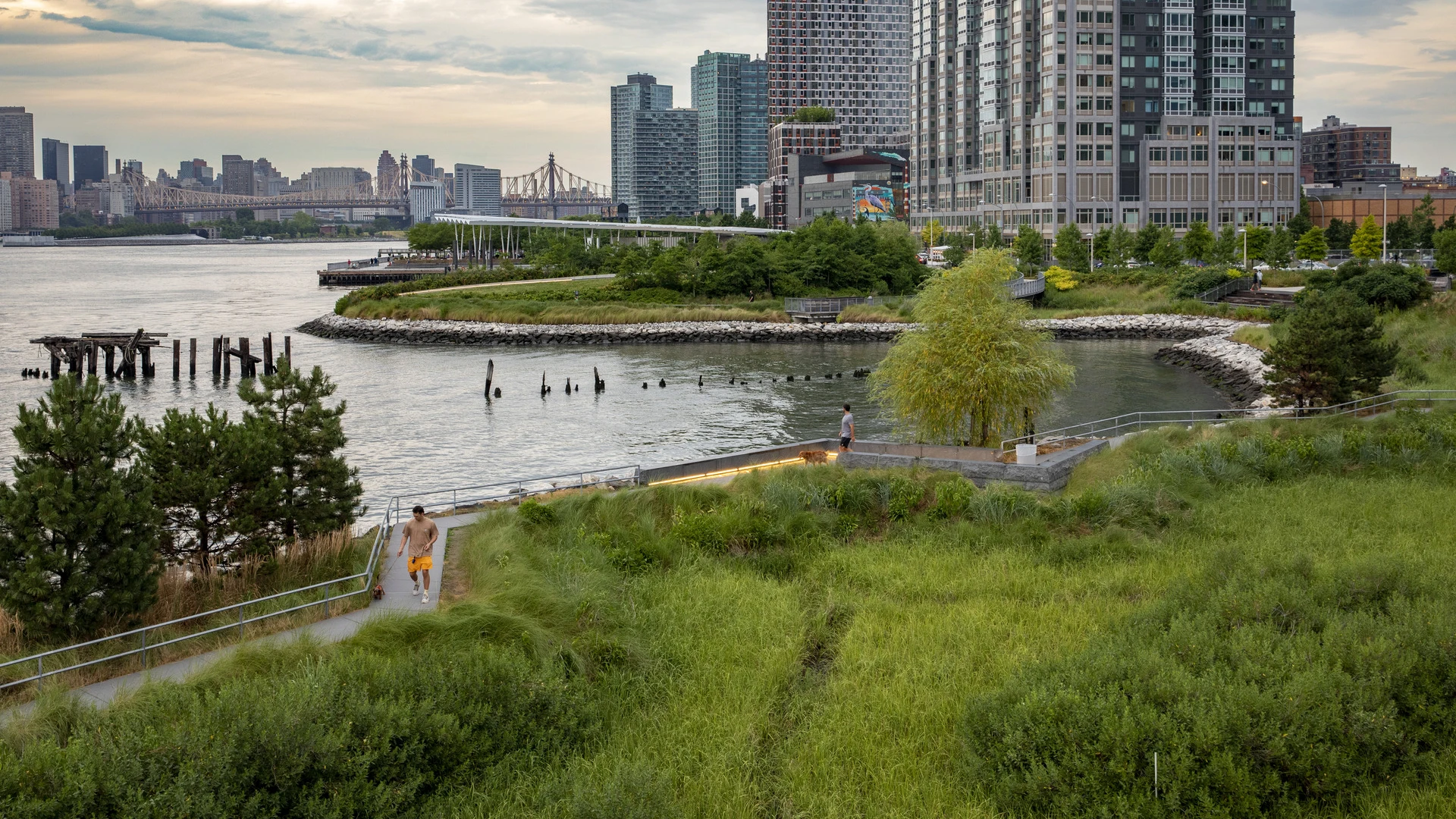
Along the East River in Queens, Hunter’s Point South Waterfront Park was conceived as public space and coastal infrastructure for a rapidly developing waterfront neighborhood. Its design anticipates periodic inundation through a layered system of hardened and planted edges, floodable open space, stormwater infrastructure, and durable materials that manage water as it moves onto and off the site.
At the center of the park, a nearly 30,000-square-foot oval lawn doubles as a flood basin, temporarily storing an estimated 558,000 gallons of water during major events and directing it back toward the East River as floodwaters recede. Along the park’s inland edge, a 760-foot biofiltration swale and rock-filled gabions intercept and slow stormwater before it reaches the city’s combined sewer system, while riprap and planted areas create additional layers of protection and absorption.
Hurricane Sandy tested these strategies while the park was still under construction. Approximately four feet of water inundated the site, closely tracing the footprint of the historic marsh that preceded its industrial development. Major constructed elements sustained minimal damage, and the site drained within five days.
Hunter’s Point South demonstrates an approach to coastal adaptation organized around accommodating change: creating space for water, distributing its impacts across multiple systems, selecting elements capable of surviving inundation, and designing for rapid recovery. As coastal flooding becomes more frequent, these strategies offer a model for public landscapes that can remain useful and resilient through a wider range of conditions.
Aquatic Park & Pier Vision Study
San Francisco, CA
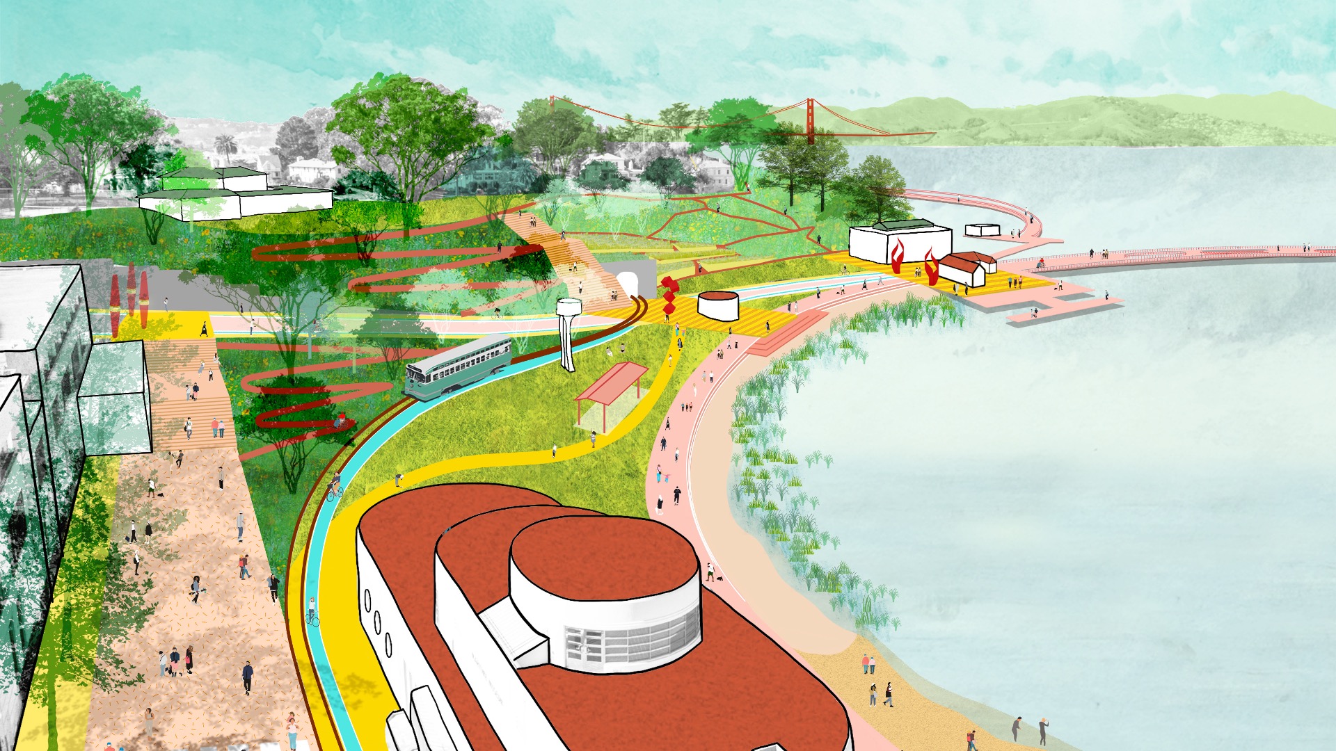
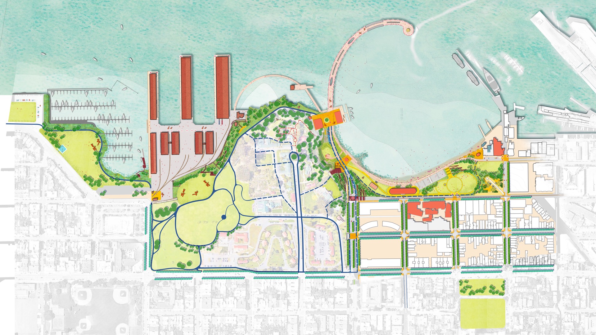
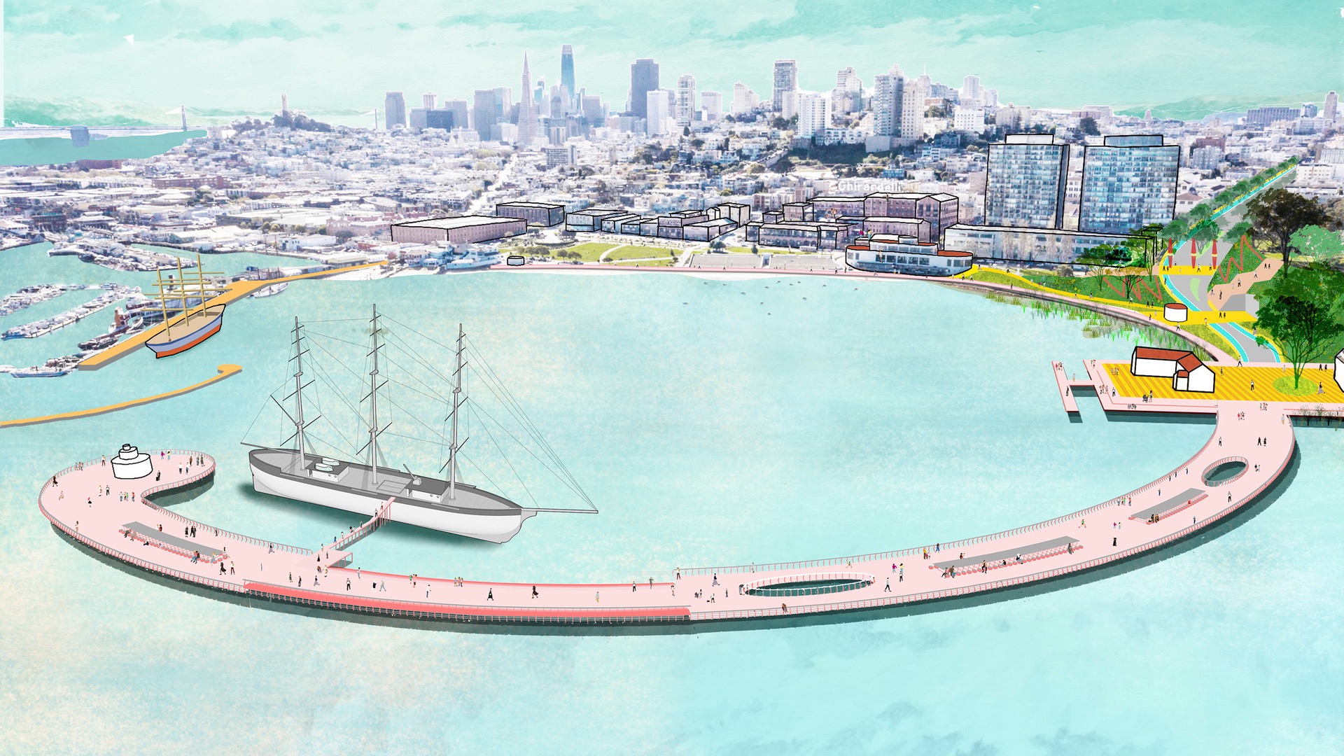
For nearly a century, Aquatic Park’s distinctive curving Municipal Pier has done more than provide access to San Francisco Bay. Extending 1,400 feet into the water, the structure shelters the cove from tidal energy and creates the calm-water conditions that support swimming, boating, historic ships, and one of the city’s most distinctive public waterfronts. Today, decades of exposure to waves, tides, storms, and earthquakes have left the pier severely deteriorated, while sea-level rise and storm surge introduce new pressures on the park and surrounding waterfront.
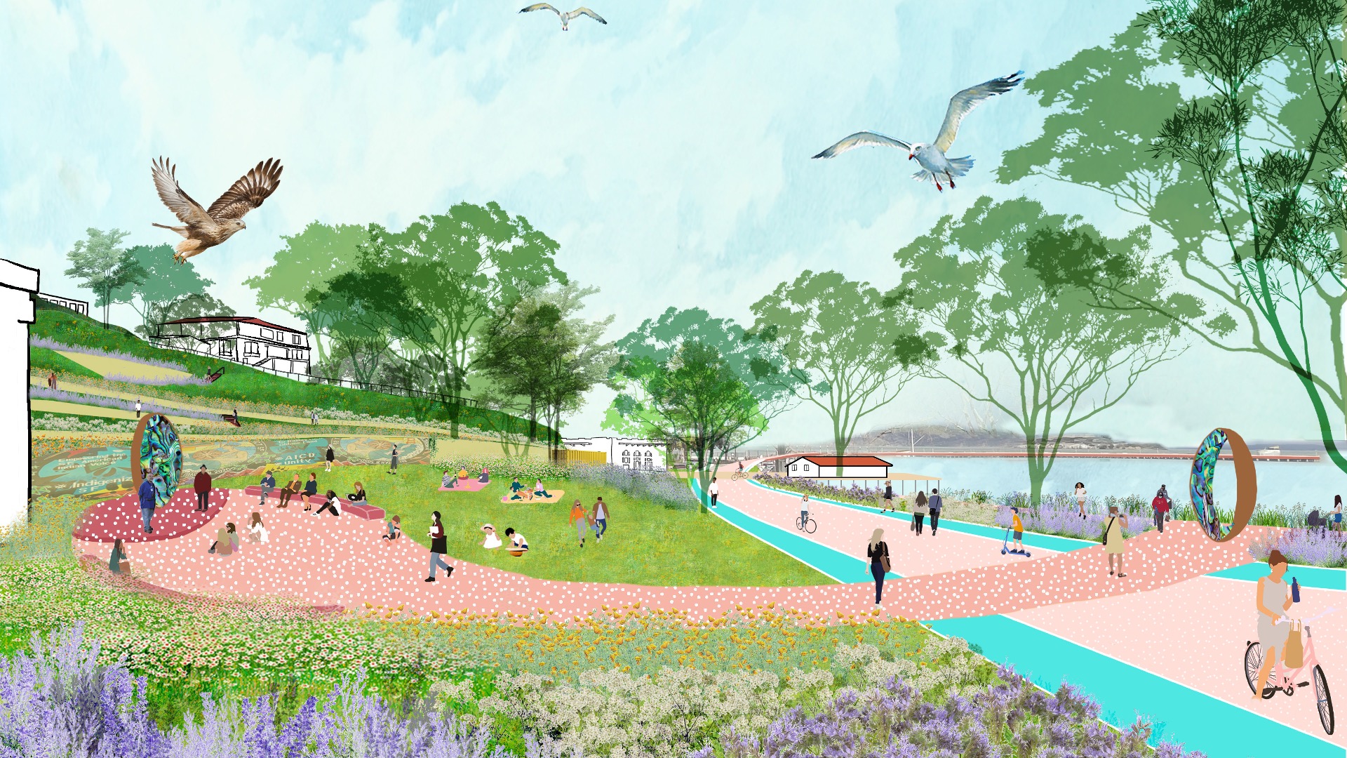
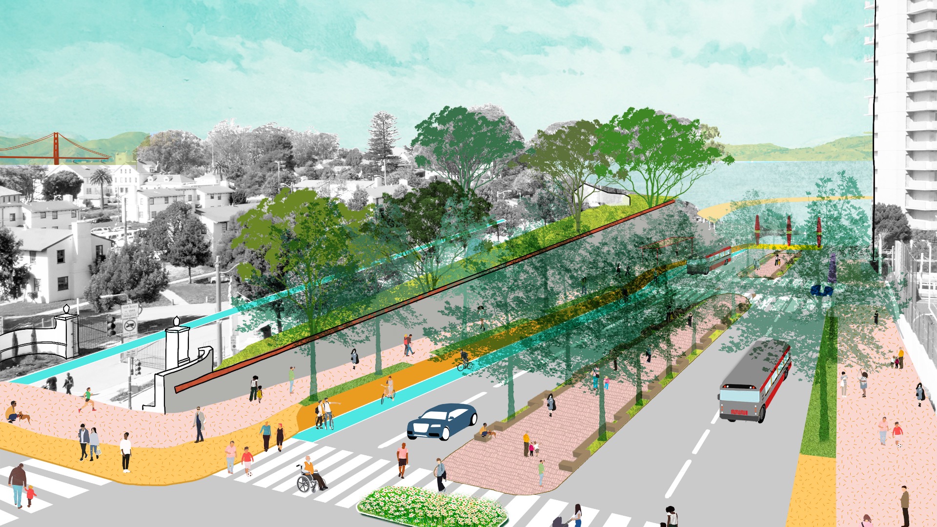
The Aquatic Park and Pier Vision Study uses the need to replace this aging infrastructure as an opportunity to consider the future of the larger waterfront. Developed through extensive community engagement, the study examines the pier alongside improvements to the shoreline, public access, ecological conditions, circulation, and connections between Aquatic Park, Fort Mason, and the city. It also incorporates a vulnerability analysis addressing sea-level rise and storm-surge risk and coordinates with larger resilience planning underway along San Francisco’s waterfront.
Aquatic Park demonstrates how infrastructure renewal can become a catalyst for adaptation. Rebuilding a protective structure creates an opportunity to anticipate future water levels, strengthen connections between shoreline systems, and align investments across agencies and jurisdictions. The result is a framework for adapting a valued civic landscape incrementally as coastal conditions continue to change.
Aliso Creek Estuary Restoration
Laguna Beach, CA
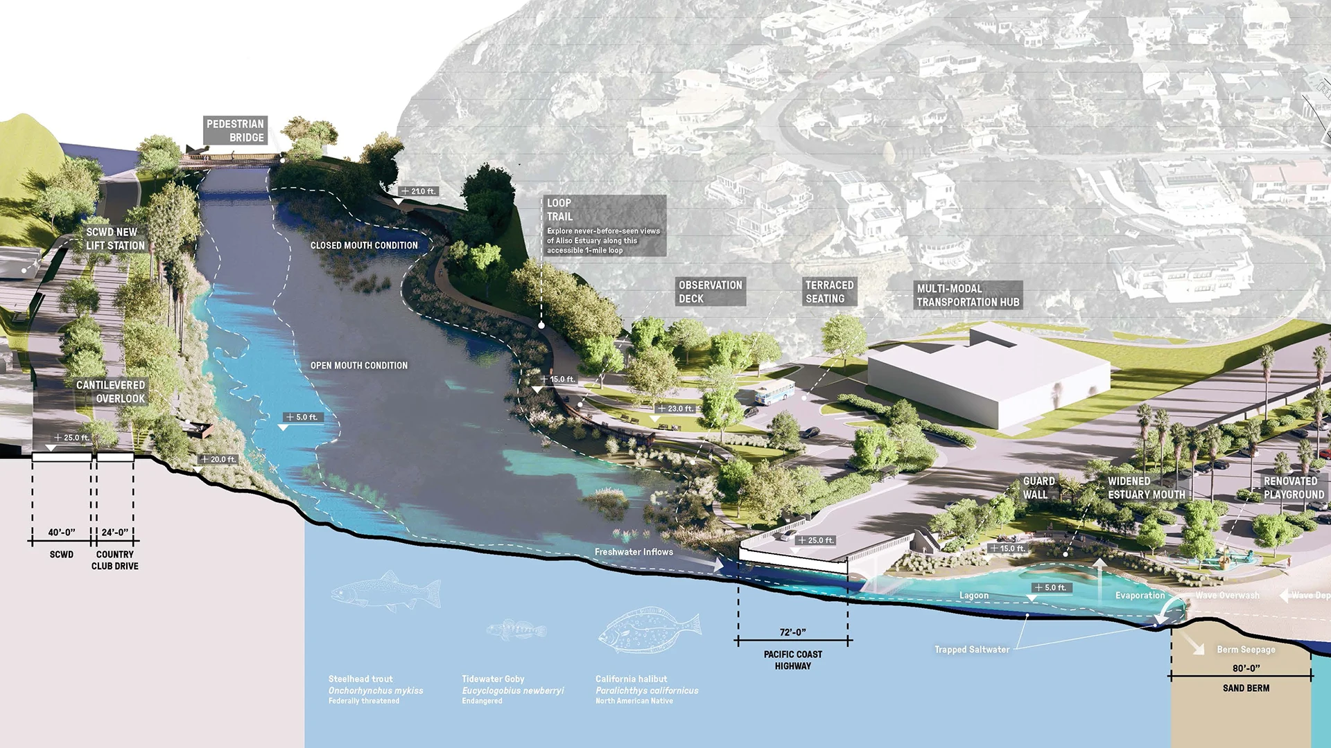
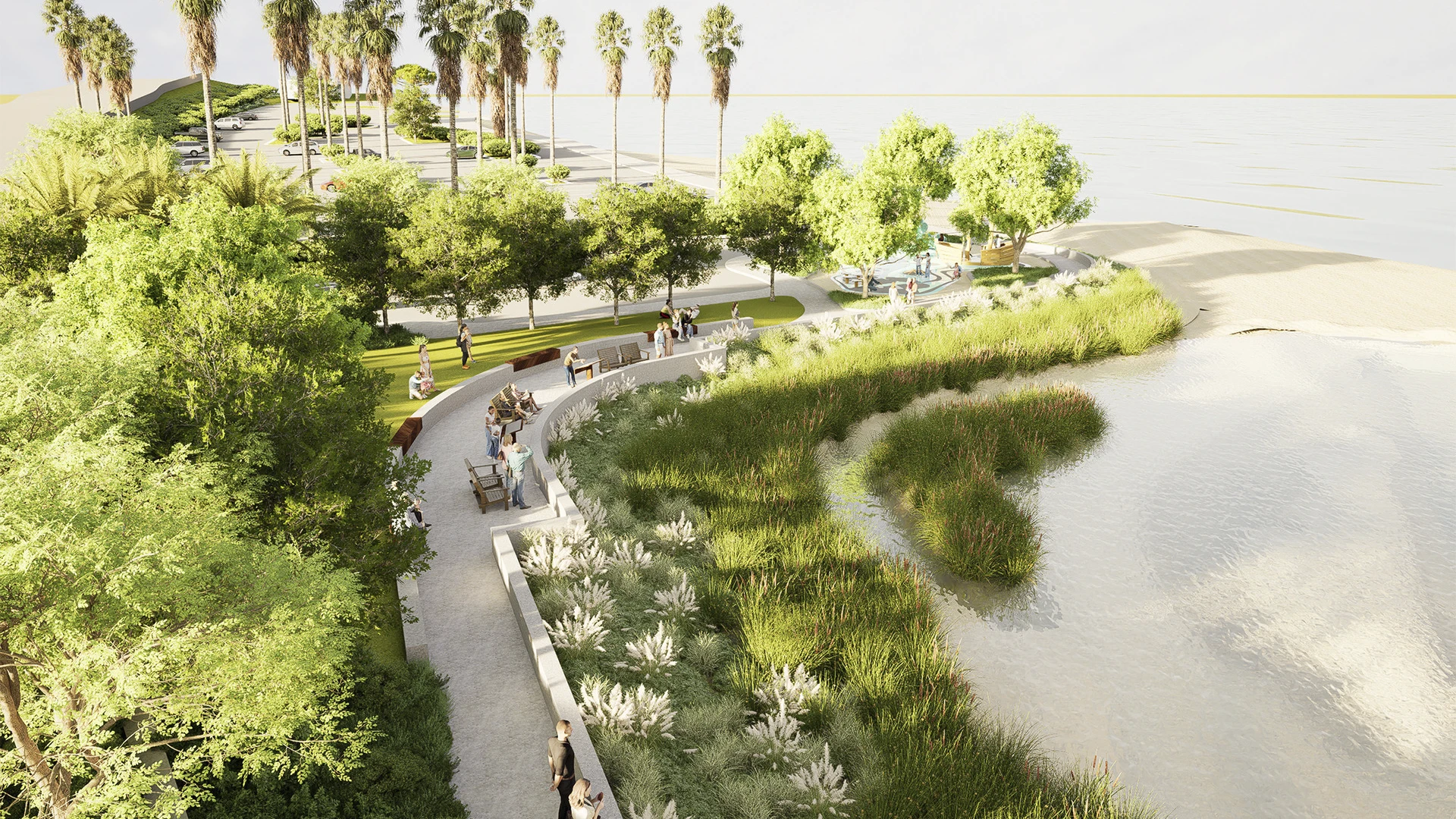
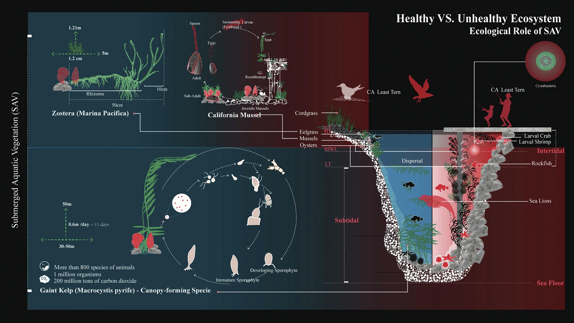
At the mouth of a highly urbanized watershed in Laguna Beach, the Aliso Creek Estuary occupies the dynamic interface between creek and ocean. Decades of channelization, fill, infrastructure, and increased urban runoff have dramatically altered this system, reducing what was once an extensive coastal wetland to a degraded lagoon with limited habitat value and diminished ecological function.
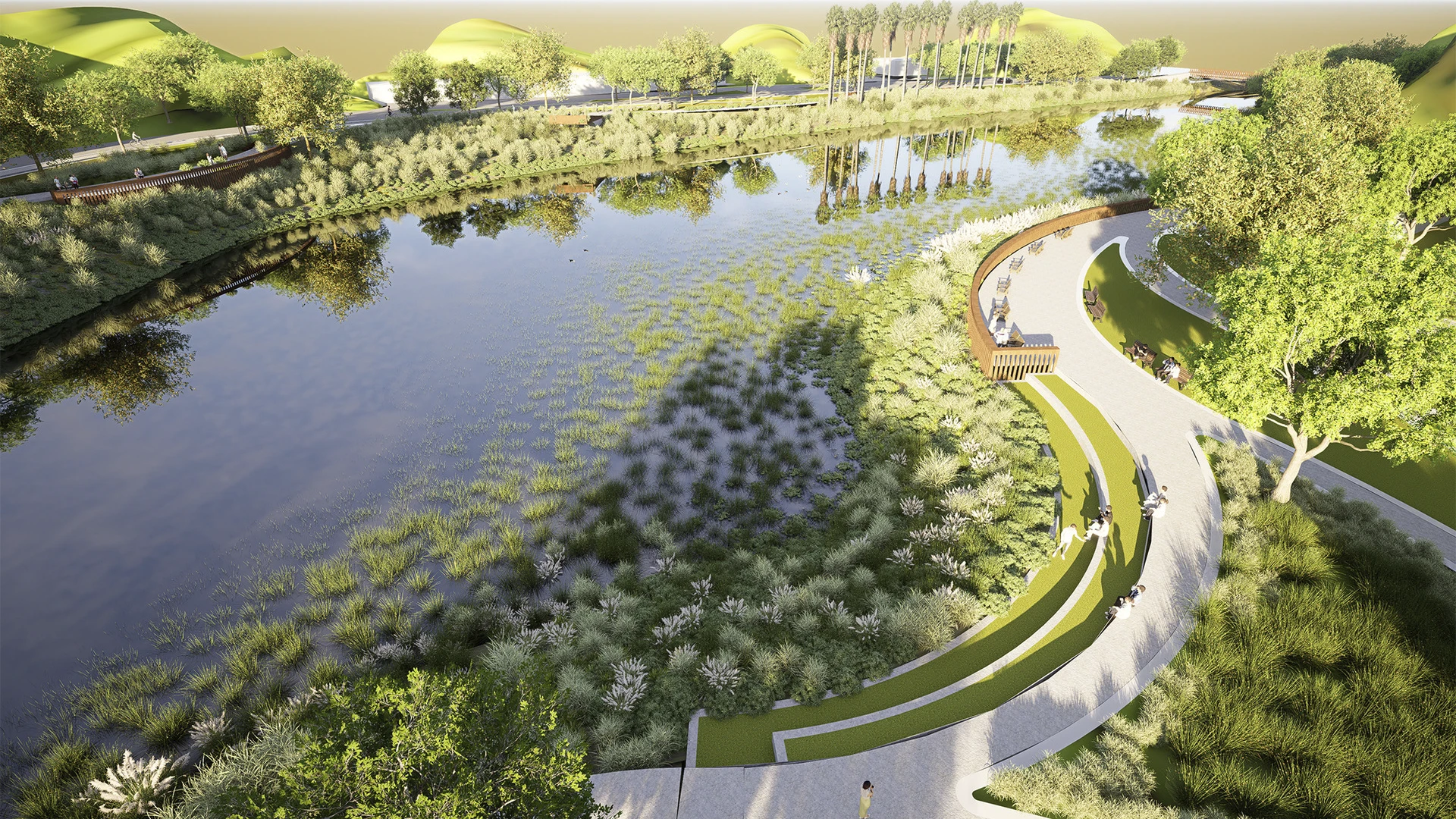
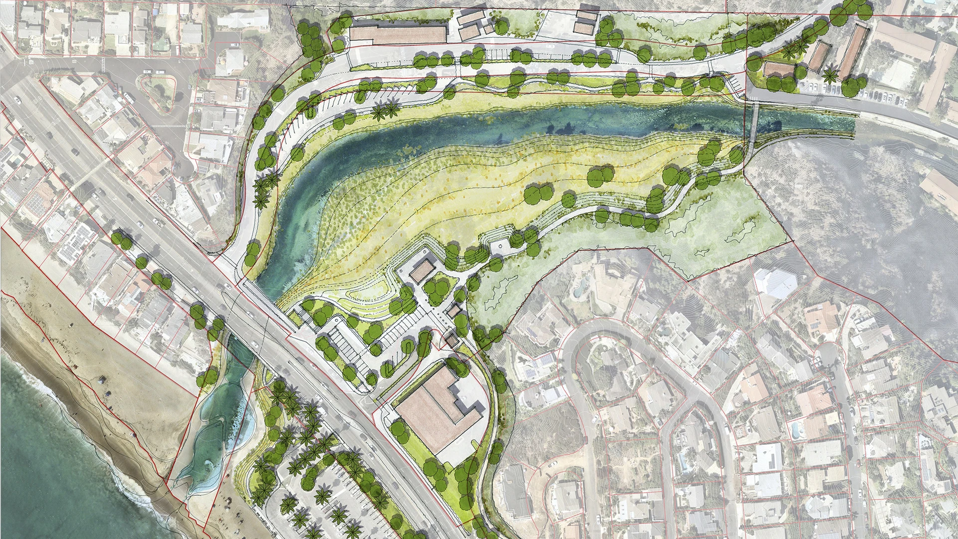
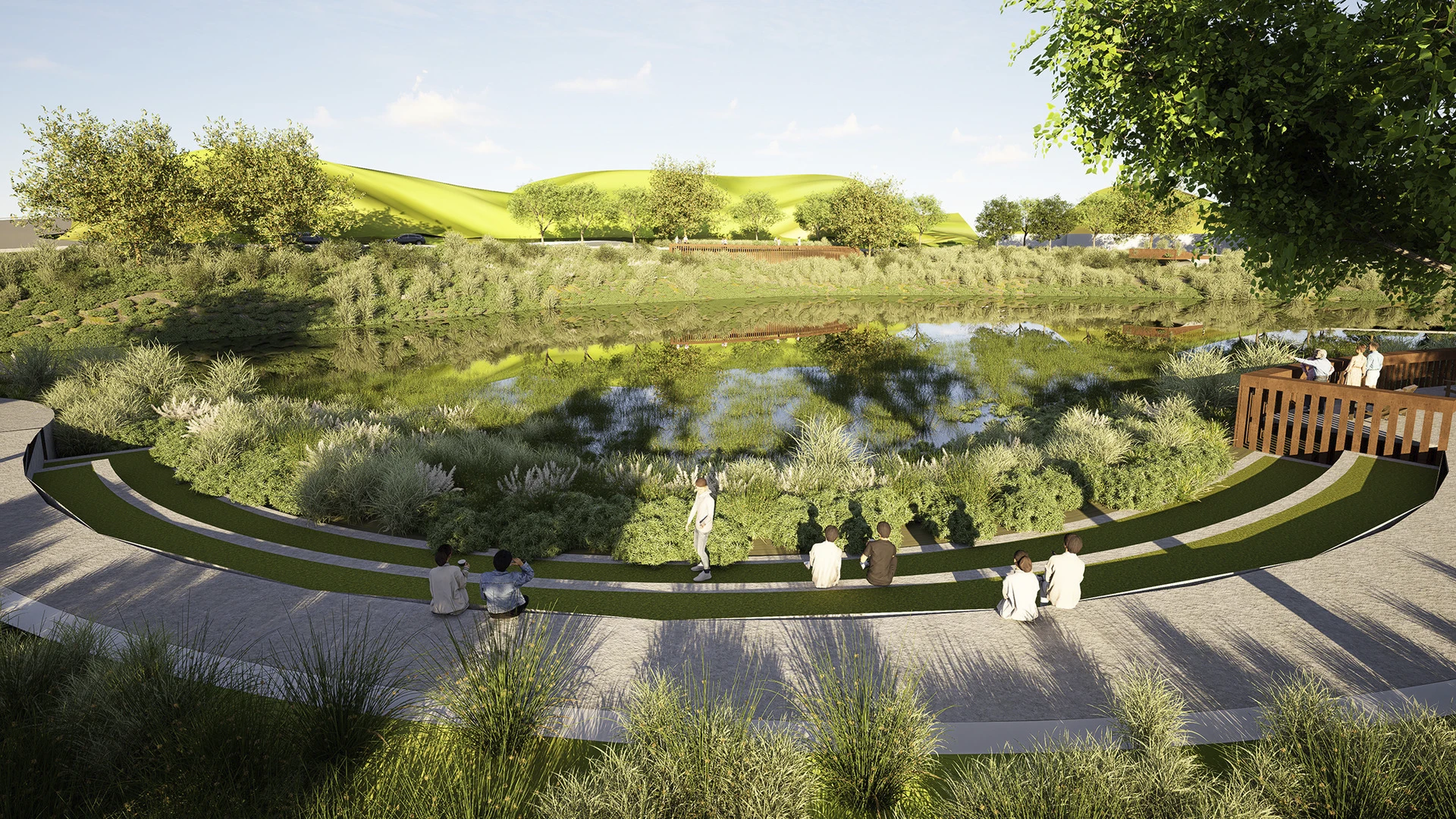
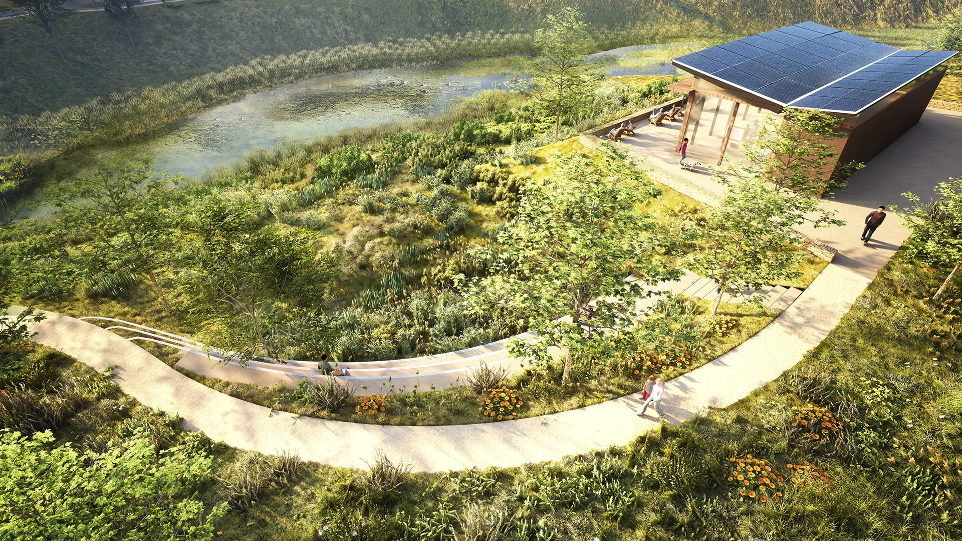
Working with the Laguna Ocean Foundation and a multidisciplinary restoration team, SWA led the public-realm design for a larger effort to restore the estuary as a functioning coastal ecosystem. The plan removes artificial fill, widens the channelized creek, re-establishes wetland habitat, improves water quality, and restores a more natural relationship between freshwater flows, the lagoon, and the Pacific Ocean. The restoration is paired with new trails, overlooks, multimodal connections, and interpretive spaces that reconnect the community to the estuary.
As the project advances, flooding and sea-level rise are being evaluated alongside grading, infrastructure relocation, habitat, and water quality. Aliso Creek demonstrates the role ecological restoration can play in coastal adaptation: recovering space for wetlands and hydrologic processes creates a landscape with greater capacity to accommodate changing water levels, buffer coastal hazards, and evolve as conditions shift. It also shows how adaptation can strengthen the ecological systems and public connections that make a coastline resilient over the long term.
San Pedro Waterfront Connectivity Plan
Los Angeles, CA
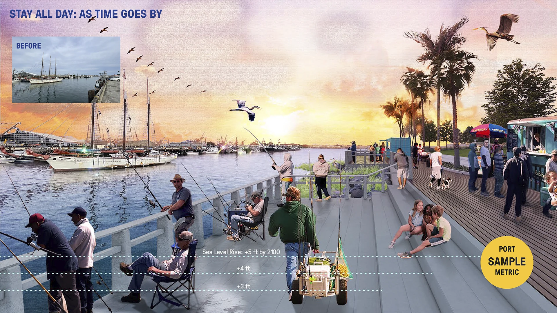
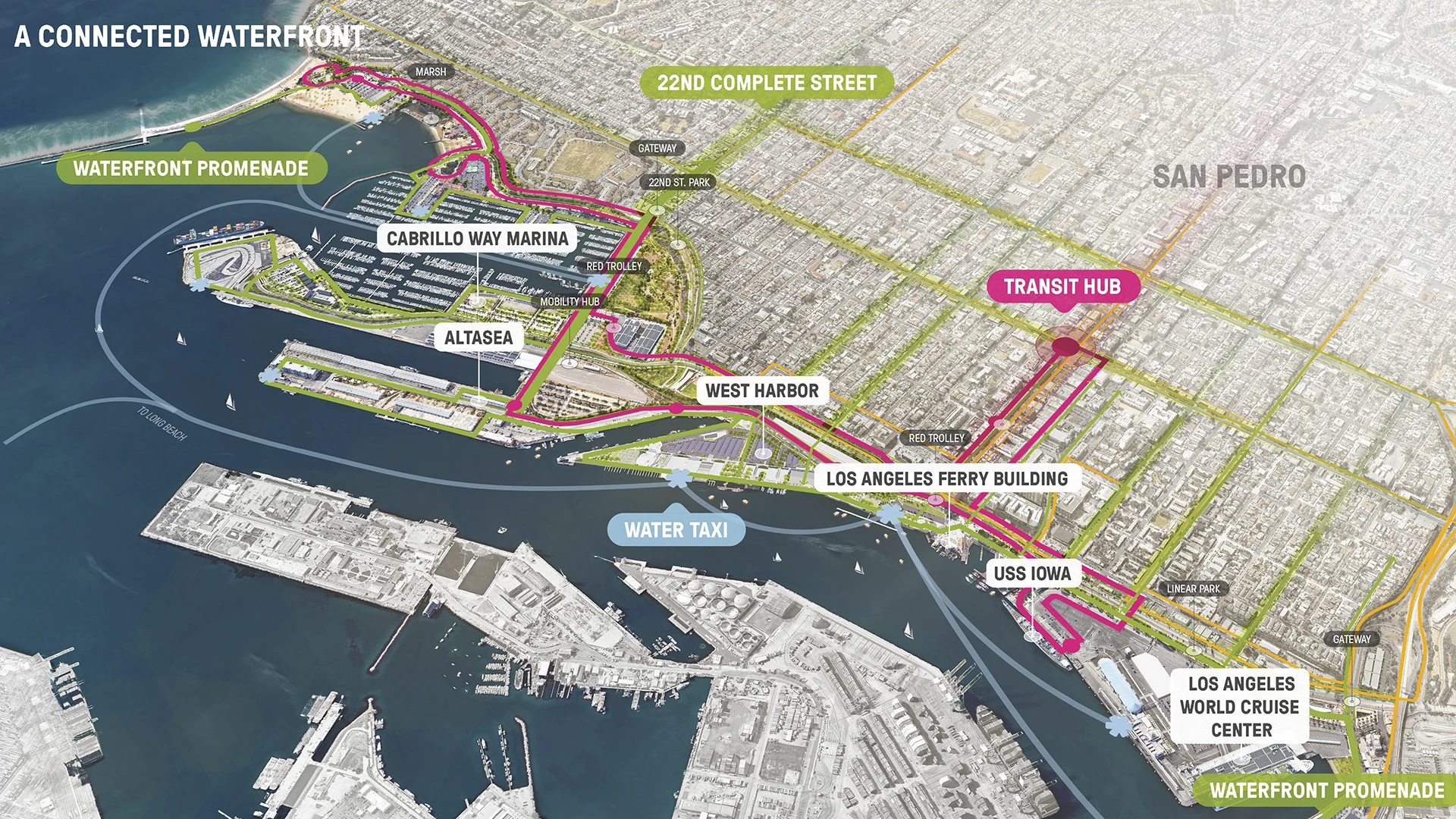
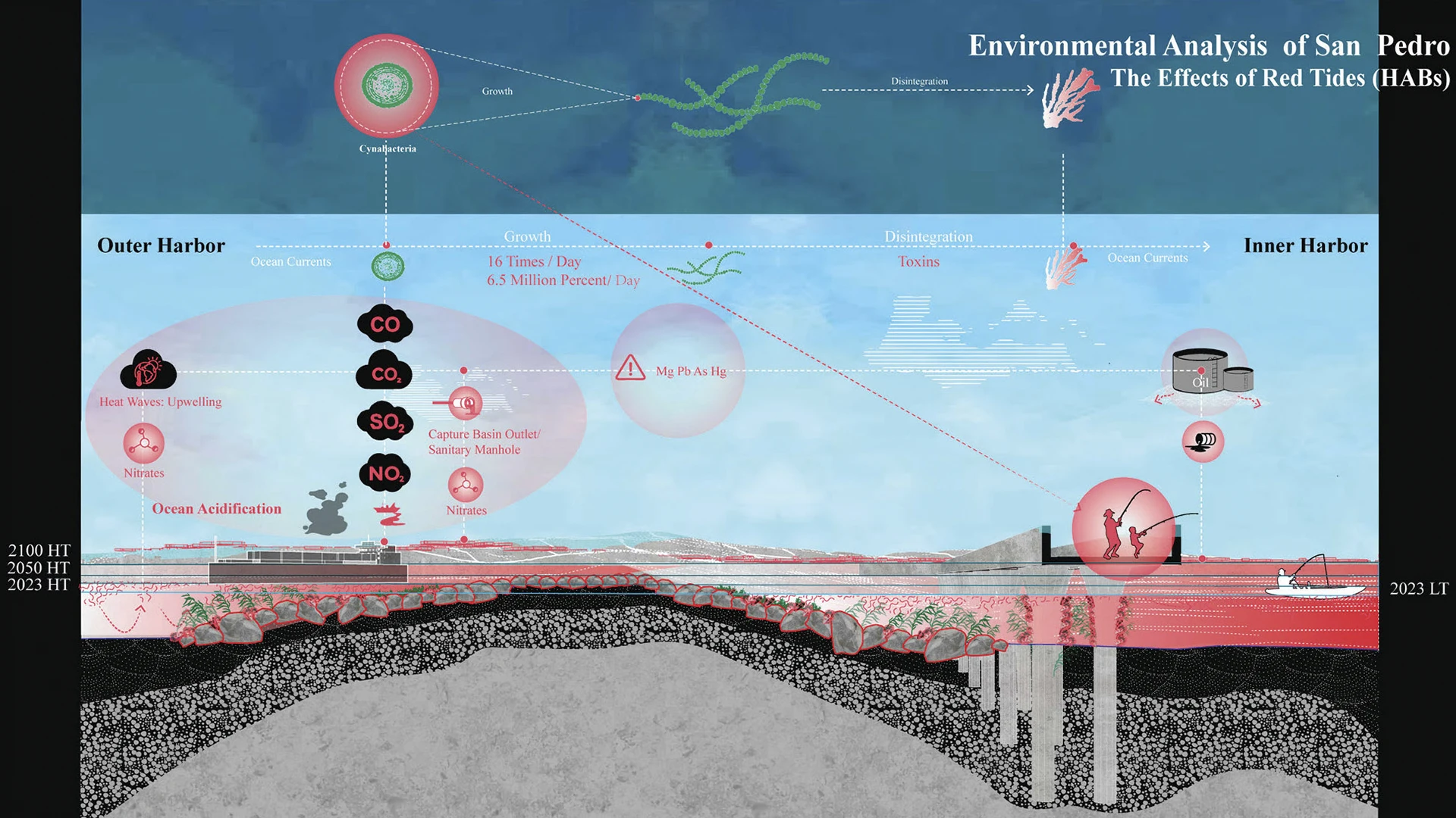
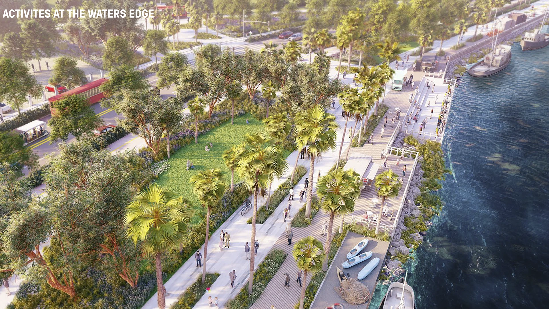
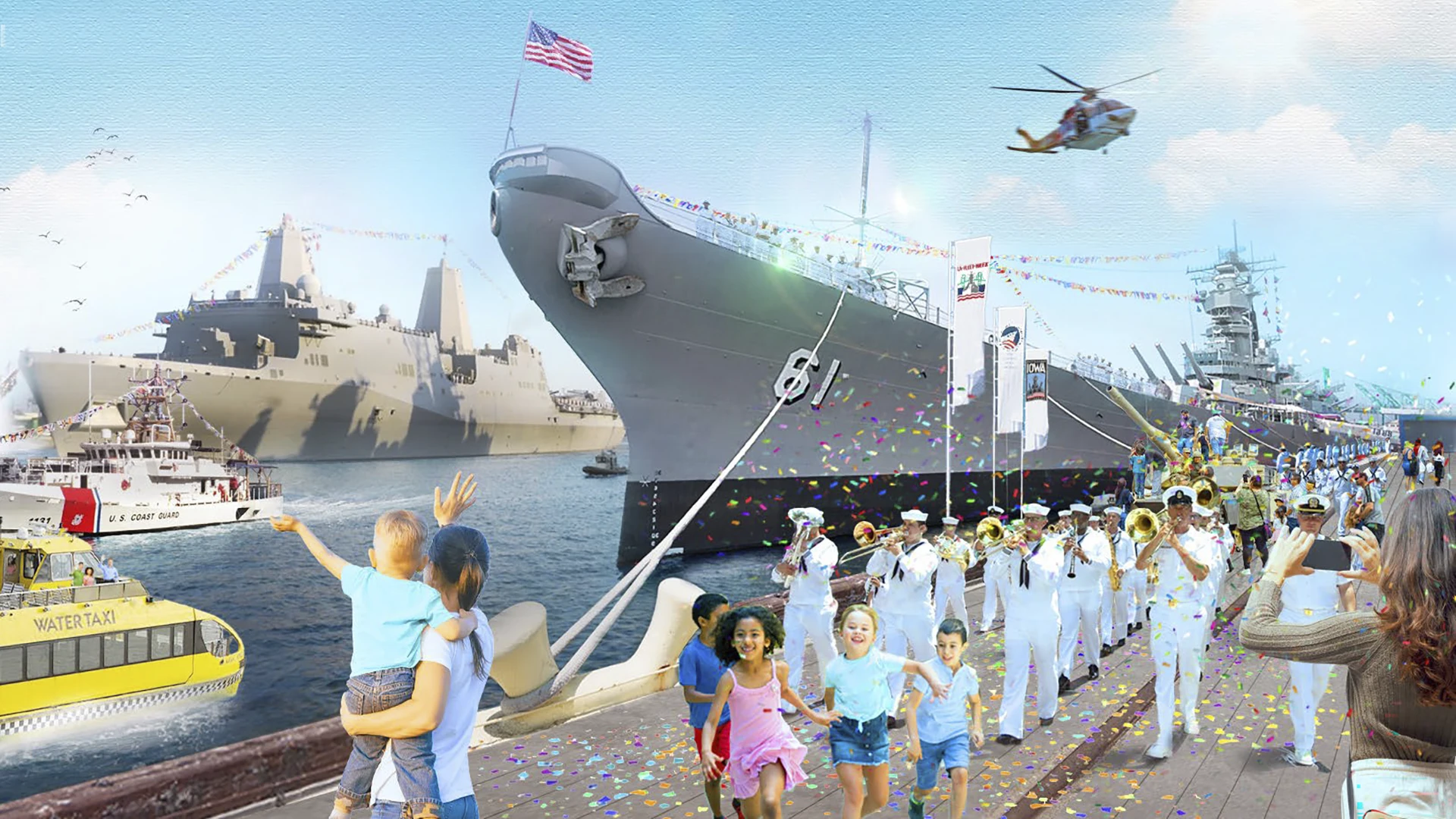
Few waterfronts carry as much weight as the Port of Los Angeles, the largest container port in the U.S. and a linchpin of global logistics. Its 460 acres and eight miles of low-lying Pacific shoreline are exposed to rising seas, extreme heat, and more frequent storms. SWA’s San Pedro Waterfront Connectivity Plan treats that exposure as a planning condition from the start. The plan builds on nearly $234 million in public access investment over the past two decades. It aims to link the shoreline, neighboring San Pedro, and the wider region through a more connected, accessible, and resilient waterfront.
Rather than prescribing a single fixed outcome, the plan sets out fundable, feasible strategies that can adapt to future use and changing coastal conditions. Its more than 100 recommended projects cover vehicular, pedestrian, bicycle, transit, and water-based mobility, along with open space, public art, and wayfinding. They are phased so they can be implemented over time. Each is tied directly to local climate action policy, which positions the Port to deliver on its long-term sustainability goals across every proposed project.
Nearly 300 community participants shaped the plan, including residents of San Pedro neighborhoods who have long been disconnected from the waterfront. Their input helped ensure the framework serves the people who live closest to the Port and who are most exposed to its environmental impacts. By bringing human-scale public space into an active industrial seaport, the plan offers a model for building climate resilience into a working waterfront without displacing its role in the regional economy.
Miami Resilient City Study
Miami, FL
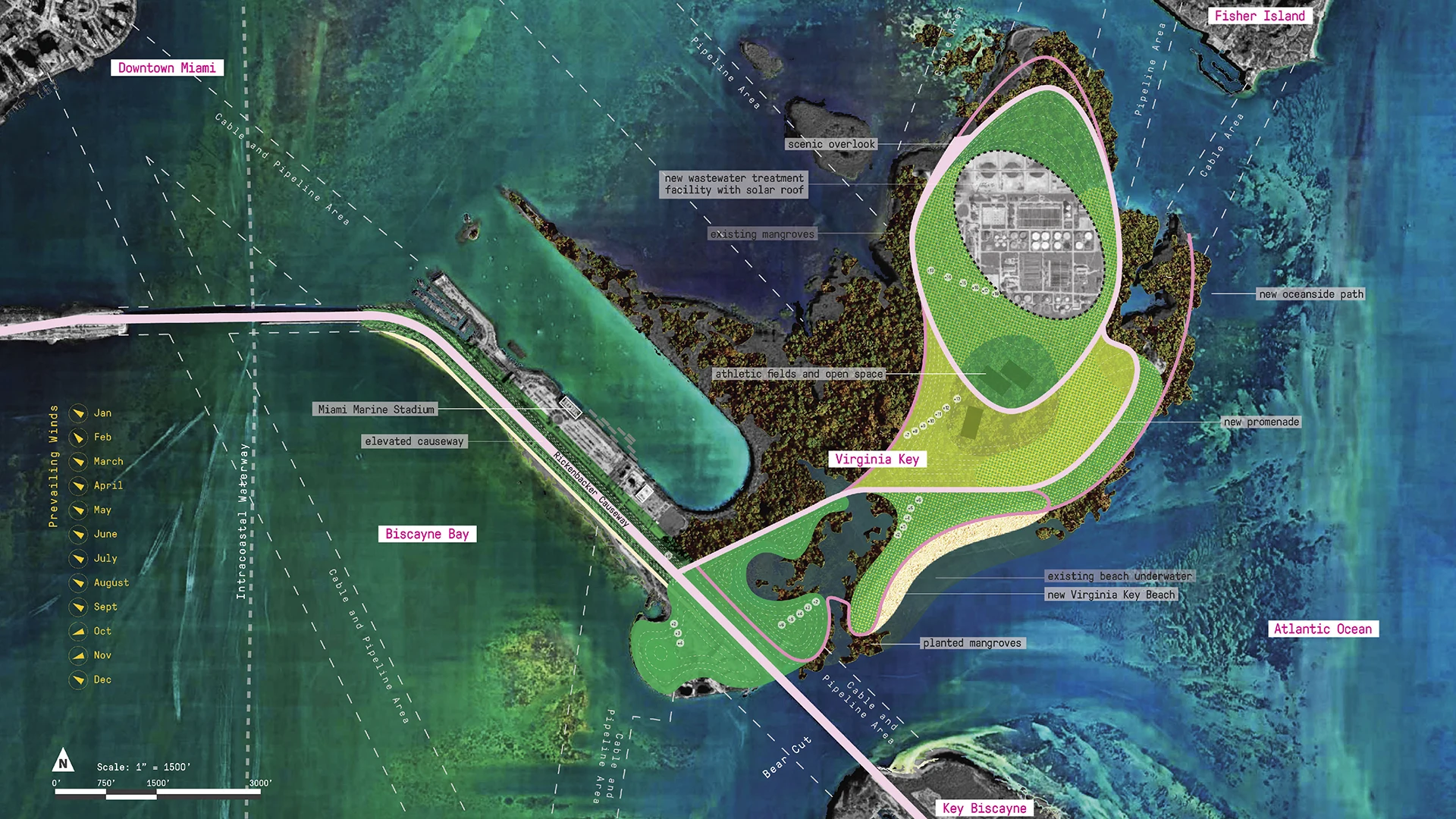
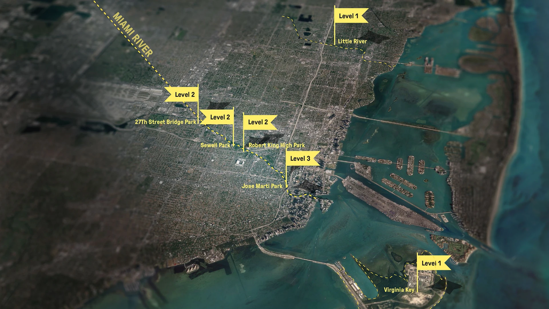
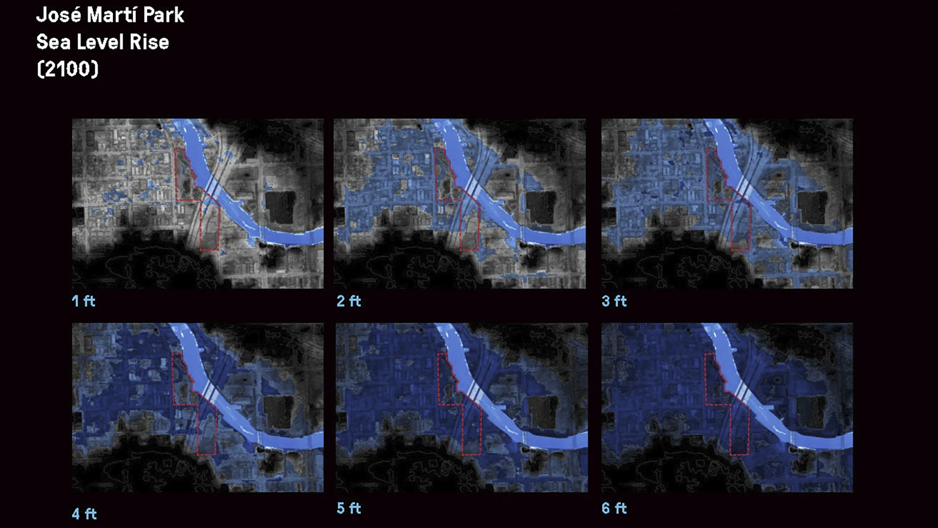
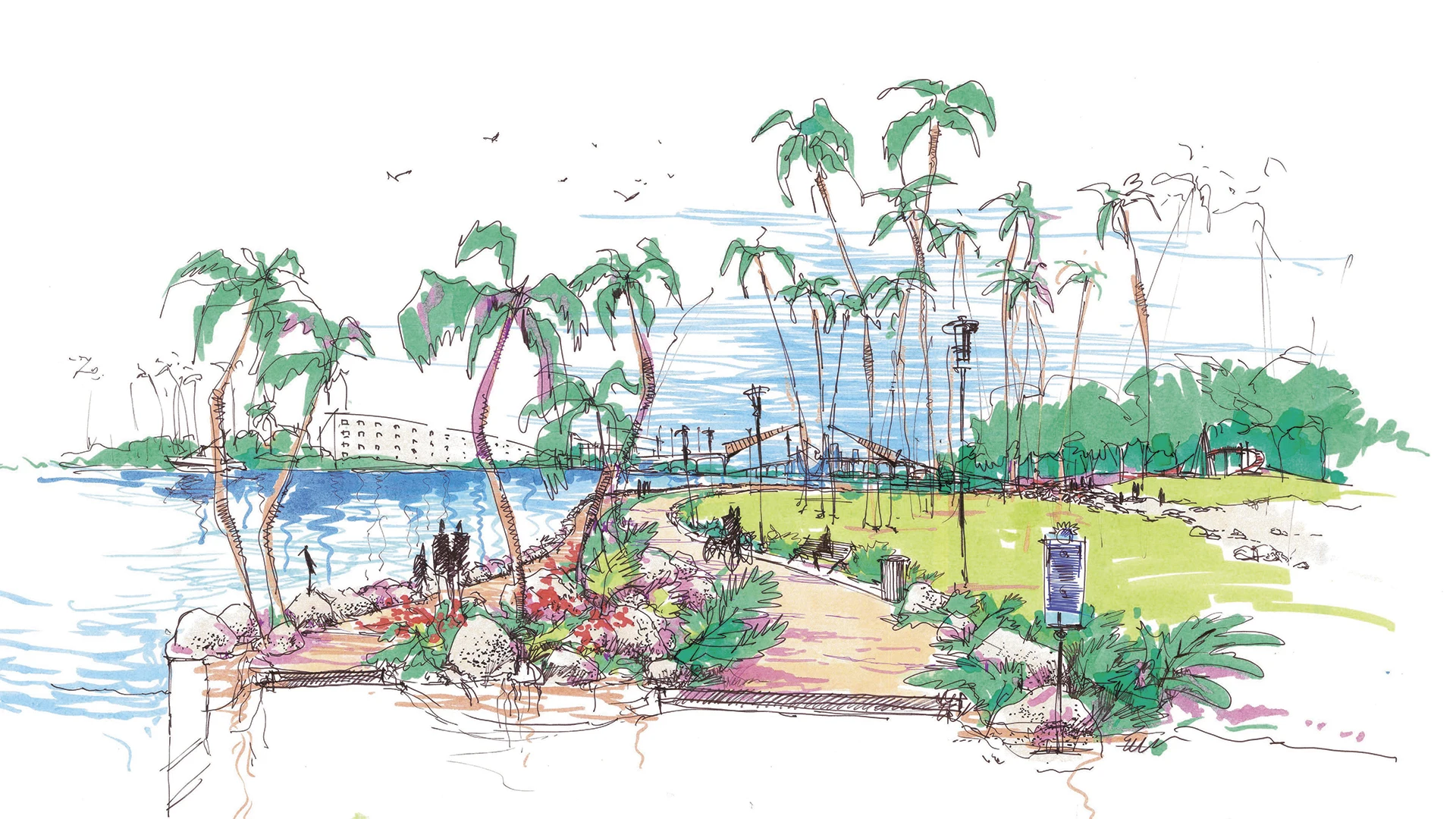
SWA’s Resilient Cities Project was a research initiative aimed at improving quality of life in dense urban places around the globe through partnerships with city leaders, research, site visits and meetings, and a charrette-workshop focused on a pressing local and regional issue. For Miami, the first city in the series, that issue was how a low-lying coastal metropolis can adapt to sea level rise, storm surge, and recurring flooding. SWA’s research team supported three design teams working at three scales across six sites. The sites ranged from the regional landscapes of Little River and Virginia Key, to the Miami River Greenway parks, to José Martí Park at the neighborhood scale. The team supplied place-based and site information, along with background on risk, resilience, projections, and both physical and planned strategies for coastal adaptation.
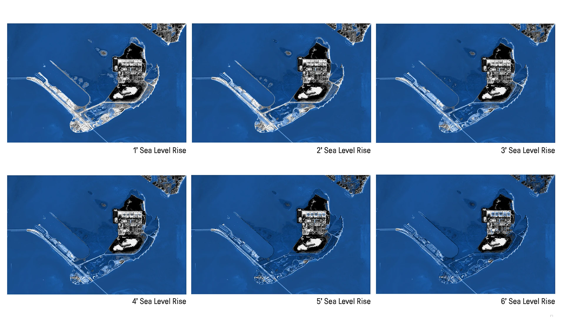
The team gathered its findings in a briefing book that gave the design teams a shared foundation. It included regional and site basemaps showing transit and circulation, flooding extents in one-foot increments, median income, and land use. Together, these let teams read flood exposure alongside the communities most affected by it. A visual glossary defined specialized terminology and local issues. Site profiles and an appendix of partner agency documentation, news articles, and report excerpts rounded out the book. That research informed a two-day charrette in June 2017, where 28 SWA principals worked with local government and community organizations to develop a range of adaptation ideas. These included planning lower-lying areas to flood and become submersible parks and canals, and phasing a gradual move inland on Virginia Key supported by restored mangroves and an elevated promenade.
Learn more here and here.
2017 Summer Student Program
Houston, TX
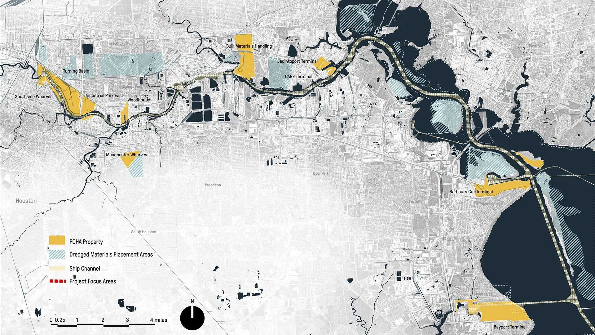
In the summer of 2017, SWA’s Summer Student Program centered on a research initiative called Moving Landscape: Port Houston. The central question was how the Port could better connect with the city. Its 25-mile channel through Buffalo Bayou and Galveston Bay supports more than $617 billion in U.S. economic activity, yet the Port remains largely invisible to the region it serves. The program set out to give that landscape of logistics a clearer identity, testing ideas for urban spaces and ecological services that could redefine the Port’s role in the region.
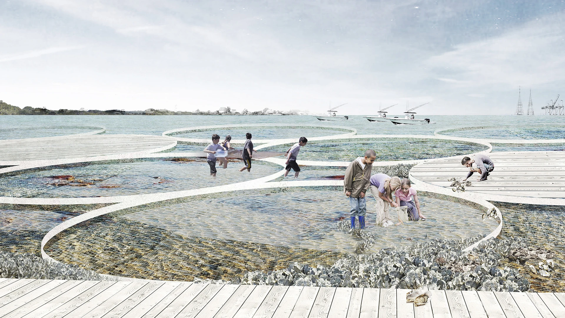
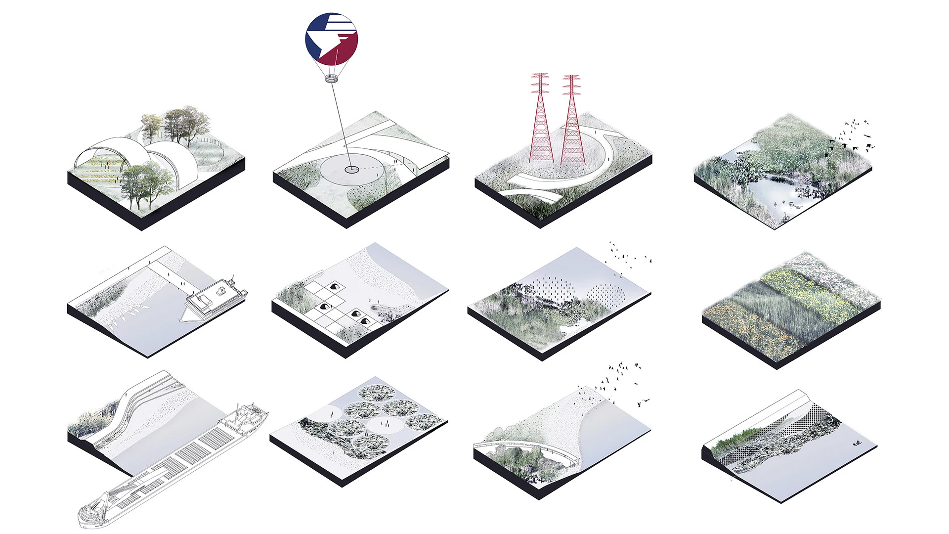
The research began by reading the Port as a system of cycles. The team traced the historic eastward movement of port operations, from the original landing in downtown Houston to the current Turning Basin and likely further toward Galveston Bay as larger ships require deeper channels. They also examined the ship channel’s constant dredging, which both sustains navigation and reduces flood risk by clearing silt from Buffalo Bayou. Rather than treat dredged material as a costly byproduct, they reframed it as a resource for building habitat and public space. They also drew on migratory bird and oyster ecology to guide the design of new land. Two frameworks emerged from this thinking. The Urban Framework covers the Turning Basin to Brady Island, and the Ecological Framework covers Hogg Island to Galveston Bay.
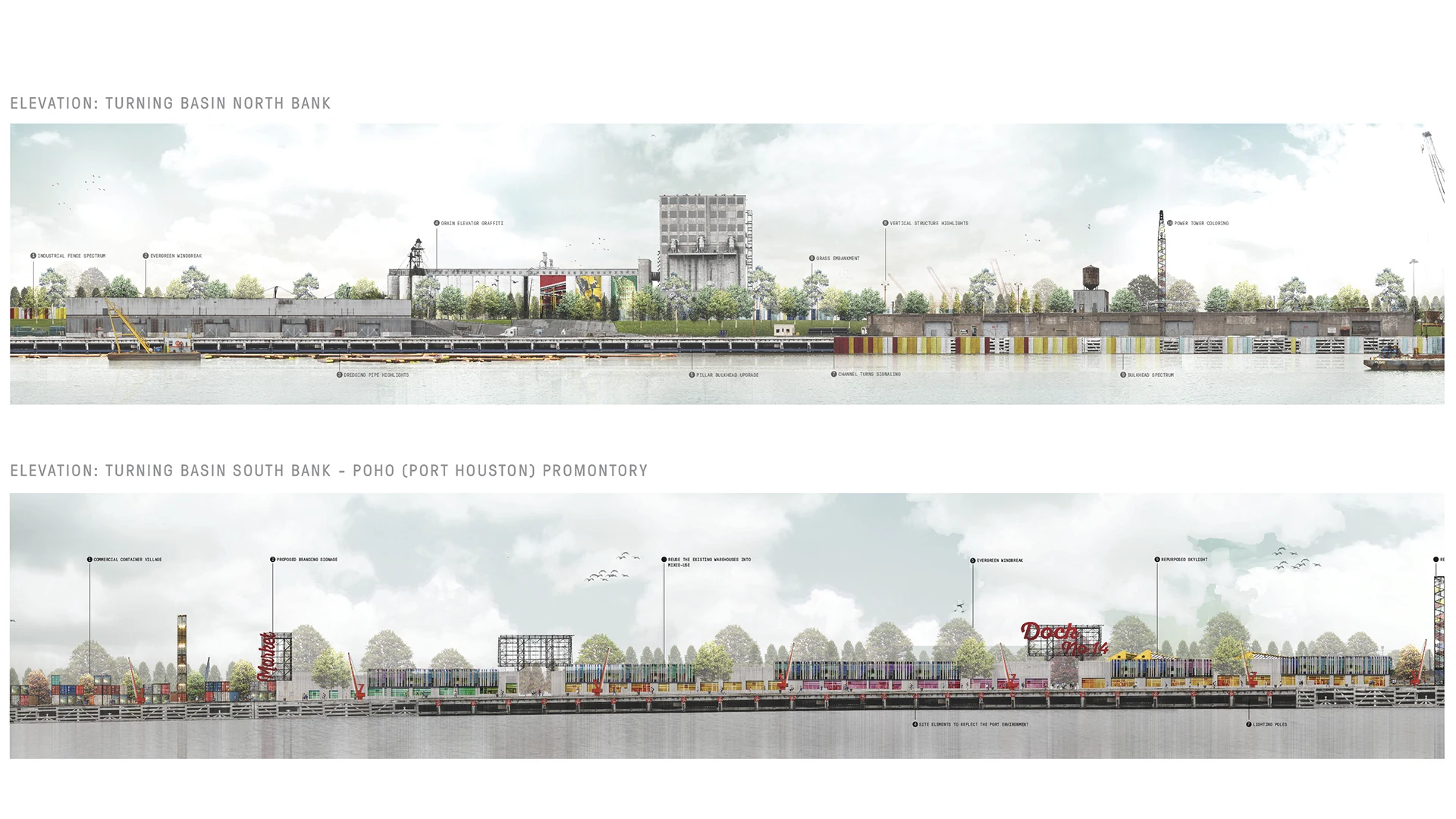
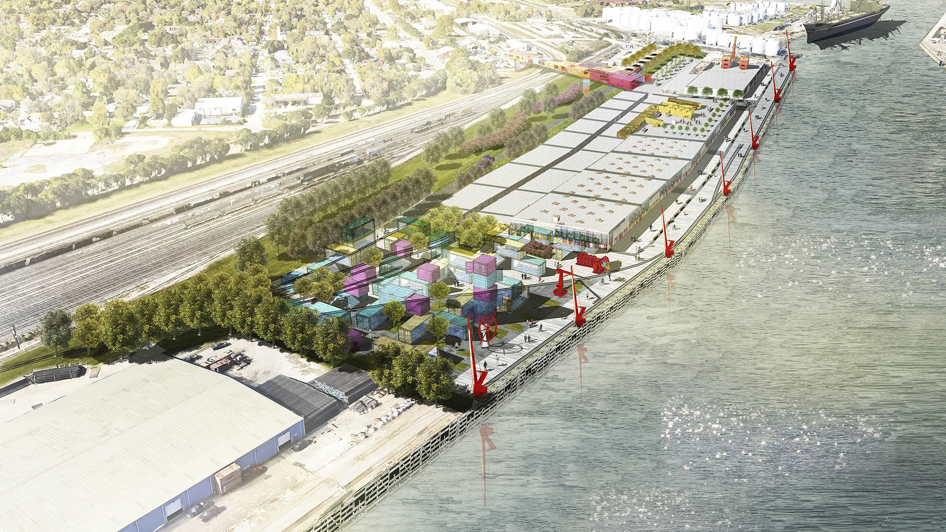
The Urban Framework proposes ways to open the Port campus to the public while keeping its secure perimeter intact. These include a Port museum, an observation tower, a redeveloped historic cotton warehouse district, a green trail network, and a phased strategy that expands public access as operations move east. The Ecological Framework turns the dredge placement islands into constructed habitat and a regional eco-tourism destination. Its elements include marsh and prairie restoration, oyster reef restoration and education, stormwater management, and bird-viewing structures. The same islands are designed to offer protection from storm surge.
Additional Projects
The Landing
Burlingame, CA
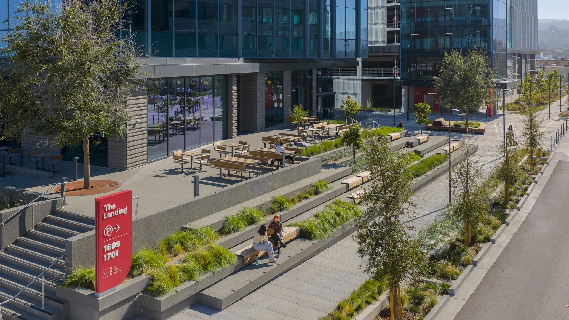
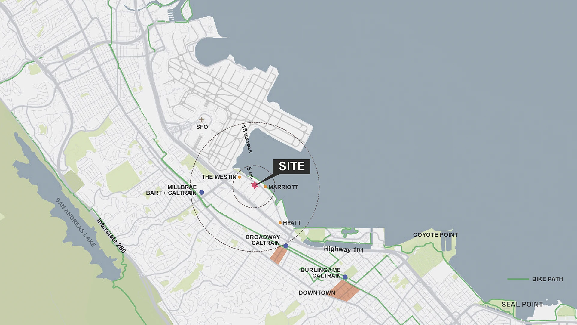
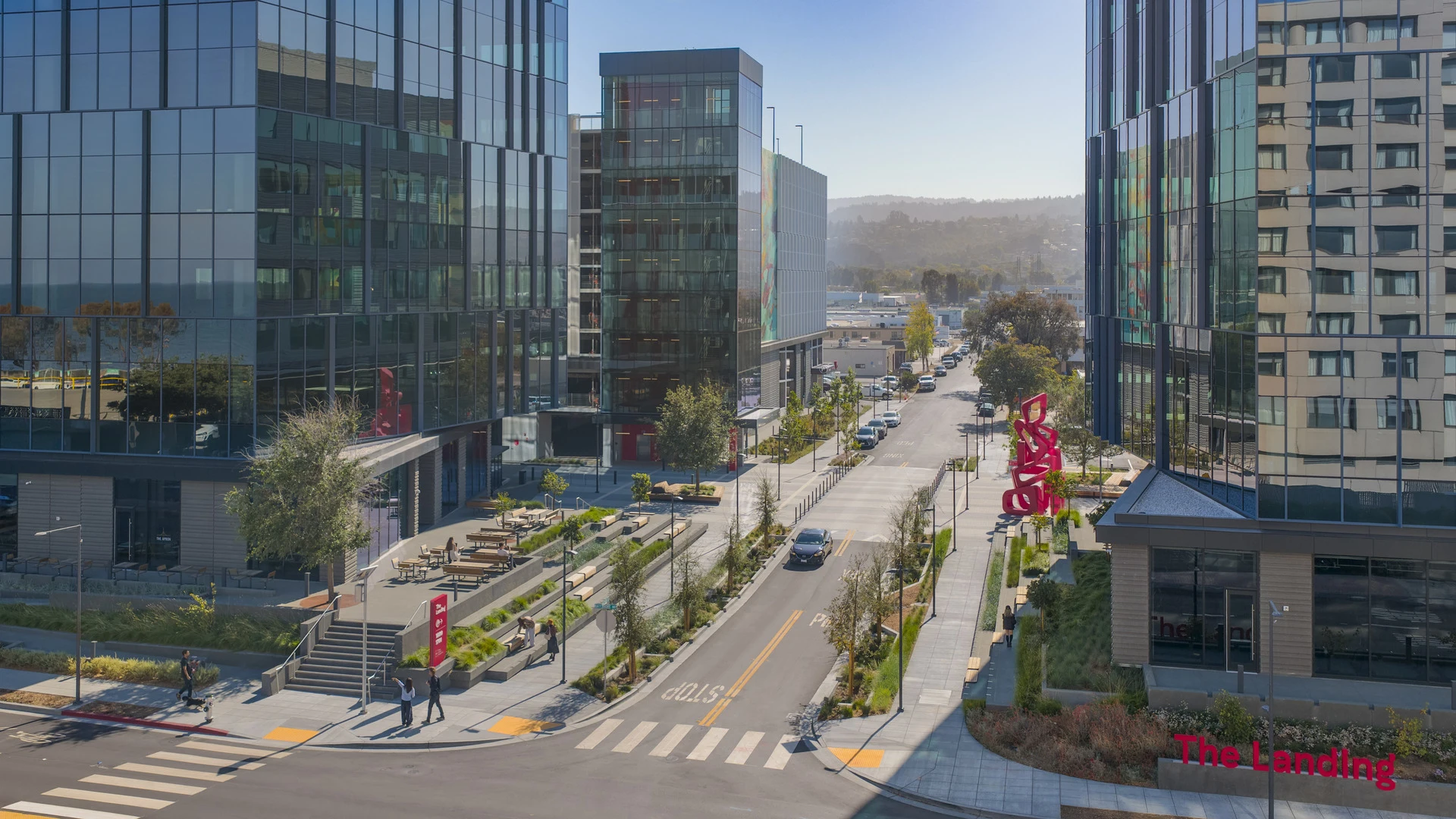
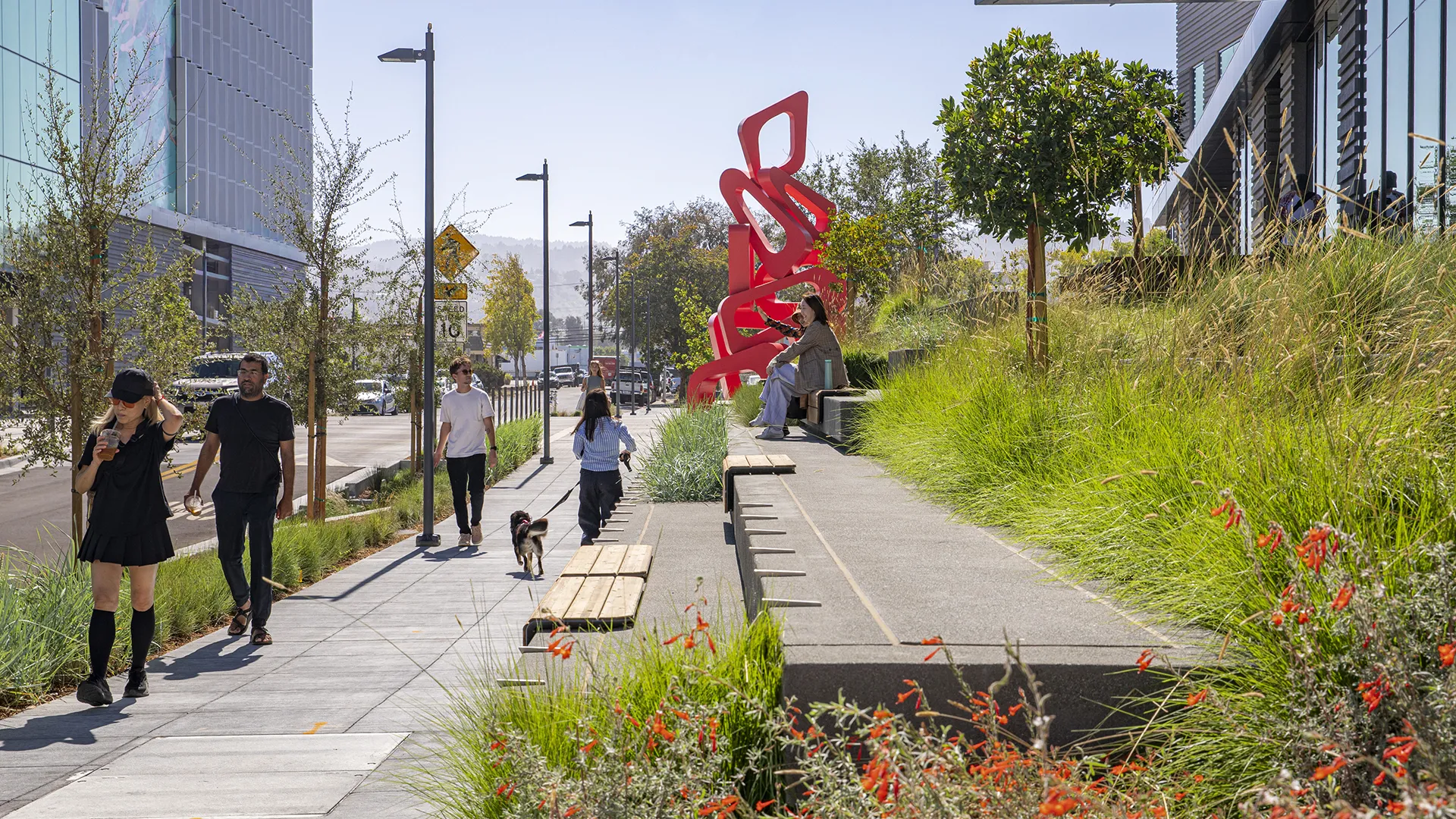
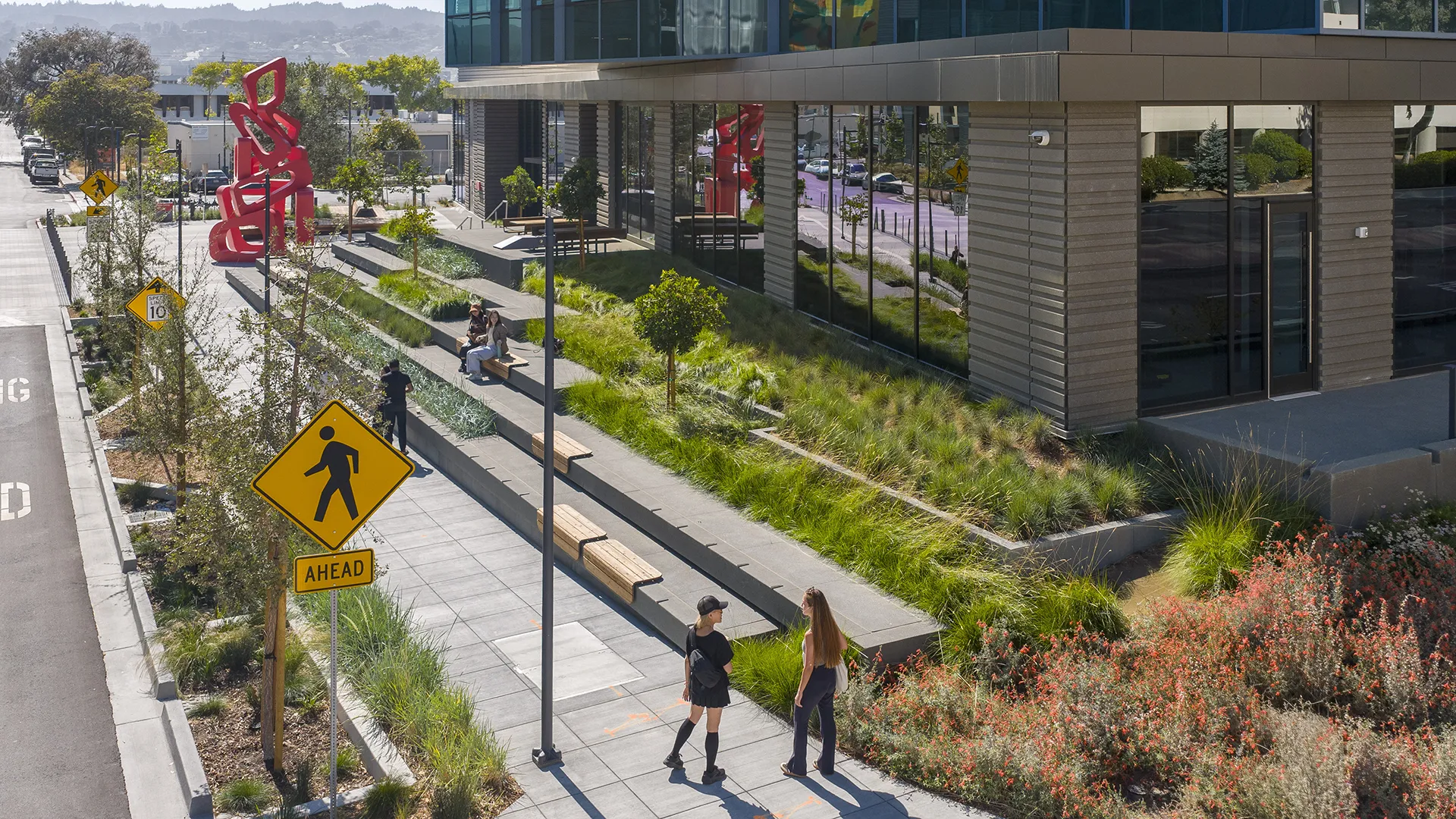
The Landing demonstrates how adaptation at the building scale can be integrated into the public realm. As structures are raised to anticipate future flood elevations, landscape becomes essential connective tissue—absorbing grade changes, maintaining accessibility, and creating useful civic space across multiple elevations. This approach allows individual development projects to prepare for future water levels while remaining connected to the city around them.
Dongguan Delta City
Dongguan, China
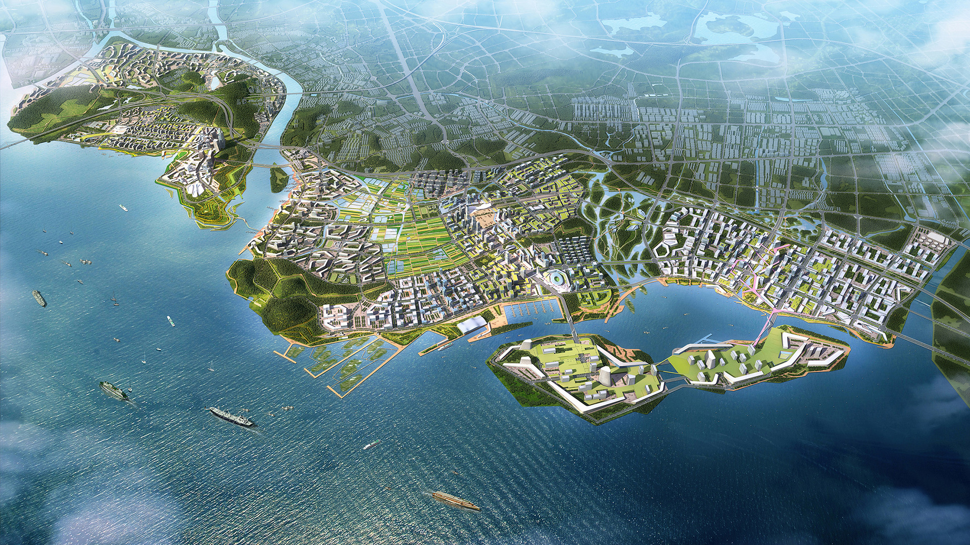
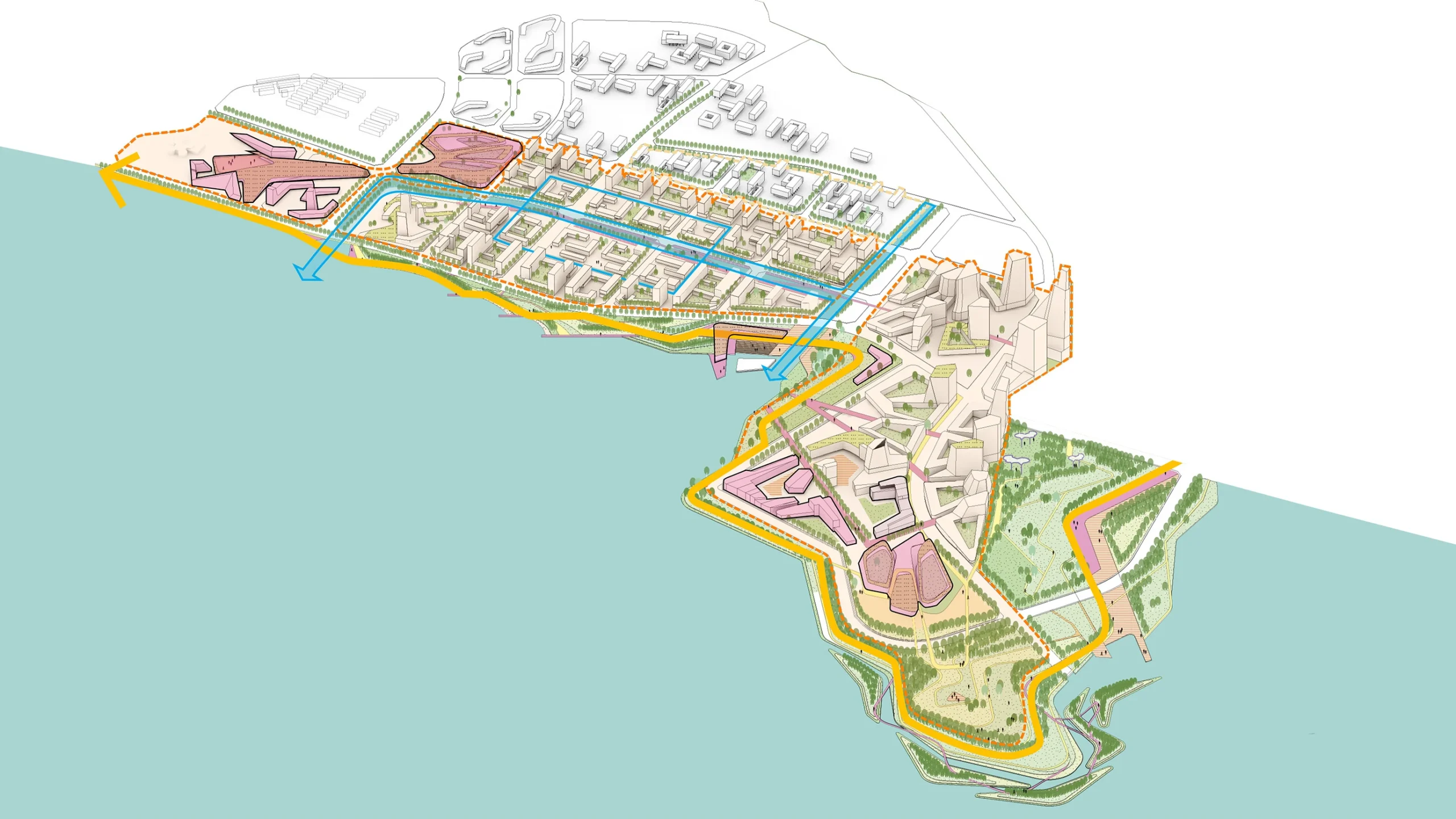
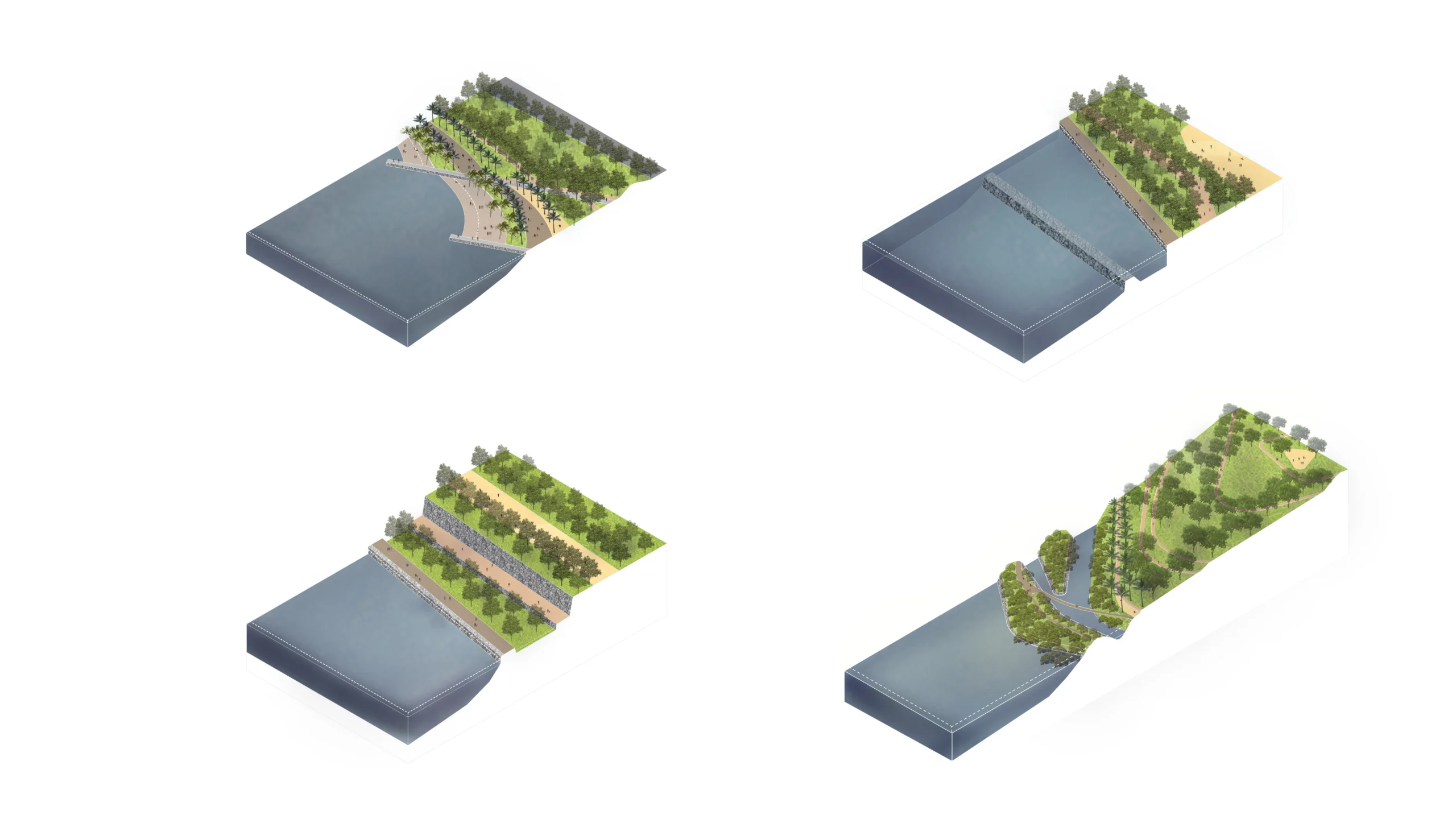
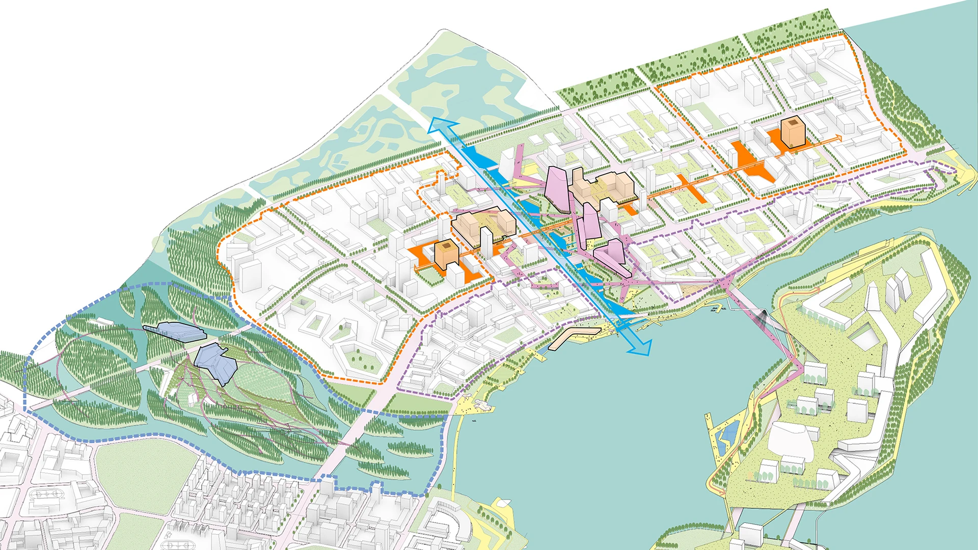
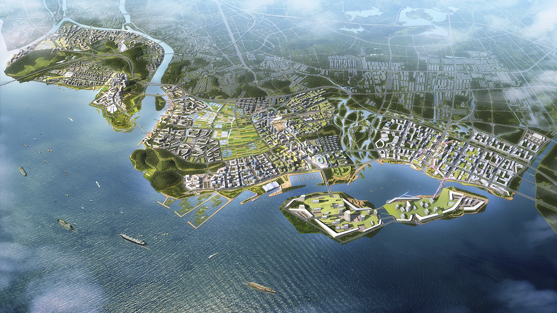
Located along the Pearl River Estuary between Guangzhou and Shenzhen, Dongguan sits within one of the world’s most intensively urbanized and flood-exposed delta regions. Dongguan demonstrates how future flood conditions can shape the underlying structure of urban development from the outset. At the district scale, elevation, floodable landscapes, ecological systems, and architecture can work together to create multiple layers of adaptation as water levels and coastal conditions change.

Tianjin Eco-City South Bay Park
Tianjin, China
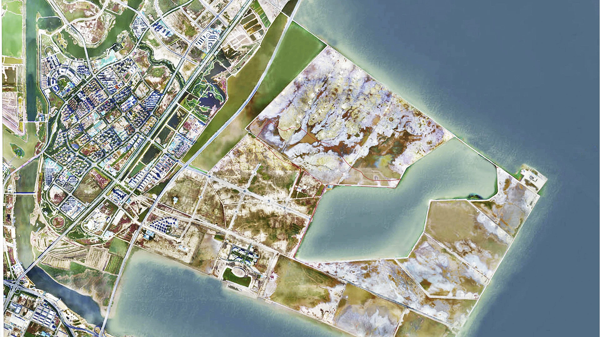
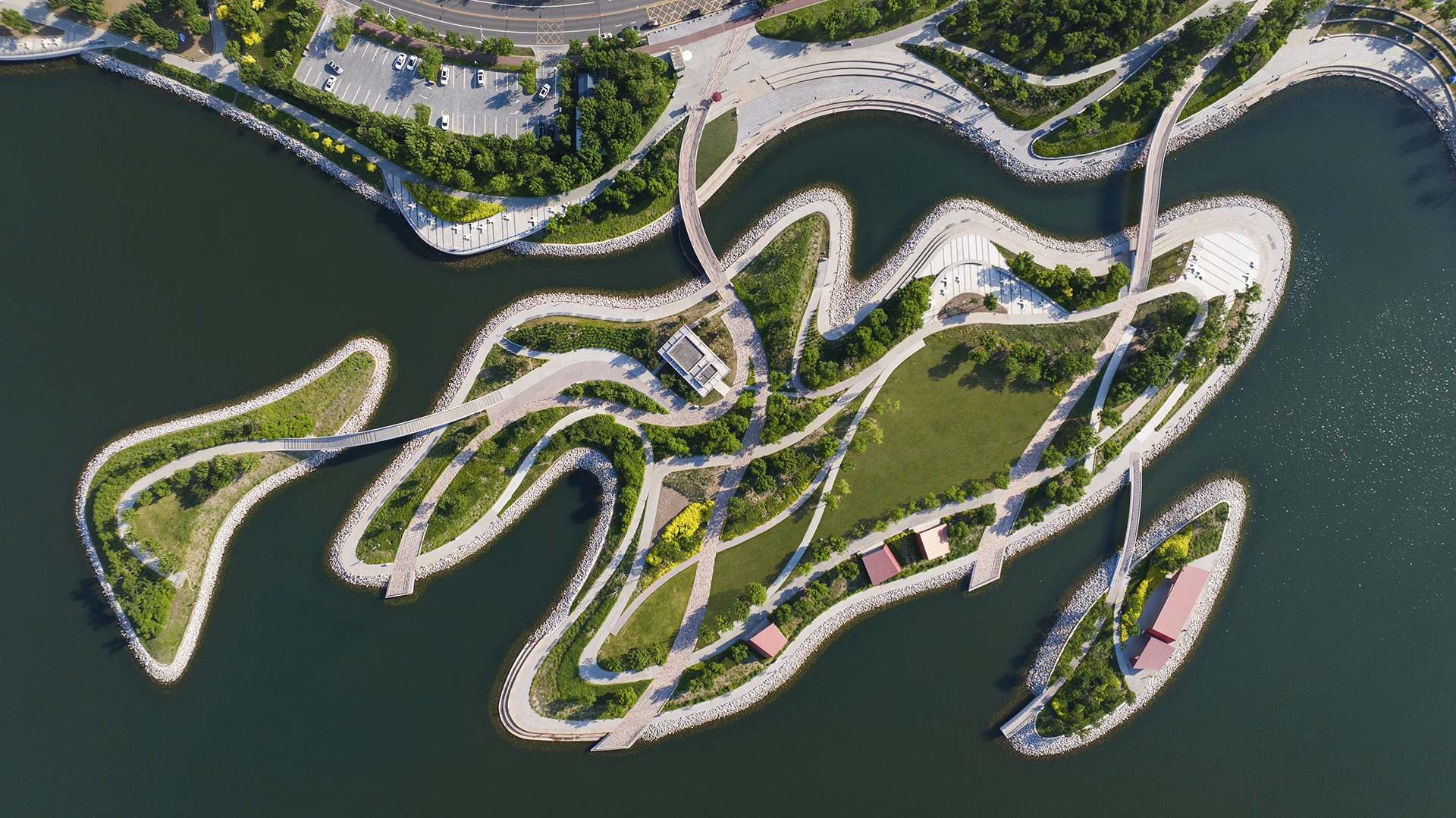
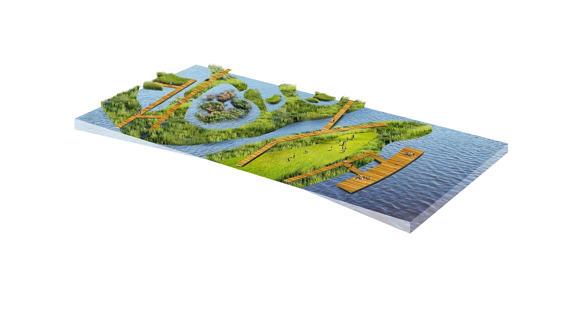
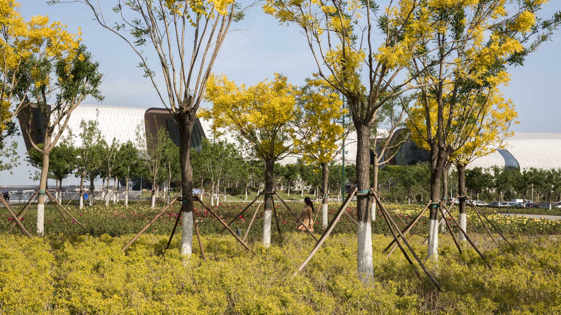
Built along the low-lying coast of Bohai Bay, Tianjin Eco-City demonstrates how a new urban district can organize growth around a landscape-based water system. Rather than assuming a single static condition, the landscape accommodates fluctuations in water level and establishes ecological systems capable of evolving. That capacity is especially relevant in Tianjin, where the combination of low elevations, land subsidence, storm surge, heavy rainfall, and rising seas is increasing coastal flood risk.

King Harbor Public Amenities Plan
Redondo Beach, CA
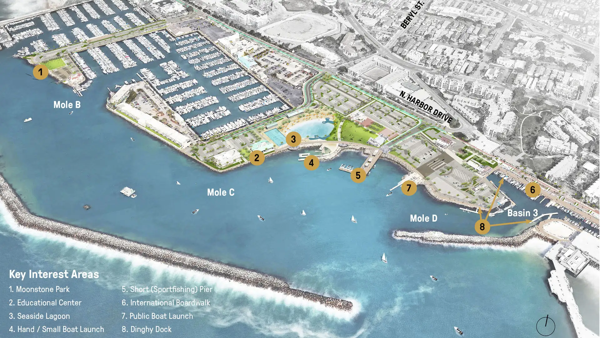
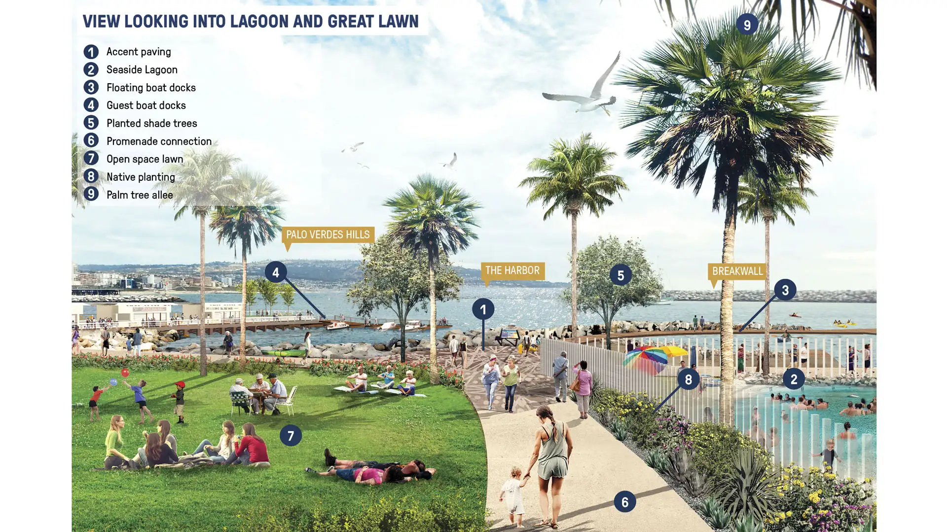
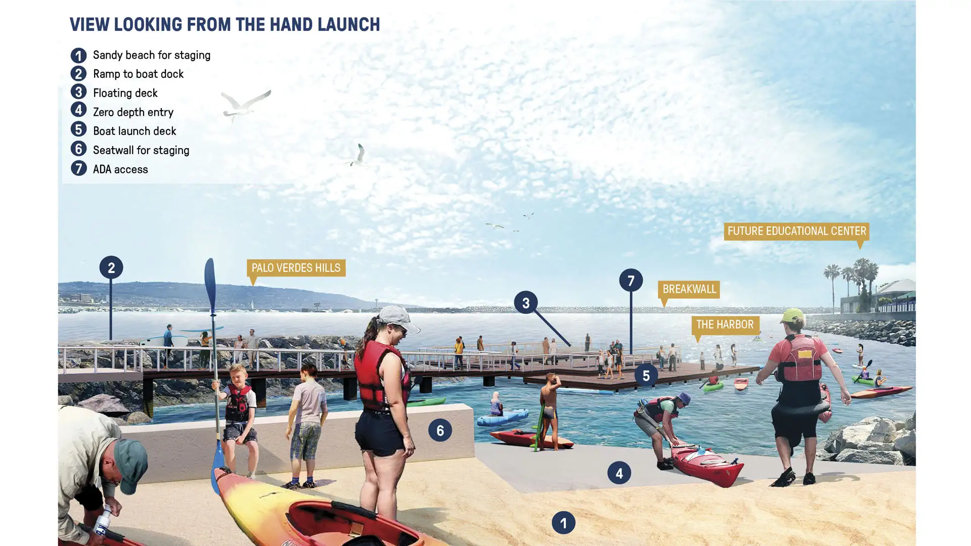
King Harbor is directly exposed to King Tides, seasonal flooding, and sea level rise, and businesses and pedestrians along its promenades already feel the effects. SWA’s Public Amenities Plan for the Redondo Beach waterfront addresses these conditions alongside the feasibility, phasing, and funding needed to carry improvements forward. The team developed short- and long-term solutions for sea level rise along the promenades. These include relocating activities away from easily flooded areas and raising a portion of the site above current flood levels.
Changsha Baxizhou Island
Changsha, China
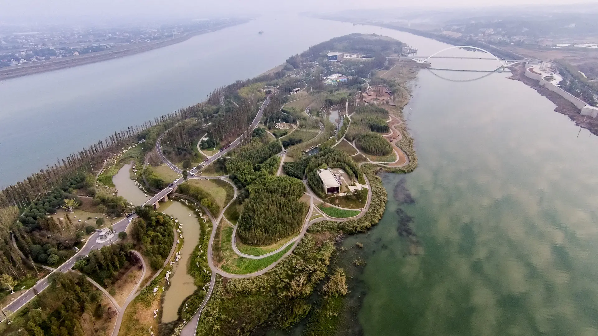
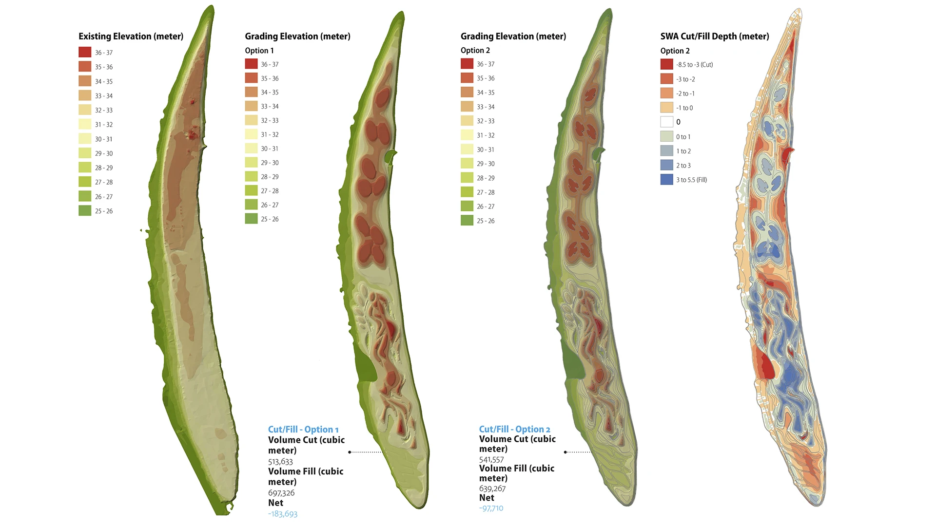
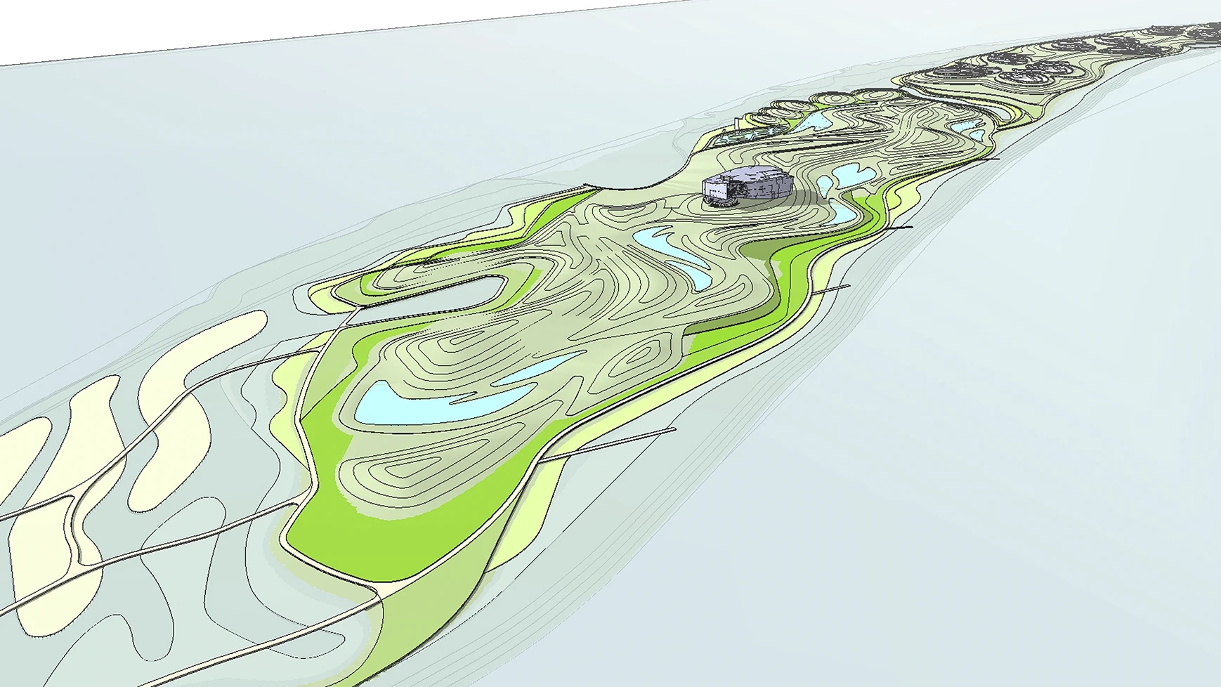
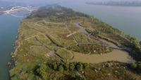
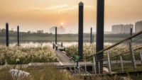
Set in the Xiang River at the heart of Changsha, Baxizhou Island shows how a flood-prone river landscape can become a defining civic asset. Rather than hardening the island’s edges with concrete flood walls, SWA shaped 92 hectares of terraced wetlands and native forest that move with the river’s seasonal rise and fall. Completed in 2014, the park absorbs floodwaters, supports wildlife habitat, and keeps people connected to the water, offering a model for living with fluctuating water levels instead of resisting them.
Jeddah Cruise Hub
Jeddah, Saudi Arabia
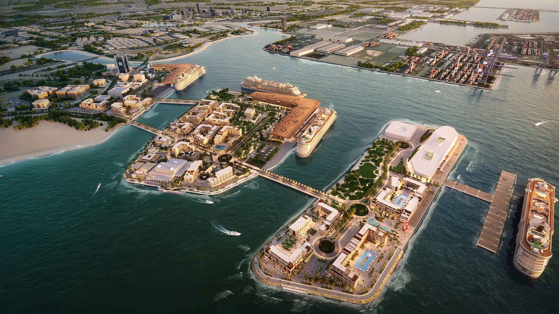
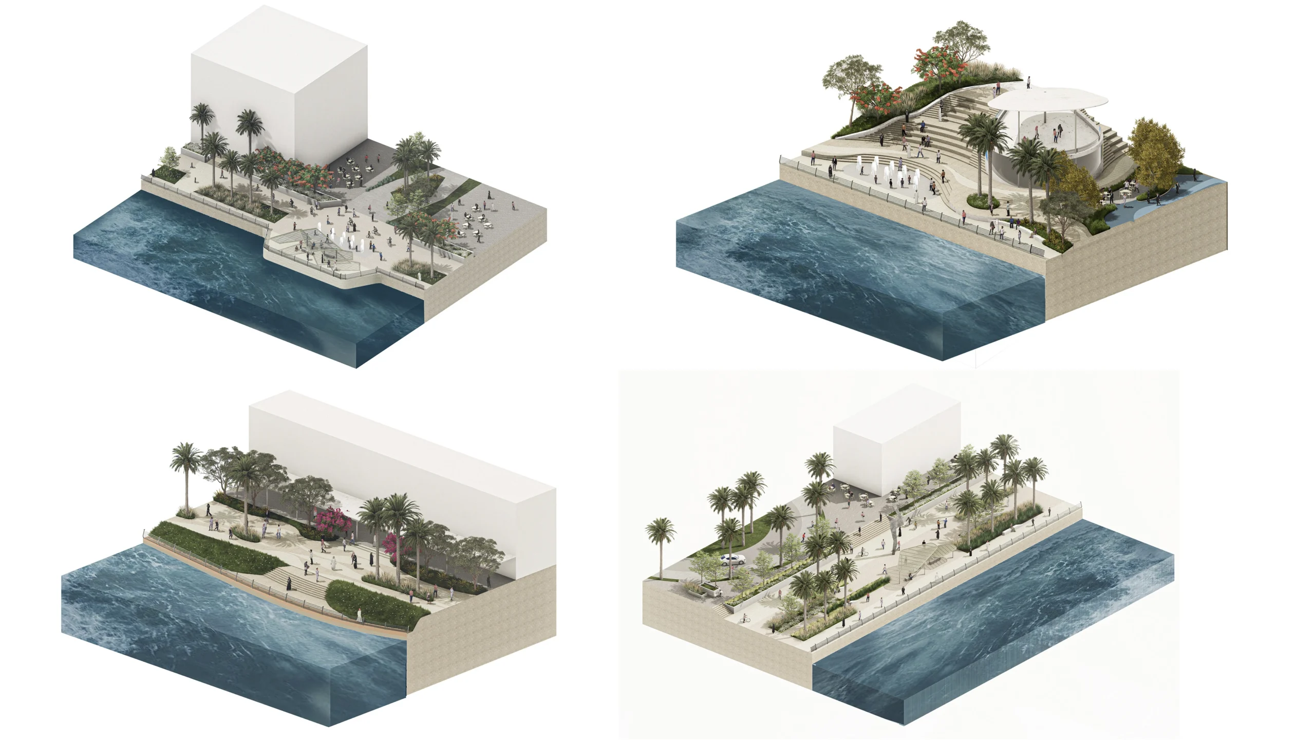
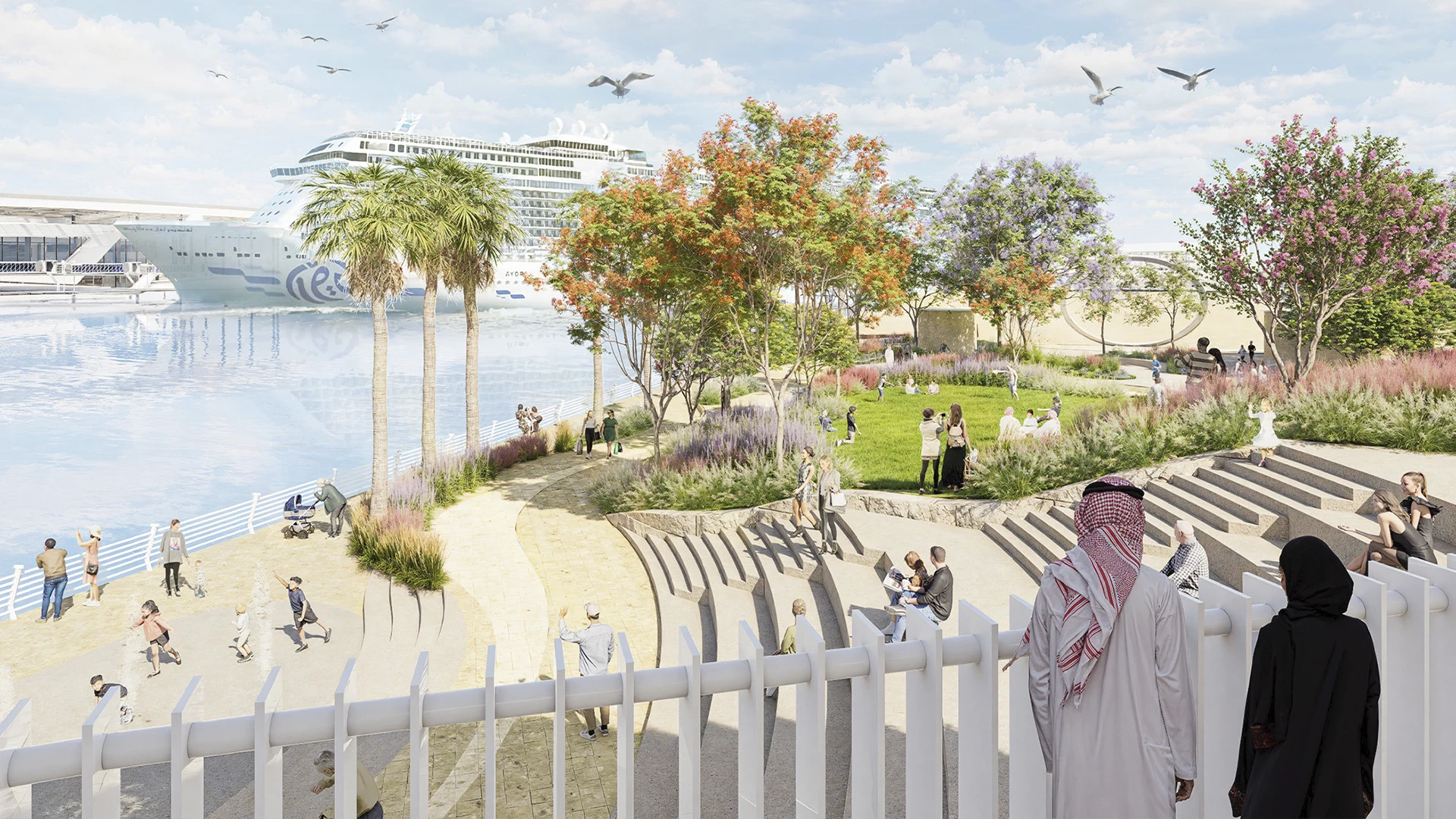
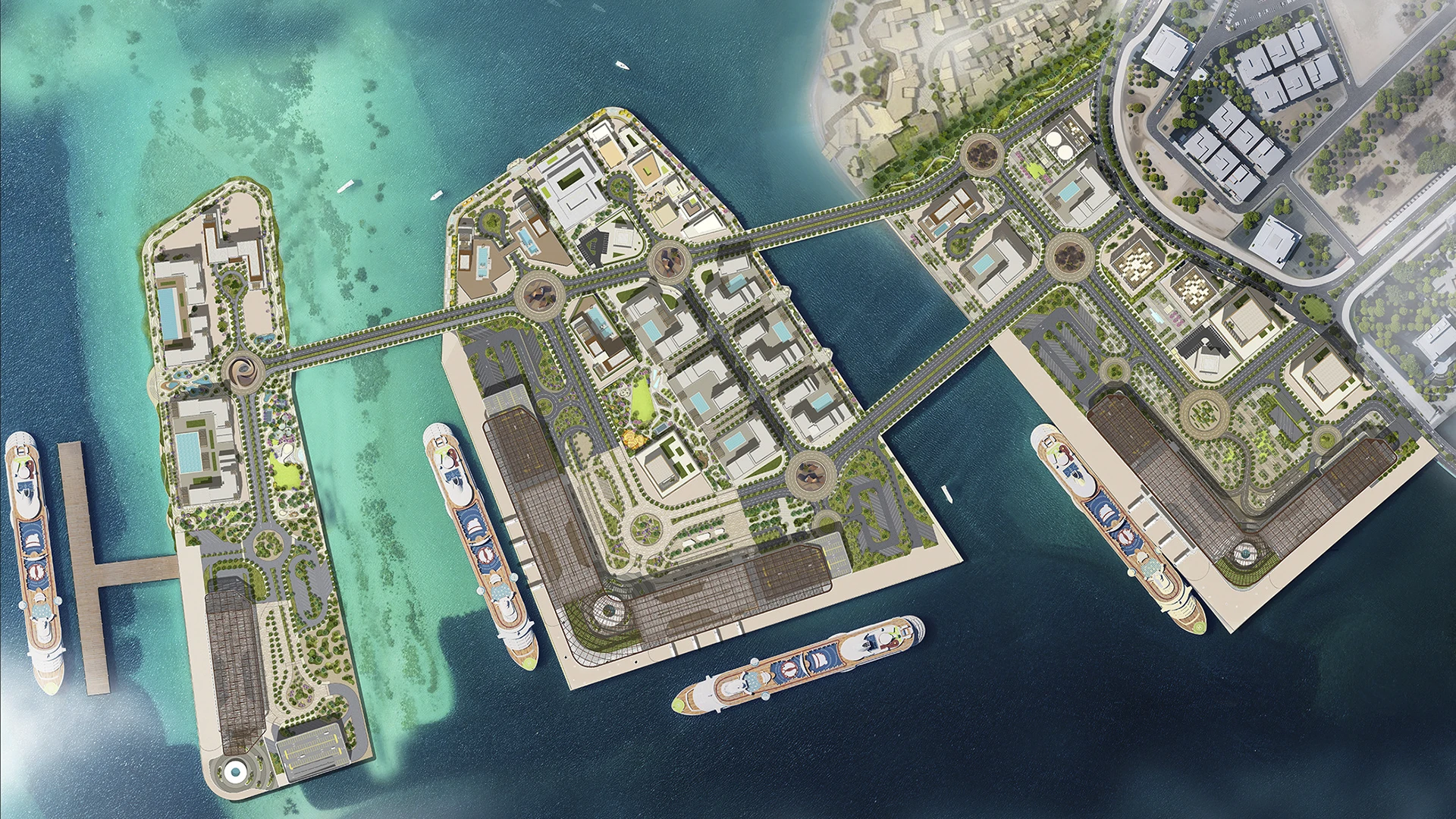
As sea levels rise and tidal flooding becomes more frequent along the Red Sea coast, Jeddah Cruise Hub shows how a working waterfront can be designed for changing conditions from the outset. The master plan connects cruise terminals, residential quarters, and a central park into a walkable neighborhood, while accommodating tidal variation and saline conditions. Shaded promenades, plazas, parkland, and active waterfronts create a climate-responsive edge that remains safe and inviting to the public as water levels shift over time.