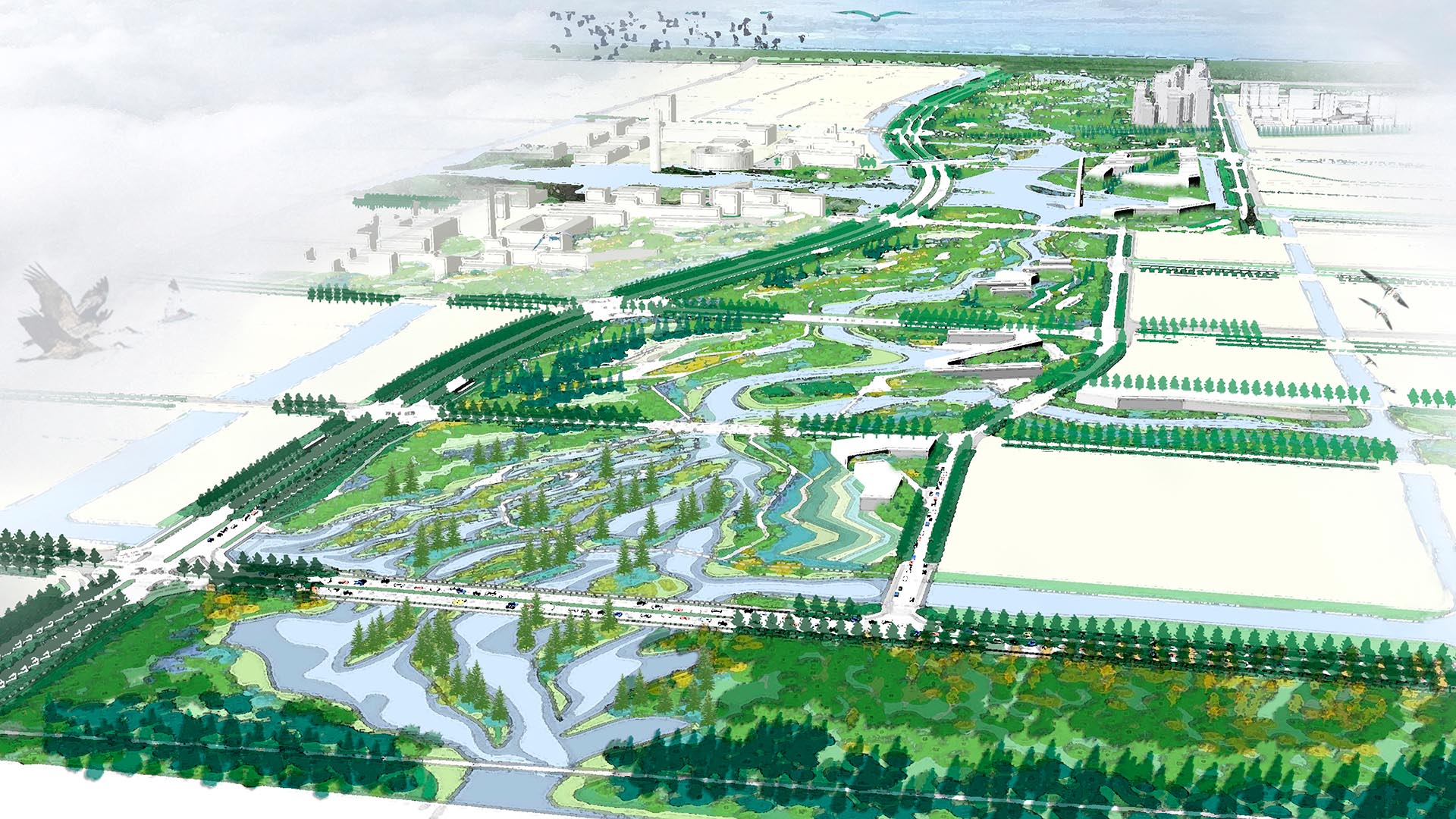
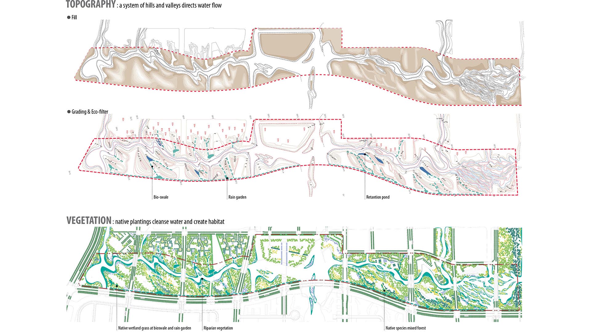
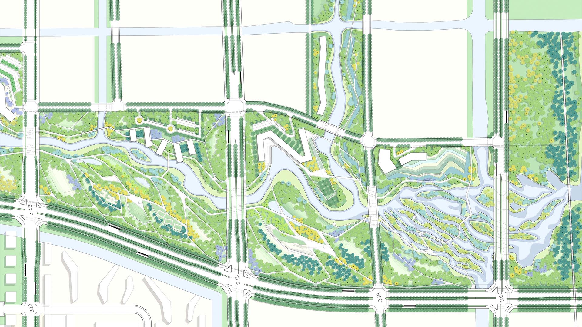
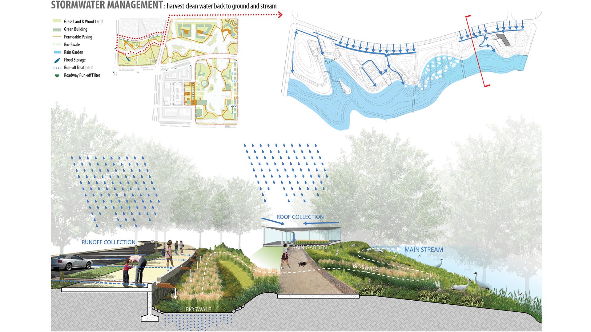
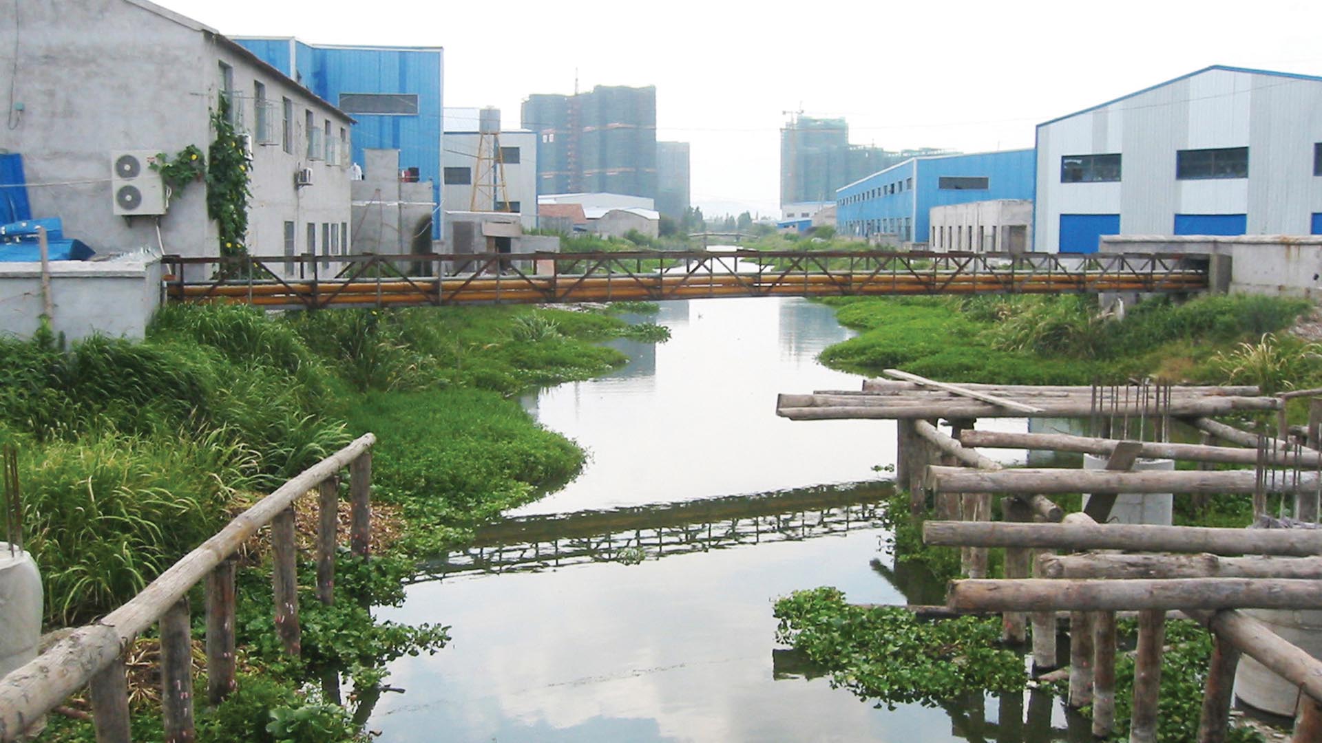
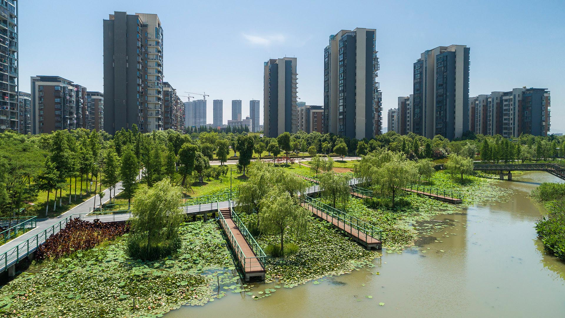
SWA provided planning and design services for the 3.3km long, 250-acre metropolitan Ningbo Eco-Corridor, which transforms a former agricultural plain that had been taken over by industrial use into urban green infrastructure. Located in the heart of the Yangtze River Delta on China’s coastline, Ningbo is one of China’s oldest cities, with an area of 3,616 square miles and a population of 5.43 million. Ningbo, which translates to “tranquil waters,” has been a well-known key port for foreign trade since ancient times. The development of this area inspired a strategy to establish Ningbo as a larger metropolitan area of economic and environmental importance and has set the stage for an ecological approach to the re-development of the city. Acting as a living filter, the design utilizes ecological strategies of hydrology, vegetation and topography, providing recreational, educational and cultural facilities for the Ningbo Eastern New City. Each area of development exemplifies a sustainable ecological approach by treating and recycling surface run-off water, harvesting solar energy, and reducing the urban heat-island effect. SWA additionally implemented a sustainable hydrological design that allows water to be filtered and aerated effectively and retained for aquifer recharge. The design seeks to offer a link between humans and their environment, fostering a community relationship to water and opportunities for environmental and ecological education. By linking together the ecological network in this region, the Ningbo Eco-Corridor enhances public health, quality of life, and property values of local and neighboring communities, and encourages other cities in the region to support ecological components in their respective developments.
Katy Trail
Katy Trail represents a remarkable resource for the residents of the Dallas Fort Worth region. This project enlivens and makes accessible right-of-way established by the storied, but later abandoned, Missouri-Kansas-Texas (better known as the “Katy”) line, and serves as a unifying element for the surrounding neighborhoods. Katy Trail provides appro...
Hermann Park
Hermann Park is one of Houston’s great civic resources containing a significant urban forest and many public venues. It is the flagship of the Houston Park system, serving the recreation needs of the City’s diverse population of some four million and welcoming over six million visitors a year. However, like many urban parks in America, much of Hermann Park has...
Bend of the River Botanic Garden
The Bend of the River Botanic Garden Master Plan will transform an 88-acre site in Temple, Texas, into a regional destination. Located at the southeast quadrant of the intersection of interstate I35 and the Leon River, the site is composed of two parcels separately donated to the City of Temple and consolidated into a single property. Public engagement was cr...
Perk Park
Originally completed in 1972, this vestige of IM Pei’s urban renewal plan was built when the street was seen as a menace and parks turned inward. Rolling berms surrounded the edges and the sunken middle areas were filled with concrete retaining walls. After years of decline, Thomas Balsley Associates’ designed a plan to reunite the community with its park. The...


