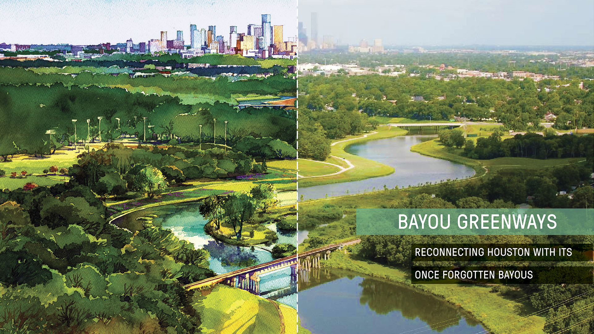
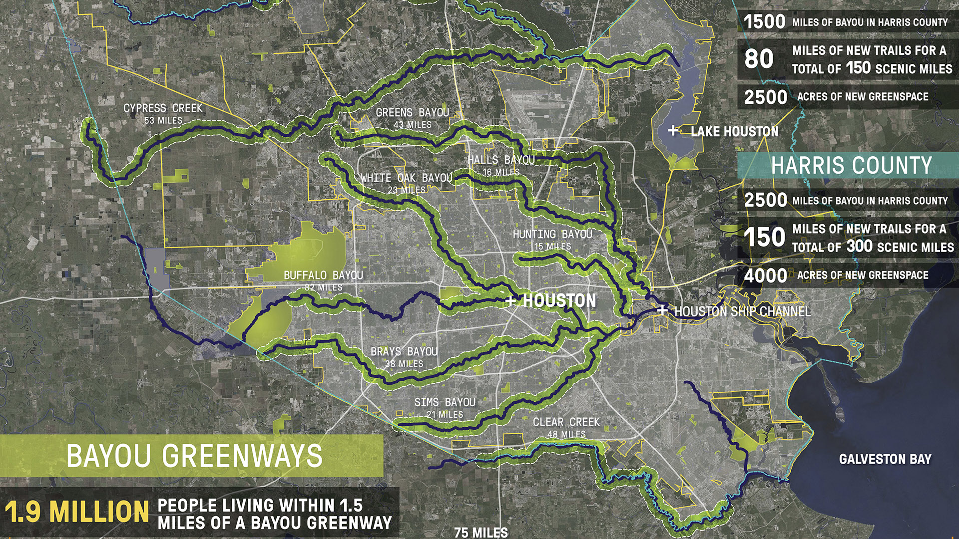
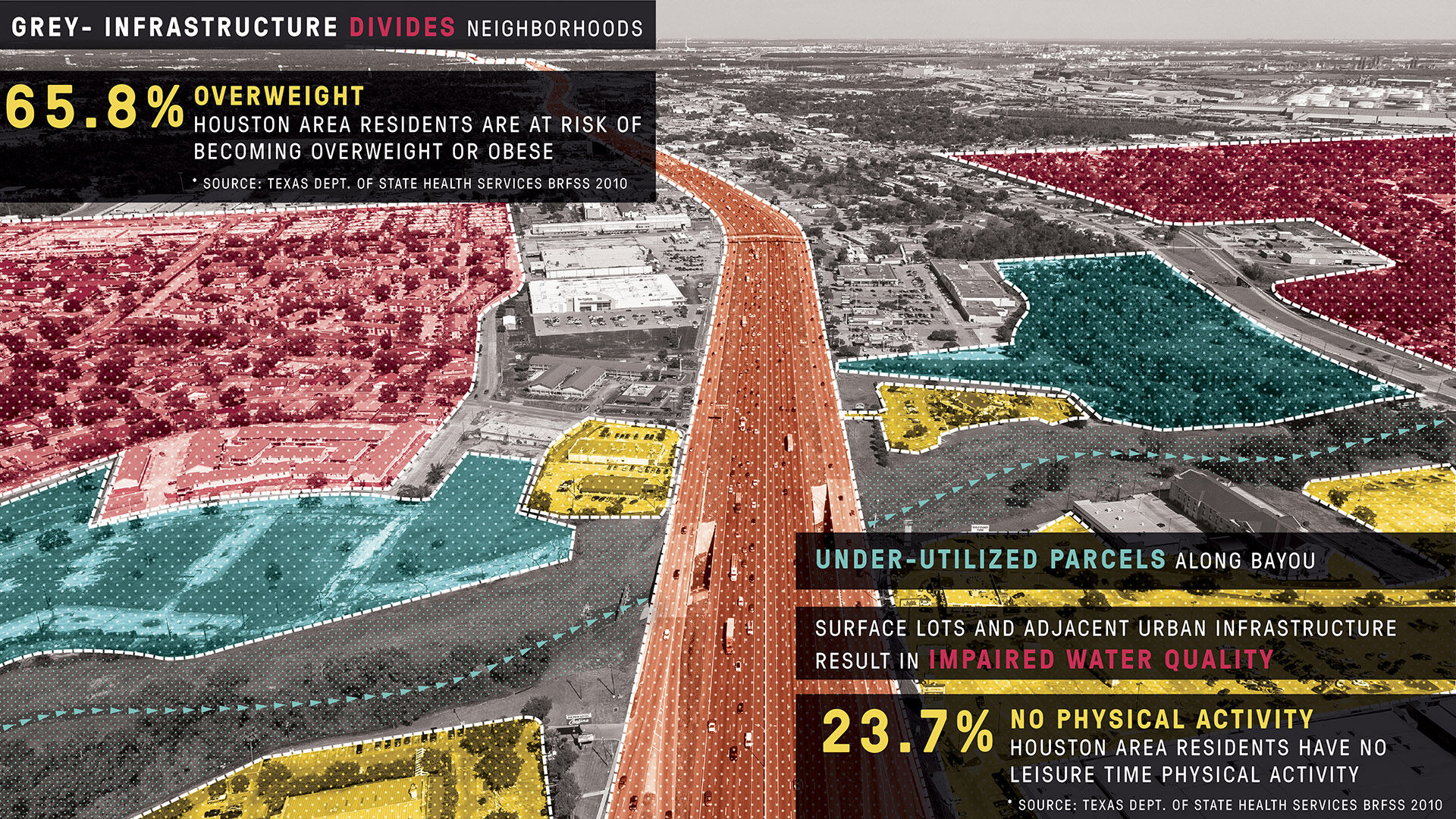
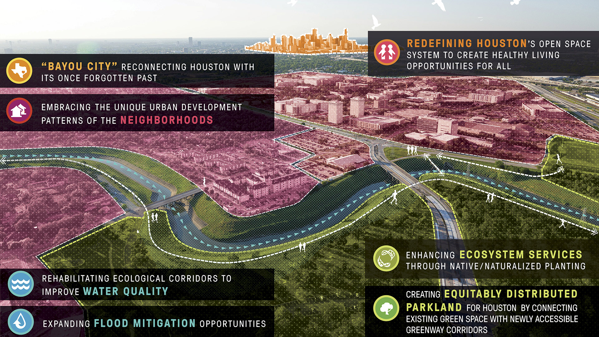
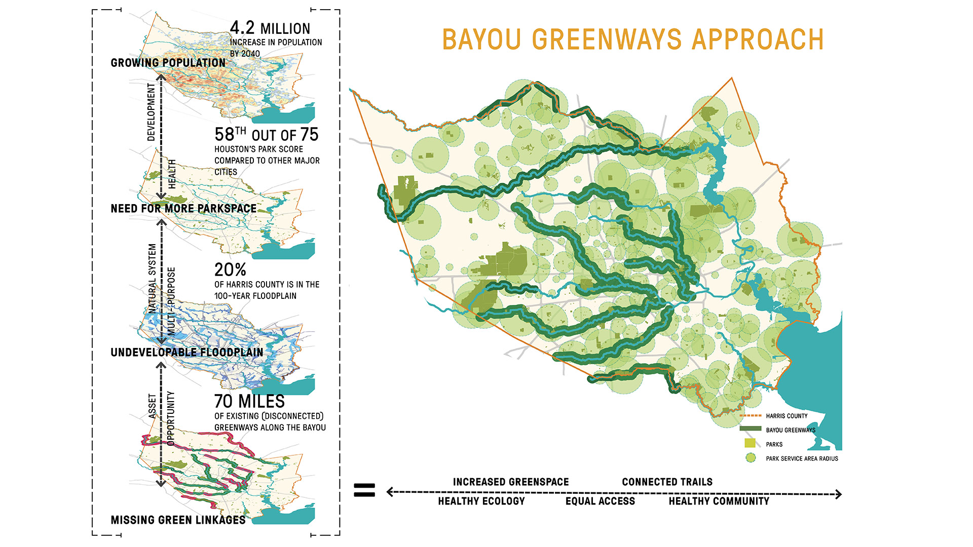
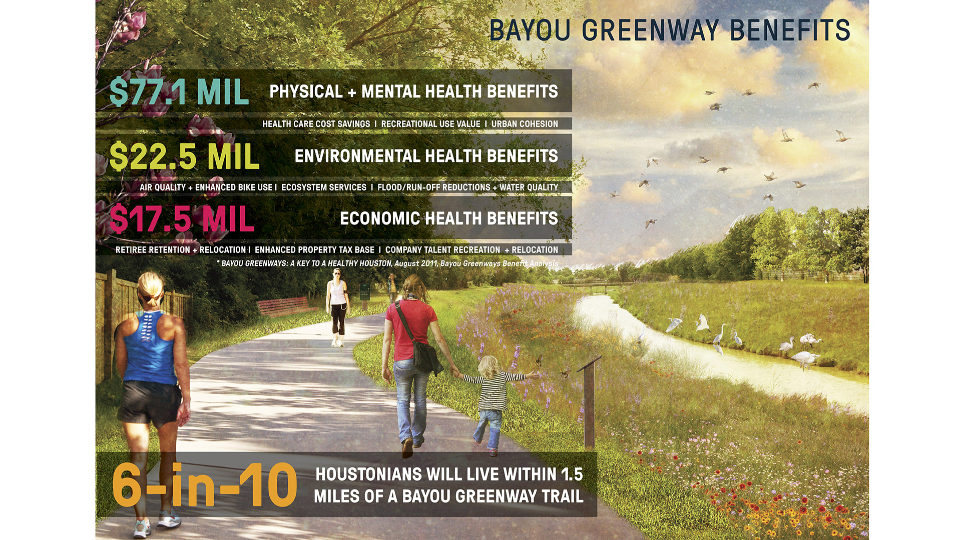
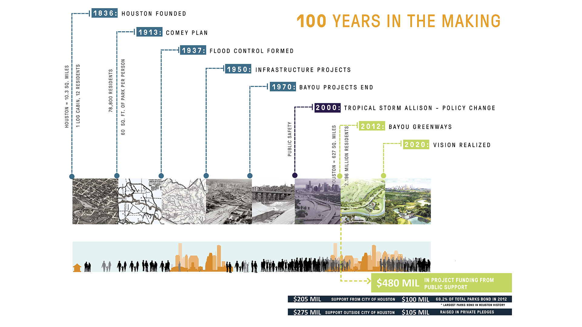
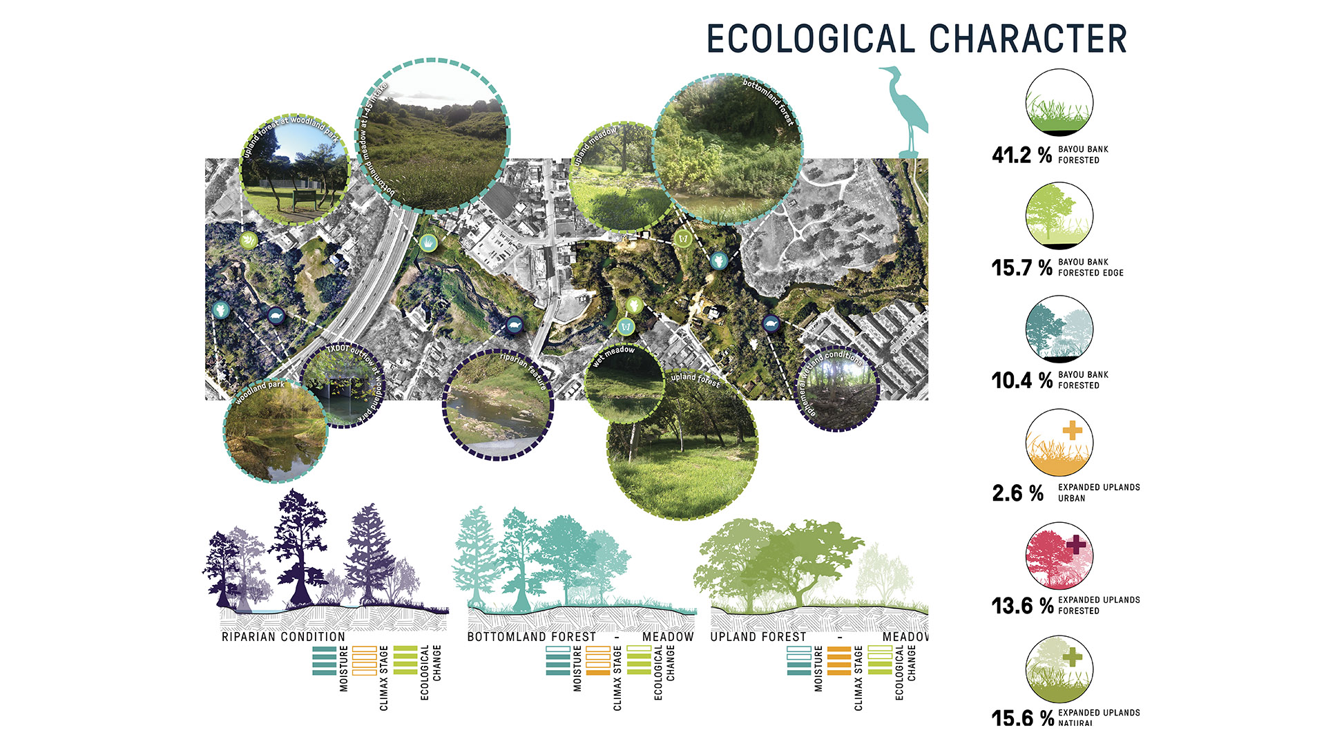
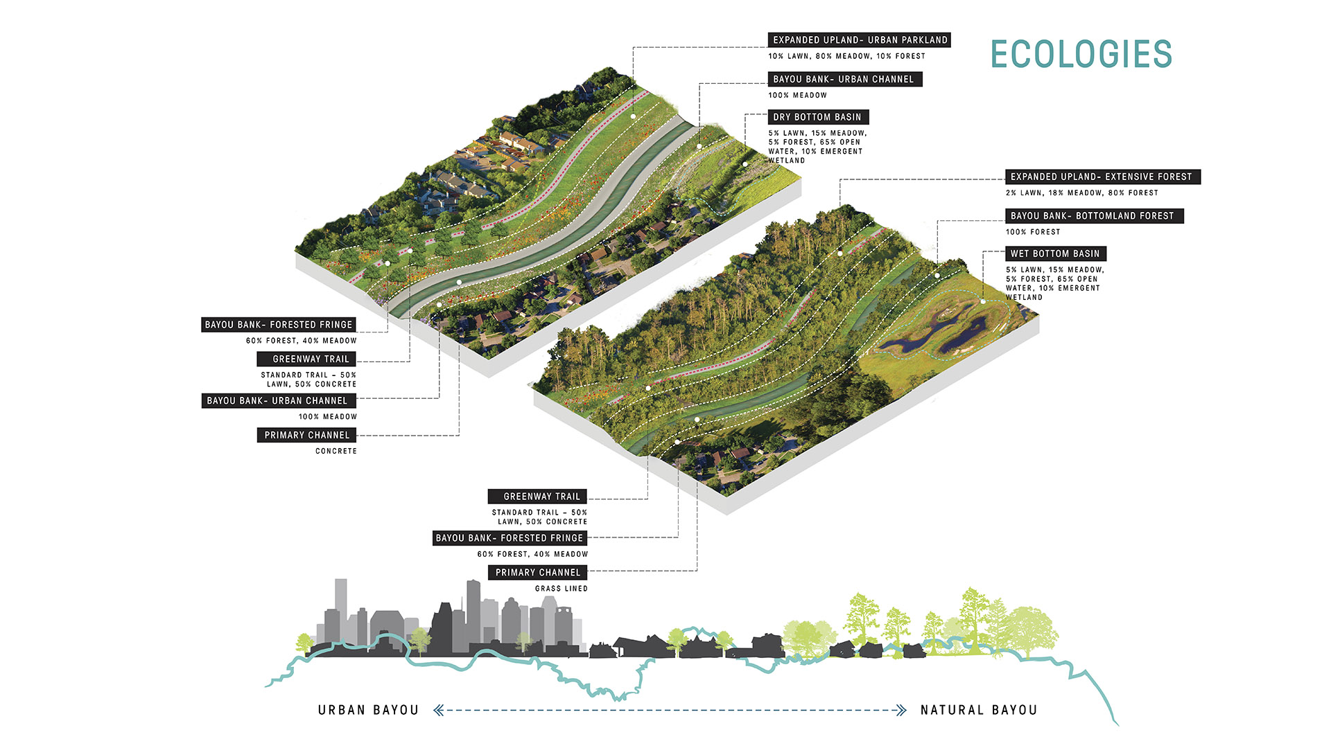
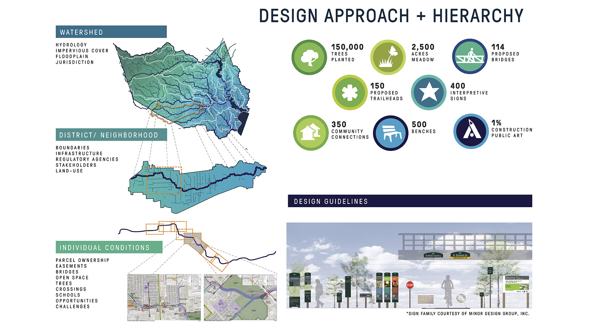
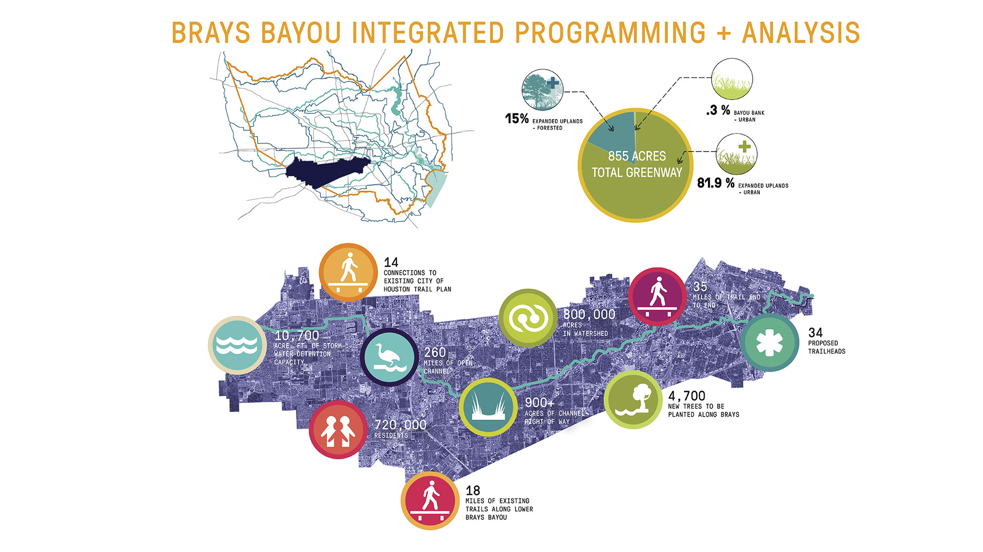
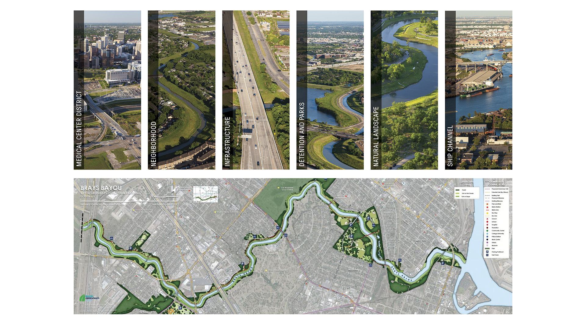
While Houston does have significant park spaces and trails, the city of no zoning has historically been unable to create enough designated open spaces and the necessary connectivity between them. The key to increasing the open space network lies within the region’s floodplains. Relatively flat terrain, intense rain events, and urbanized watersheds create broad jurisdictional floodplains. With developmental restrictions and regulatory controls, vast land areas are left as unused green space or vacant lands. The Bayou Greenway plan recommends leveraging these underutilized spaces to create trail corridors, new parks, and flood mitigation facilities that will be within 1.5 miles of 6 out of 10 Houstonians. The resulting network will stretch over 300 miles and include 4,000 acres of new land connected to existing neighborhoods, schools, churches, and other community assets. The acquisition areas will allow access where physical or jurisdictional obstacles now occur, increase flood mitigation opportunities, and help reconnect currently fragmented ecologies. Resultant facilities within the greenway corridor will perform as functioning recreation space throughout the year, with just a 1% chance of experiencing a significant flood event during that time. Bayou Greenways addresses numerous health, safety, and welfare issues inherent in the daily lives of citizens in the nation’s fourth largest city. Rated as one of the unhealthiest, park-deficient, most economically divided, ethnically diverse, sprawling, and fastest-growing cities in the country, Houston faces enormous social challenges. Already five times the area of most North American cities, Houston is expected to double in population by the year 2035. The Bayou Greenways are now shaping the development fabric of the city by creating healthy connections that are in close proximity to the outdoor world and between highly diverse populations. As a comparison, Portland represents the next-largest green network in the nation, at half of Bayou Greenways’ distance, with 150 miles of multi-use trails. This is a very popular effort: in 2012, receiving the highest approval of all measures on the city ballot, Houston voters approved $100 million in public funding for the project, with a private match of $105 million.
Galveston Island State Park
SWA worked with Texas Parks and Wildlife to reassess the 2013 master plan for Galveston Island State Park. The vision for the 191-acre beachside park – the only beach-to-bay ecosystem on Galveston Island – was to create a destination for families and individuals that allows visitors to ...
Naftzger Park
Naftzger Park offers a contemporary and communal gathering space in downtown Wichita with enough variety to appeal to everyone. Designed to activate an area of town between Old Town and a burgeoning new entertainment district, the park is at once an urban foyer and outdoor recreation room. A contemporary pavil...
Tulsa Riverfront Park
SWA directed conceptual studies for incorporating a landmark residential estate, a multi-family housing complex and a creek corridor into the adjacent Arkansas River waterfront of Tulsa, Oklahoma. Recently acquired by a local community foundation, the total 64-acre area features sweeping lawns and a historic home that provides much-needed space for the city’s ...
Tianjin Culture Park
In the strategy for the upcoming integration of Beijing, Tianjin and Hebei Province, the city of Tianjin has been identified as an advanced national manufacture and research base, as well as a core area of international shipping, a financial innovation demonstration zone, and a pilot region for the overall reformation of the area. The location of the SWA-desig...


